Starting point: Prebersee (1514 m)
| Latitude/Longitude: | 47,1855°N 13,8537°E |
| |
Walking time: 4 h
Difficulty: very difficult marked way
Elevation gain: 1228 m
Elevation difference along the route: 1280 m
Map:
Recommended equipment (summer): helmet
Recommended equipment (winter): helmet, ice axe, crampons
Views: 4.365
 | 1 person like this post |
Access to starting point:
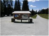
From the highway Beljak / Villach - Salzburg, take the exit St. Michael and follow the road ahead to the town of Tamsweg, where we turn left towards the settlement Sauerfeld (also possible from the town Murau). In Sauerfeld, we notice signs for the lake Prebersee, which direct us to the ascending road, which we follow to the large parking lot before the lake.
Route description:
Along the main road near the parking lot we will notice signposts that direct us onto a macadam mountain road in the direction of Preber, Roteck. After a few dozen meters of walking we come to a junction, where we continue straight on the road which is closed with a barrier. In the right bend the blazes then direct us onto a footpath through the forest. After a short ascent the path brings us back to the road which we follow for a short time, then the signposts again direct us onto a footpath. The path later joins the mountain road twice for a short time and then follows the ascent towards the hut. If we miss the blazes somewhere on the path we can also follow the mountain road, which likewise leads to the mountain hut Preberhalterhütte.
A little above the hut inscriptions on the rock direct us to the left (right leads a direct path to the summit Preber). The path then ascends grassy slopes towards the west and then slowly turns right into the valley Preberkessel between the peaks Preber (2740m) and Golzhöhe (2580m). On grassy slopes along the path livestock also grazes in the summer time. When the path brings us to a junction we continue straight through the valley, left branches the path towards the summit Lachriegel (2125m) and into the valley towards the settlement Lessach. The path through the valley Preberkessel is not strenuous and only slightly ascends and offers nice views of the surrounding peaks. Towards the end of the valley the path nevertheless ascends somewhat and brings us to a trail junction. We head left towards the saddle Mühlbachtörl (2478m), right leads the path over the southern slopes of the peak Preber towards the hut Grazerhütte. After a short ascent we reach the mentioned saddle between the peaks Preber and Roteck. We head left (right leads a marked path to Preber). On the saddle we will also notice signposts and warning signs on which it is written that the path to Roteck is dangerous for falling and suitable only for experienced people who have no problems with vertigo. After a short ascent from the saddle we soon enter the climbing part of the path, where memorial plaques along the path additionally remind us of the difficulty. At the beginning we must first climb over some steep rocks then the path turns to the right and on a narrow trail crosses steep slopes towards the north. The path then turns to the left and ascends on the north side towards the ridge. When we reach the ridge we descend through a narrow passage to the south side. On the south side of the ridge we then cross precipitous slopes towards the west. The path then leads us over some steep gullies and narrow quite exposed ledges. At the end the path turns slightly to the right and follows a short steep ascent towards the summit.
The entire path from the saddle Mühlbachtörl towards the summit is quite exposed and is not secured.

Photos:
 1
1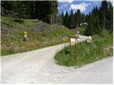 2
2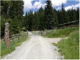 3
3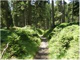 4
4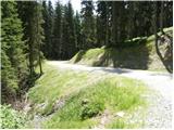 5
5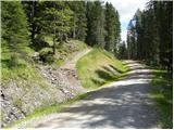 6
6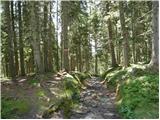 7
7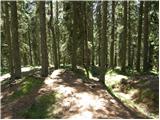 8
8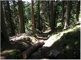 9
9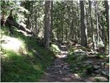 10
10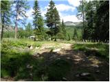 11
11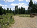 12
12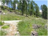 13
13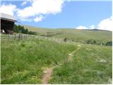 14
14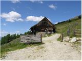 15
15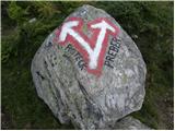 16
16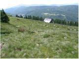 17
17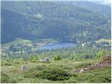 18
18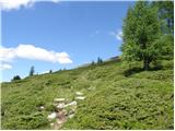 19
19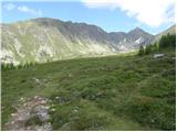 20
20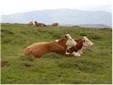 21
21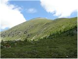 22
22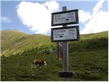 23
23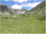 24
24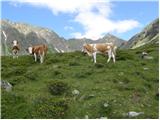 25
25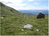 26
26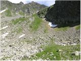 27
27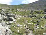 28
28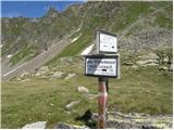 29
29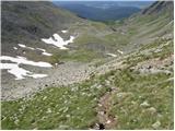 30
30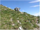 31
31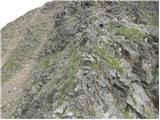 32
32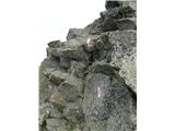 33
33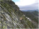 34
34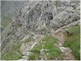 35
35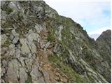 36
36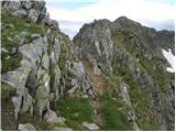 37
37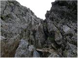 38
38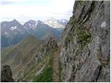 39
39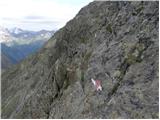 40
40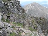 41
41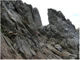 42
42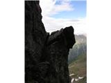 43
43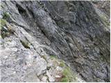 44
44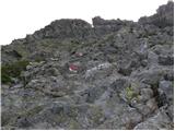 45
45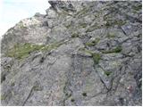 46
46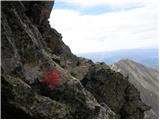 47
47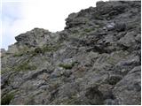 48
48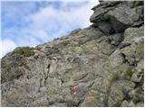 49
49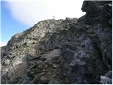 50
50 51
51
Discussion about the trip Prebersee - Roteck
To post a comment you must log in:
If you do not yet have a username, you must first
register.