Starting point: Prebersee (1514 m)
| Latitude/Longitude: | 47,1855°N 13,8537°E |
| |
Walking time: 3 h 30 min
Difficulty: easy marked way
Elevation gain: 1226 m
Elevation difference along the route: 1226 m
Map:
Recommended equipment (summer):
Recommended equipment (winter): ice axe, crampons
Views: 8.222
 | 2 people like this post |
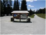
Access to starting point:
From the highway Beljak / Villach - Salzburg, we take the exit St. Michael and follow the road ahead to the settlement Tamsweg, where we turn left in the direction of the settlement Sauerfeld (also possible from the town Murau). In Sauerfeld, we notice signs for lake Prebersee, which direct us onto an ascending road, which we follow to a large parking lot before the lake.
Route description:
By the main road near the parking lot we will notice signposts, which direct us onto a macadam mountain road in the direction of Preber, Roteck. After a few tens of meters of walking, we come to a junction, where we continue straight on the road which is closed with a gate. In the right turn, blazes then direct us onto a footpath through the forest. After a short ascent, the path again brings us onto the road, which we follow for a short time, after which signposts again direct us onto a footpath. The path later joins the mountain road twice for short stretches and then follows the ascent towards the mountain hut. If we miss the blazes somewhere on the path, we can also follow the mountain road, which also leads to the mountain hut Preberhalterhütte.
A little above the mountain hut, inscriptions on the rock direct us slightly to the right (left runs the direct path towards the summit Roteck). The path then ascends over grassy slopes towards the north and brings us to signposts. We continue straight upwards (right runs the path towards the mountain hut Grazerhütte). The path ahead then ascends on the left side of the mountain stream and gets very close to it several times. We soon come again to signposts where we continue slightly to the left. The path then in a gentle ascent brings us to the western slopes of the mountain where we come again to a junction of paths. We head right following the signs for Preber, while left runs the path towards the saddle Müchbachtörl and further towards Roteck. The path then in ascent crosses the slopes towards the notch Rossscharte where we come to the southern ridge of the mountain. Here the path turns to the left and follows a somewhat steeper ascent along the ridge towards the summit. The entire path to Preber is not demanding and is very popular also among touring skiers.

Photos:
 1
1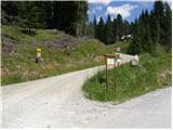 2
2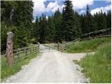 3
3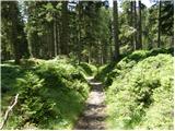 4
4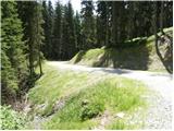 5
5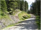 6
6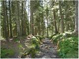 7
7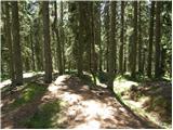 8
8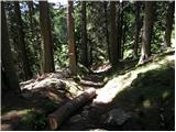 9
9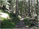 10
10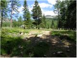 11
11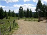 12
12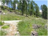 13
13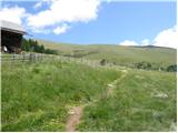 14
14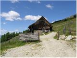 15
15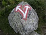 16
16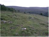 17
17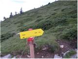 18
18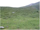 19
19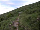 20
20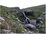 21
21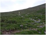 22
22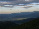 23
23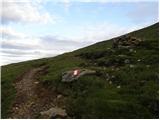 24
24 25
25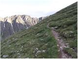 26
26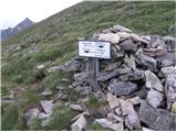 27
27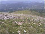 28
28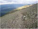 29
29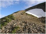 30
30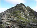 31
31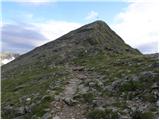 32
32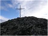 33
33
Discussion about the trip Prebersee - Preber
|
| katty16. 05. 2013 |
Yesterday a group of 7 hikers set off for Preber....Due to snow we still counted the tour as winter, so crampons and ice axe were mandatory equipment in the backpack....but due to small snow patches we didn't touch either one. The trail is otherwise very scenic, so you can also cast an eye on the Visoke Ture....A strong wind forced us to a quick descent....Well, we were looking forward to the wind calming down somewhere lower, but it persisted along the ridge too, only in the last third of the trail was it gone....But the weather improved noticeably then, so we had really super views around....
It was a nice day that we spent in good company and changeable weather.
|
|
|
To post a comment you must log in:
If you do not yet have a username, you must first
register.