Praprotno - Sveti Tomaž above Praprotno
Starting point: Praprotno (390 m)
| Latitude/Longitude: | 46,1955°N 14,2647°E |
| |
Walking time: 45 min
Difficulty: easy marked way, easy unmarked way
Elevation gain: 276 m
Elevation difference along the route: 276 m
Map: Škofjeloško in Cerkljansko hribovje 1:50.000
Recommended equipment (summer):
Recommended equipment (winter):
Views: 14.412
 | 1 person like this post |
Access to starting point:
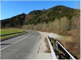
A) First, we drive to Škofja Loka, then we continue driving towards Železniki. When the Škofja Loka - Železniki road first crosses the Selška Sora river over a bridge, we pay attention, because right behind the bridge we park on the right side of the road.
B) From Tolmin or Most na Soči, we drive to Podbrdo, then we continue driving towards Železniki and Škofja Loka. Only about 100 meters after the settlement Praprotno, right before we cross the Selška Sora river, we will notice a larger macadam parking lot on the left side of the road, where we park.
Route description:
From the starting point we walk some 10 meters along the main road towards Železniki, then signs for Praprotno and Lubnik direct us left onto a narrower local road, along which we quickly arrive in the village Praprotno. Through the village we follow the rare blazes, but the path, which all the time runs along the road, leads us over initially still panoramic slopes, from which a nice view opens up on Lubnik and Planica. The asphalt road continues for a short time through the forest, then ascends over a grassy hayfield, over which increasingly beautiful views open up to us. The path ahead leads us through the lower part of the village Sveti Tomaž, where at the intersection we continue left and then continue ascending along an increasingly panoramic road. With a view of Storžič, Kočna, Grintovec and other peaks in the Kamnik and Savinja Alps, we then walk to the upper part of the village, where we step onto a panoramic ridge.
When we reach the ridge, we continue right (left Lubnik) and continue the path right on an unmarked trail that leads us, past residential houses, to panoramic meadows, over which in 2 minutes of further walking we walk to the church of St. Tomaž.

Along the route: Tomaž nad Praprotnim (626m)
Photos:
 1
1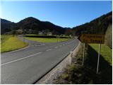 2
2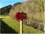 3
3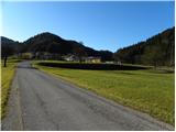 4
4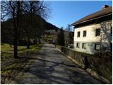 5
5 6
6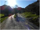 7
7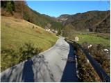 8
8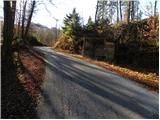 9
9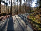 10
10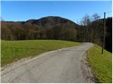 11
11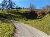 12
12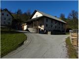 13
13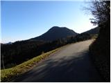 14
14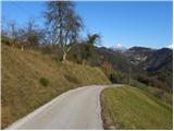 15
15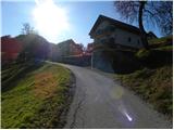 16
16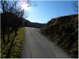 17
17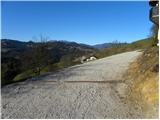 18
18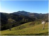 19
19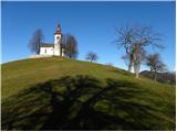 20
20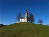 21
21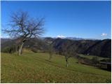 22
22
Discussion about the trip Praprotno - Sveti Tomaž above Praprotno
To post a comment you must log in:
If you do not yet have a username, you must first
register.