Starting point: Praprotno (390 m)
| Latitude/Longitude: | 46,1955°N 14,2647°E |
| |
Walking time: 2 h 15 min
Difficulty: easy marked way
Elevation gain: 635 m
Elevation difference along the route: 650 m
Map: Škofjeloško in Cerkljansko hribovje 1:50.000
Recommended equipment (summer):
Recommended equipment (winter): crampons
Views: 21.864
 | 2 people like this post |
Access to starting point:
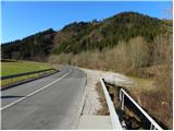
A) First, we drive to Škofja Loka, and then we continue driving towards Železniki. When the Škofja Loka - Železniki road first crosses the Selška Sora river over a bridge, we pay attention, because right behind the bridge we park on the right side of the road.
B) From Tolmin or Most na Soči, we drive to Podbrdo, and then we continue driving towards Železniki and Škofja Loka. Just about 100 m after the settlement Praprotno, right before we cross the Selška Sora river, we will notice a larger macadam parking lot on the left side of the road, where we park.
Route description:
From the starting point we walk some 10 m along the main road towards Železniki, then signs for Praprotno and Lubnik direct us left onto a narrower local road, along which we quickly arrive in the village Praprotno. Through the village we follow the rare blazes, and the path, which all the time runs on the road, leads us across initially still panoramic slopes, from which a nice view opens up on Lubnik and Planica. The asphalt road continues briefly through the forest, then ascends over a grassy hayfield, across which increasingly beautiful views open up. The path ahead leads us through the lower part of the village Sveti Tomaž, where at the intersection we continue left and then continue ascending along an increasingly panoramic road. With a view on Storžič, Kočna, Grintovec and other peaks in the Kamniške and Savinjske Alps, we then walk to the upper part of the village, where we step onto a panoramic ridge.
When we reach the ridge, we continue left (right 3 minutes, church of sv. Tomaž) and with a view on a large part of the Škofjeloško hribovje, we walk to the edge of the forest, where there is a marked junction.
We continue straight in the direction of Lubnik (right Gabrška Gora, Poljane...) and continue the ascent on a cart track, from which soon a marked footpath branches off to the left. Higher, the footpath returns to the cart track, then leaves it again for some time. Higher, after we have again stepped onto the cart track, we join a macadam road, along which we walk to the homestead Zalubnikar.
Above the homestead the road ascends more steeply and brings us to a saddle, where there is also a marked junction. We continue left in the direction of Lubnik, on a path which quickly brings us to a macadam road, along which we continue a gentle ascent in the already familiar direction. The macadam road then goes into the forest, where it crosses slopes towards the right. Somewhat higher a marked path from Breznica pod Lubnikom joins from the right, we continue slightly left on an increasingly worse, partly already cart track road. We continue the ascent on an always worse and gradually also increasingly steep cart track, but we also leave this one and continue the ascent on a marked mountain path (due to numerous cart tracks orientation is somewhat harder at a few places). Higher a few more mountain paths join from the right, we follow the path, which is steeper in places, all the way to the top of Lubnik, a peak from which a nice view opens up.

Along the route: Tomaž nad Praprotnim (626m)
Photos:
 1
1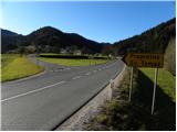 2
2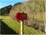 3
3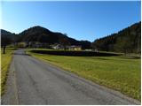 4
4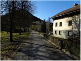 5
5 6
6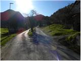 7
7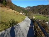 8
8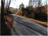 9
9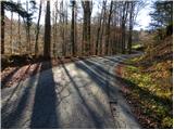 10
10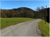 11
11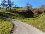 12
12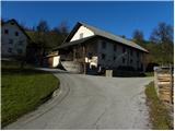 13
13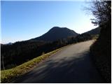 14
14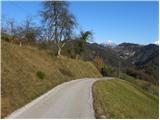 15
15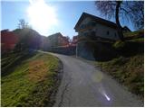 16
16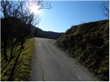 17
17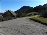 18
18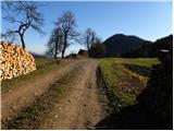 19
19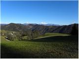 20
20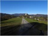 21
21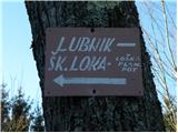 22
22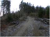 23
23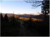 24
24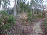 25
25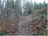 26
26 27
27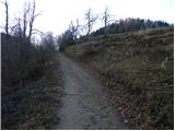 28
28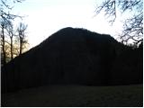 29
29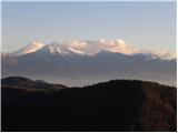 30
30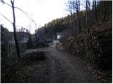 31
31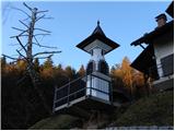 32
32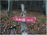 33
33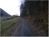 34
34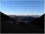 35
35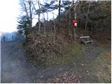 36
36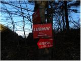 37
37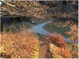 38
38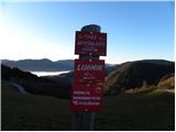 39
39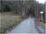 40
40 41
41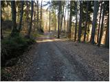 42
42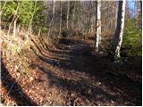 43
43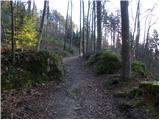 44
44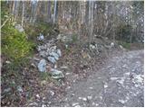 45
45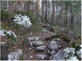 46
46 47
47 48
48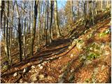 49
49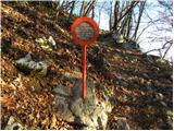 50
50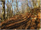 51
51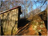 52
52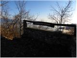 53
53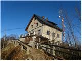 54
54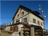 55
55 56
56
Discussion about the trip Praprotno - Lubnik
|
| GregorC9. 12. 2011 |
Nice path to Lubnik, which I hike often. I start at Sv. Tomaž (before the forest where the junction is marked), to avoid walking on the asphalt road, of which there is quite a bit.
|
|
|
|
| bats9. 12. 2011 |
Judging by the pictures it looks really nice, otherwise I walked part of it at night on the Pasja ravan-Dražgoše hike, as seen it is also interesting for combination with bike to the saddle. More familiar to me is bike to Naceta from Šk.Loka and then a jump to the top.
Back of course "bonaca".
|
|
|
|
| GregorC9. 12. 2011 |
with bike you can also go further from the saddle. You can carry it over the first steep part to the cart track (max 5-10 min or a couple hundred meters), from where the ride to Naceta is exceptionally nice and completely undemanding. Or go right at the saddle and later turn to the less visible cart track and the path is (almost) rideable the whole time. I usually carry the bike.
It is really an interesting path here with bike in any direction. Both descent (here I experienced so far my worst bike fall (here I experienced so far my worst bike fall ) and ascent. ) and ascent.
|
|
|
|
| bats9. 12. 2011 |
@GregorC Thanks for the info, I haven't really ridden further over the pass yet, I'll try to make a loop sometime, it's also a nice pedal-kicking tour further to Stari vrh and to Blegoš via the military path.
Yeah yeah let them go as nice as they are they are also dangerous, especially downhill from Nace it's quite a busy road. Anyway all this for next year, need to swap the ski bike, only snow left.
|
|
|
|
| GregorC10. 12. 2011 |
Loop Železniki - Praprotno - Sv. Tomaž - Nace - Stari vrh (Zapreval) - Rovte, from there either towards Blegoš or over Golica back to the valley I do at least once a year. And it's a great loop and you get a good workout too. Recommend. Best
|
|
|
|
| GregorC11. 12. 2011 |
MajaO this is a very interesting and welcome piece of information I'll go check it. This year probably first on foot, next year by bike. LP I'll go check it. This year probably first on foot, next year by bike. LP
|
|
|
|
| Strucko25. 12. 2011 |
I'm interested if it's possible to drive by car to Sv. Tomaž above Praprotno, or if there's parking there. How much time then walking to the top.
|
|
|
|
| GregorC25. 12. 2011 |
Of course Strucko it is possible! From the village drive a few hundred meters more to the saddle, where you leave the car by the path (don't know how with larger amounts of snow). From there to the top approx. 1 to 1.5 hours walking.
|
|
|
|
| krempač21. 02. 2018 |
Nice good day to all!
Please for information, is the road to Praprotno passable for a bus and the path from this starting point to Lubnik passable? On Saturday I'm leading a bus of hikers.
Thanks for the reply, nice greetings and stay safe!
|
|
|
|
| Gost21. 02. 2018 |
Krempač Hello,
the road to Praprotno is normally passable, of course also for buses. The path from Praprotno to Lubnik is daily trodden and also passable. Crampons are recommended, as the path is slightly frozen. (info. obtained at the hut itself) What the weather will bring in the coming days is another question. I'm attaching the phone number of the hut on Lubnik and advise you to call the hut on Friday, the day before the guided tour, and thus get fresh information.
Tel. no. of the Lubnik hut 031/655-556, email: lubnik@pd-skofjaloka.com.
Safe travels and nice regards.
|
|
|
|
| LISAC17. 01. 2025 18:20:56 |
For the mentioned path to Lubnik, foot access from the village Praprotno is no problem.
If someone wants to park higher in the village Sv. Tomaž, however, it's not so easy.
Everywhere there are private property signs and vehicle towing signs, no parking.
The gravel section of the road from the intersection church Sv. Tomaž - section towards the described footpath to Lubnik (before the forest) is INTENTIONALLY unmaintained and the ruts are deliberately such that you'd get stuck if you continue driving there. Obviously hikers are not welcome here. Lp
|
|
|
|
| andraja17. 01. 2025 19:03:11 |
Lisac unfortunately holds true, almost no parking possible at Sv. Tomaž. The problem is the landowner offering apartments. Even for viewing the little church there's nowhere to park, he immediately warns it's private property and doesn't allow parking or even walking on his land, which surrounds the church too.
|
|
|
|
| LISAC17. 01. 2025 23:03:58 |
andraja really. I agree. It's right that the mentioned is known. So everyone who reads knows what such a person can be like and that we have no problems with him... I'll forward the information to the local PD Škofja Loka for possible consideration since with moderation a lot could be done.
|
|
|
To post a comment you must log in:
If you do not yet have a username, you must first
register.