Povlje - Velika Poljana (via mala Poljana)
Starting point: Povlje (710 m)
| Latitude/Longitude: | 46,3296°N 14,3768°E |
| |
Route name: via mala Poljana
Walking time: 2 h
Difficulty: easy marked way
Elevation gain: 675 m
Elevation difference along the route: 725 m
Map: Karavanke - osrednji del 1:50.000
Recommended equipment (summer): helmet
Recommended equipment (winter): helmet, ice axe, crampons
Views: 4.450
 | 2 people like this post |
Access to starting point:
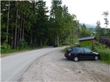
a) From the Ljubljana-Jesenice motorway take the Brnik exit, and when you reach the Mengeš-Kranj road, continue left towards Kranj. Drive along the main road to Kranj to the first roundabout, from which continue on the first right exit towards Šenčur. Through Šenčur continue on the main road, then, upon reaching the Kranj-Zgornje Jezersko road, continue right towards Jezersko. Upon arriving in Preddvor leave the main road and continue driving left towards the centre of the said place, from there follow the signs to the Bašelj settlement. Somewhat beyond the Bašelj settlement the road descends to the Milka stream and crosses it via a bridge. Here a road first branches off to the right to the villages Babni Vrt, about 100 m further also to the village Povlje. Continue on the ascending road towards Povlje, park on the small parking area above the village. At the starting point there is a small junction, several hiking direction signs and a larger information board of the Trstenik walking-educational trail "path under Storžič".
b) From the Jesenice-Ljubljana motorway take the Kranj west exit, then continue driving towards Golnik. Upon arriving in Tenetiše leave the main road towards Golnik and continue driving right towards Trstenik. Approximately 1 km beyond the Trstenik settlement arrive at a small junction, where continue left towards the village Povlje. Continue on the ascending road towards Povlje, park on the small parking area above the village. At the starting point there is a small junction, several hiking direction signs and a larger information board of the Trstenik walking-educational trail "path under Storžič".
Route description:
From the parking lot head to the left road towards Velika and Mala Poljana (the path between both roads leads to Planina Javornik, also Dolenčeva pot to Velika Poljana). The road soon turns left, where it leads past a water reservoir and a quarry. Somewhat further the road turns into a cart track, which then ascends more steeply for a transitional period. Just after the cart track flattens and turns right into the forest, a marked footpath branches off even more to the right from it, on which we continue the ascent. For a short time we continue the ascent along the torrent, then the path turns left and ascends across, in the last part through a somewhat collapsed gully. At the top of the gully we step onto a kind of ridge between two streams, where the path from the villages Goriče and Zalog joins from the left. A short ascent follows along the panoramic ridge, then we arrive at a marked junction, from where we continue along the lower left path towards Mala Poljana (right Velika Poljana).
The path further crosses the slopes to the left, then takes us into the valley between Tolsti vrh on the left and vrh Grebenc on the right, where we step onto the cart track. The cart track ends somewhat higher at the NOB marker, we continue along an increasingly steep little path, which continues through the steep valley or along the slope a few metres above the little valley. Higher up the valley narrows considerably, so it is particularly exposed to falling rocks in the spring period. When the little valley widens the path turns right onto the slope, where it still ascends steeply for some time, then, as the forest begins to thin, the path also flattens. A little further we step onto the pastures of Mala Poljana, and we walk along the path, from which some views open up towards Gorenjska when looking back, to the nearby hunting hut.
Behind the hut we step onto the saddle, where there is a marked junction. From the junction continue right towards Velika Poljana (sharply left Zavetišče v Gozdu, left Tolsti vrh, slightly left (a few minutes off trail) hunting path to Tolsti vrh, straight downhill Dom pod Storžičem) and continue the path along the ascending cart track. During the crossing ascent some views towards the Karavanke open up transiently, then the path returns to the forest for a short time and takes us to the upper edge of Velika Poljana, where the next marked junction is.
Continue straight ahead (left Storžič) and descend across the panoramic pasture to the Koča na Veliki Poljani.
Starting point - Gmajna 0:25, Gmajna - Mala Poljana 1:20, Mala Poljana - Velika Poljana 0:15.

Photos:
 1
1 2
2 3
3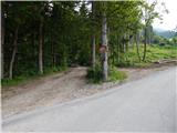 4
4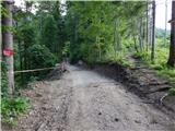 5
5 6
6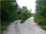 7
7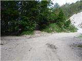 8
8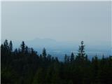 9
9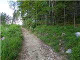 10
10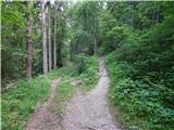 11
11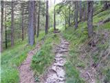 12
12 13
13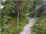 14
14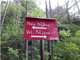 15
15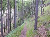 16
16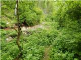 17
17 18
18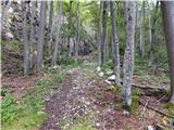 19
19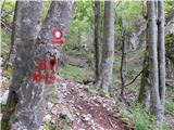 20
20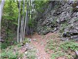 21
21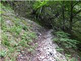 22
22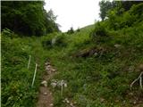 23
23 24
24 25
25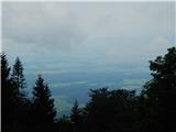 26
26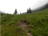 27
27 28
28 29
29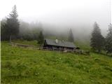 30
30 31
31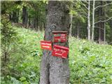 32
32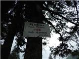 33
33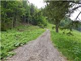 34
34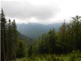 35
35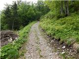 36
36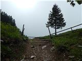 37
37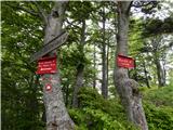 38
38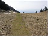 39
39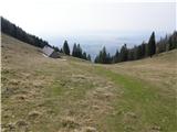 40
40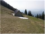 41
41
Discussion about the trip Povlje - Velika Poljana (via mala Poljana)
|
| jermi25. 02. 2019 |
It wasn't nice to go to Velika Poljana via Malo, because the path was quite crumbly, over rocky scree, and the whole thing is in shade and damp. Better use the path from Povlje directly to Velika Poljana.
|
|
|
To post a comment you must log in:
If you do not yet have a username, you must first
register.