Potoki - Gradišče nad Sotesko (Soteska)
Starting point: Potoki (570 m)
| Latitude/Longitude: | 46,4156°N 14,1174°E |
| |
Walking time: 30 min
Difficulty: easy unmarked way
Elevation gain: 154 m
Elevation difference along the route: 154 m
Map: Karavanke - osrednji del 1 : 50.000
Recommended equipment (summer):
Recommended equipment (winter): ice axe, crampons
Views: 2.114
 | 3 people like this post |
Access to starting point:
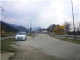
From highway Ljubljana - Jesenice we go to the exit Lipce (Jesenice east) and we drive right towards Jesenice. At the first traffic light crossroad (Slovenski Javornik) we turn right, in the next (the end of the settlement, at Acroni) we drive straight, past the settlement Koroška Bela on the left and a little later past the gas station on the right. After less than 2 km of further driving, we arrive near the next settlement Potoki, where a sign by the road directs us. We turn left and park in a suitable place near the settlement sign.
Route description:
We carefully cross the railway track and proceed along the road towards the first houses in Potokih, among which we soon find ourselves at a crossing. When we turn left here, after just a few meters, we reach the end of the road at the last house on the western edge of the village "pri Blažunu". On the right side of the house, we notice a logging trail, resembling the riverbed of a stream, and next to it, a municipal sign with an inscription. We step onto this logging trail, which, along the slope on the right, quickly leads us to the riverbed of the stream Sevnik, which we cross. Next comes a crossing, where we continue left along an initially gentle, then slightly ascending path on the edge of the forest, which leads us along the slope of the hill Gradišče above Soteska on the right. When the path emerges from the forest, it ascends a bit more steeply on a grassy slope and, in doing so, turns right. A little higher, where the steepness eases and the gravel path turns left, we leave it and continue straight along a less visible footpath, steeply into the forest. When we climb onto the forested ridge, a well-trodden and slightly steeper path leads us toward the summit of the hill. Just before the destination, when the steepness briefly eases, we continue straight onto a steep slope (slightly to the right, a hunting footpath). Just below the summit, along the path, we encounter the first remains of a wall from an ancient fort. We also notice these remains at the very summit and a few meters lower on the southern slope. From the top, which, due to the forest, doesn’t offer much of a view into the valley, we see the neighboring hill Ajdna and part of the landscape to the east and west.

Photos:
 1
1 2
2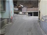 3
3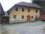 4
4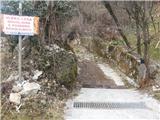 5
5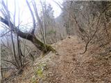 6
6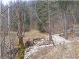 7
7 8
8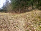 9
9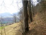 10
10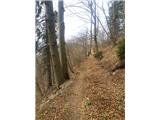 11
11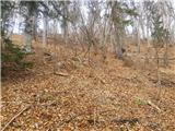 12
12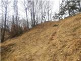 13
13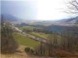 14
14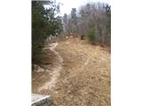 15
15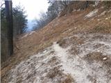 16
16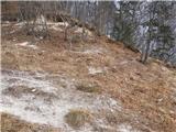 17
17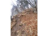 18
18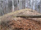 19
19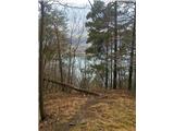 20
20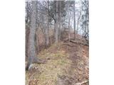 21
21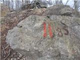 22
22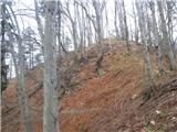 23
23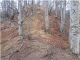 24
24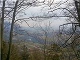 25
25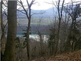 26
26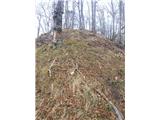 27
27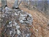 28
28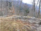 29
29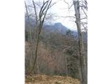 30
30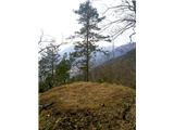 31
31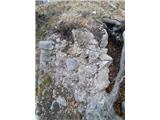 32
32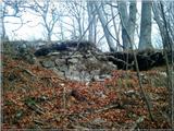 33
33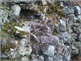 34
34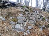 35
35
Discussion about the trip Potoki - Gradišče nad Sotesko (Soteska)
|
| Anamarija13627. 10. 2019 |
The path from the house at Blažun is a bit slippery due to the water flowing along the path, trees are across the path and you have to duck. To the left, a view opens to the highway in the distance. The path is peaceful and beautiful.
After 10-12 minutes of walking, we cross the torrent and then continue the path to the left, reach a bend and follow the path that now moves among the trees. When the path starts to ascend, we encounter an obstacle - fallen trees, we have to go back and there is a new path among the trees that leads across the meadow from where we slowly return to the path.
It ascends moderately to the saddle.
On the saddle there is an electricity pylon and a beautiful view of Koroška Bela on one side and the entire Zgornje Savska dolina, on the other side to the village Potoki, Ajdno nad Potoki, the highest peak of Karavanke, villages below Stol, Radovljica and in the distance Šmarna Gora is visible.
From the saddle we continue the path towards the ruins. The path is steep, runs along the edge and caution is needed. To the top, where the ruins are visible under the tree roots, it's another good 10 minutes of walking. No views due to the trees.
|
|
|
To post a comment you must log in:
If you do not yet have a username, you must first
register.