Potok Slanica - Andrejev dom na Slemenu
Starting point: Potok Slanica (800 m)
| Latitude/Longitude: | 46,4298°N 14,9641°E |
| |
Walking time: 1 h 15 min
Difficulty: easy marked way
Elevation gain: 286 m
Elevation difference along the route: 286 m
Map: Kamniške in Savinjske Alpe 1:50.000
Recommended equipment (summer):
Recommended equipment (winter):
Views: 10.391
 | 1 person like this post |
Access to starting point:
From the highway Ljubljana - Celje, we take the exit Mozirje and follow the road ahead in the direction of Mozirje and Logarska dolina. Immediately after the village Ljubija (which is located a little before Mozirje), the road to Bele Vode branches off to the right. The road then runs through the village Ljubija again and 500 m after the village brings us to a crossroad, where we continue right in the direction of Šoštanj, Lepa Njiva and Bele Vode. The road then soon brings us to Lepa Njiva, where we continue straight in the direction of Bele Vode. A little further, we come to a crossroad, where the road to Sveti Florjan and Šoštanj branches off to the right. Here we continue straight ahead on the road in the direction of Bele Vode, but only to the inn Grebenšek. At Grebenšek, we turn right and drive past Mornova zijalka to the next crossroad, where we continue right. The road a little ahead brings us to the next crossroad, where we continue straight. We follow this road to a sharp left turn, in the middle of which is a crossroad and a little ahead a gate. Here we park on the parking lot by the road, making sure not to hinder possible forestry work.
Access from Šoštanj is also possible.
Route description:
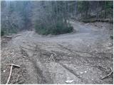
From the parking lot, we continue on the right road, which soon changes into a cart track. After a few minutes of walking, we come to a fork, where we have two options to continue.
The bottom right cart track is marked, but it changes into an entirely ruined footpath. The path is steep, and passages among fallen trees are difficult and dangerous. In the middle of the ascent, we cross the left cart track, and then we once again ascend the ruined path until we reach the forest road, where we continue left.
If we continue on the left cart track, we follow it until we reach the forest road, where we continue left (this cart track is not marked).
On the road, both paths join and it brings us to the spot where, to the right upward over a ladder, the path to Andrejev dom branches off.
Here, in both cases, we continue on the marked path, which ascends steeply through the forest. The steep path a little higher brings us to a cart track, which we follow to a smaller clearing where a cottage stands. Here the steepness eases and after a few more steps we come to grassy slopes. Only a few minutes of gentle walking to the mountain hut follow.

Photos:
 1
1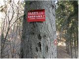 2
2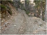 3
3 4
4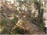 5
5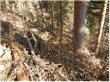 6
6 7
7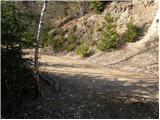 8
8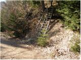 9
9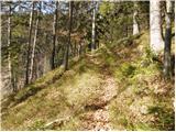 10
10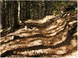 11
11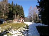 12
12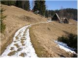 13
13 14
14
Discussion about the trip Potok Slanica - Andrejev dom na Slemenu
|
| Kokta31. 10. 2011 |
Yesterday the game wardens had an action 
|
|
|
|
| 3064. 01. 2017 |
I'd like to add updated status. On picture 3 choose the right path, which is now the only proper path and is nicely cleared and marked. The left path is just an unmarked forest track (road) on which you can easily ''get lost''...like I did .
Regards
|
|
|
To post a comment you must log in:
If you do not yet have a username, you must first
register.