Ponikva pri Žalcu - Source of Ponikvica
Starting point: Ponikva pri Žalcu (408 m)
| Latitude/Longitude: | 46,31150°N 15,14640°E |
| |
Walking time: 10 min
Difficulty: easy marked way
Elevation gain: -30 m
Elevation difference along the route: 5 m
Map:
Recommended equipment (summer):
Recommended equipment (winter):
Views: 137
 | 2 people like this post |
Access to starting point:
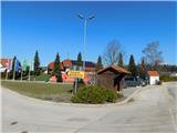
We leave the Styrian motorway at the Arja vas exit, then follow the road in the direction of Velenje. At the end of the settlement Velika Pirešica we leave the main road towards Velenje and continue driving left onto the side road in the direction of Ponikva pri Žalcu. We then drive along a somewhat narrower and mostly ascending road, which we follow to the fire station in Ponikva pri Žalcu, where we park at one of the nearby arranged parking lots.
There are also some parking options at the Church of St. Pancras and at the cemetery.
Route description:
From the fire station we first walk to the Church of St. Pancras, where we continue along the left side of the church (the right side leads the marked path to Apno), where the path leads us past several houses, the branch elementary school and the kindergarten under construction to a chapel where we arrive at an intersection.
We continue left (to the right is the drivable road towards Jama pekel) and then immediately right, so that we walk along the Banovšek farm. This is followed by some descent, and at the last house we go onto an arranged path, along which we walk to the nearby spring.
The description and images refer to the situation as of February 2026.
Along the route: Sv. Pankracij (409m)
Photos:
 1
1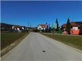 2
2 3
3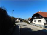 4
4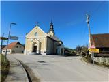 5
5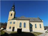 6
6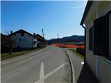 7
7 8
8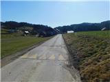 9
9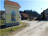 10
10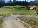 11
11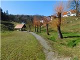 12
12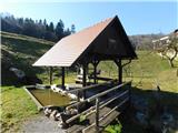 13
13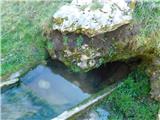 14
14
Discussion about the trip Ponikva pri Žalcu - Source of Ponikvica
To post a comment you must log in:
If you do not yet have a username, you must first
register.