Poljana (Završnica) - Waterfall below Gozdašnica
Starting point: Poljana (Završnica) (640 m)
| Latitude/Longitude: | 46,4072°N 14,1461°E |
| |
Walking time: 25 min
Difficulty: partly demanding unmarked way
Elevation gain: 120 m
Elevation difference along the route: 120 m
Map: Karavanke - osrednji del 1 : 50.000
Recommended equipment (summer):
Recommended equipment (winter): ice axe, crampons
Views: 8.571
 | 3 people like this post |
Access to starting point:
From the highway Ljubljana - Jesenice, we first head to the Lesce exit, and then at the roundabout onto the old road in the direction of Žirovnica and Jesenice. After a few km of driving, we drive past the intersection where the road towards the center of the settlement Žirovnica branches off to the right. When we drive past the viaduct Završnica, we encounter the right turn-off, where we go (we turn sharply right). Already immediately afterwards at the smaller intersection we turn left, in the next one (after 50 meters) to the right, in the direction of Završnica. After a short descent, the road briefly ascends a little and then flattens, and brings us to the spot where the macadam road towards Valvasorjev dom branches off to the left. We park on the new parking lot nearby, which is situated next to the accumulation lake on the right side of the road.
Route description:
From the parking lot, we continue about 200 m in the same direction along the road to the first wide forest path that we notice on the left side of the road (on the right there is the first holiday cottage). We head onto this forest path and follow it only briefly. When on the tree trunks on the left side of the path (before the small bridge over the stream) we notice two attached blazes, at the second we head perpendicularly to the left, steeply uphill on an initially poorly visible path, onto the slope of the hill Gozdašnica. The uphill path leads towards the north and first ascends quite steeply for some time, turning slightly to the right as it does so, then crosses the increasingly steep eastern slope of Gozdašnica. When the steepness of the ascent eases, the path crosses the steepest and, when wet, slippery and dangerous slope of the hill. Soon afterwards we notice the cliff over which the waterfall falls. After some 10 meters of further traversing, the path brings us close to the waterfall, where we also cross the streambed and through a rocky narrow passage (gate) step under the waterfall. Before the mentioned narrow passage, slightly to the right we can also climb onto a small ridge from which we view the waterfall and the cirque (amphitheater) at its foot.

Photos:
 1
1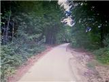 2
2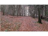 3
3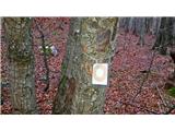 4
4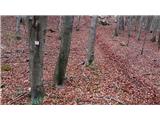 5
5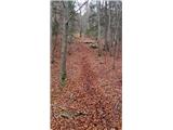 6
6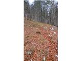 7
7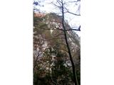 8
8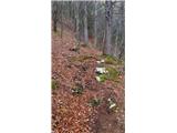 9
9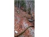 10
10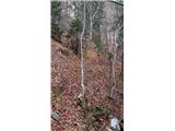 11
11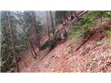 12
12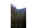 13
13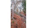 14
14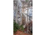 15
15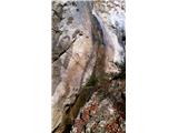 16
16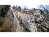 17
17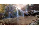 18
18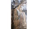 19
19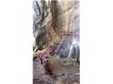 20
20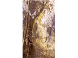 21
21
Discussion about the trip Poljana (Završnica) - Waterfall below Gozdašnica
|
| ločanka10. 03. 2023 16:30:24 |
yes, the path is well-followable once you find it. But we missed it at the wooden bridge over the stream. There is a sign on a high pole there, but it points in the direction of the stream. And you follow some kind of path for a while, which becomes less and less visible and leads to the opposite bank. Well, we persisted for quite some time, but when it really became all fallen and crumbled, Jože luckily noticed a hiker with a dog much higher on the left side, and that's when it became clear to us that we had actually missed the right path. So we pushed left out of the gully and stepped onto the path. No problems after that, and the same on the way back . The waterfall is worth seeing! . The waterfall is worth seeing!
It's true that I didn't read this description well before, because the path wasn't planned.
|
|
|
|
| jerque15. 10. 2024 18:16:18 |
Although it sounds sexist, according to maPZS, other maps and ultimately the direction sign at the road junction, "Hudič babo pere" seems to be the official name of the waterfall. Therefore, for search engines' sake, I suggest renaming the "mountain" name (and possibly adding a sentence about other names).
Otherwise, the only path from the marked road junction is along the right bank of the stream (i.e., the stream is on our right when going uphill), which I don't find difficult at all, probably recently maintained, and there's a scenic bench just before the waterfall.
However, I do not recommend looking for the path "to the viewpoint" along the other (left) bank of the stream, which maPZS indicates. There is actually no path, just very steep and hard-to-traverse terrain. Even if you reach the waterfall via the official path and cross the stream there, think carefully if you want to head steeply uphill on the other side (or if you can return the same way). From the "viewpoint," you only see trees, and further on is the aforementioned steep pathless terrain.
|
|
|
|
| grega_p22. 09. 2025 19:37:27 |
Nice and fairly easily accessible waterfall, which with its 20m drop into a hollowed basin at the foot offers a pleasant backdrop.
On the other side, however, there really is no visible path ahead from the viewpoint under the cliffs, just steep and annoying terrain. Maybe someone knows if there is an "acceptable" passage to the upper road and Turška jama on Gozdašnica?
|
|
|
To post a comment you must log in:
If you do not yet have a username, you must first
register.