Poljana (Završnica) - Waterfall below Kurica
Starting point: Poljana (Završnica) (640 m)
| Latitude/Longitude: | 46,4072°N 14,1461°E |
| |
Walking time: 35 min
Difficulty: easy unmarked way
Elevation gain: 120 m
Elevation difference along the route: 120 m
Map: Karavanke - osrednji del 1 : 50.000
Recommended equipment (summer):
Recommended equipment (winter): ice axe, crampons
Views: 5.247
 | 3 people like this post |
Access to starting point:
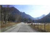
From the highway Ljubljana - Jesenice we first head to the exit Lesce, and then at the roundabout onto the old road in the direction of Žirovnica and Jesenice. After a few km of driving, we drive past the intersection where the road towards the center of Žirovnica branches off to the right. When we drive past the viaduct Završnica, we come to the right turn-off, where we turn (sharply right). Already immediately afterwards at the smaller intersection we turn left, in the next (after 50 m) right, in the direction of Završnica. After a short descent, the road briefly rises a little and then levels out, and brings us to the spot where a macadam road towards Valvasorjev dom branches off to the left. We park on the new parking lot, which is located nearby, next to the reservoir, on the right side of the road.
Route description:
From the parking lot we continue on the road past the reservoir and (later) enclosed grassy areas. The road loses its asphalt surface, and after approximately one kilometer of walking from the starting point on the left side of the road we encounter the tributary of Završnica, which we recognize by the small bridge on the road and the log cabin in the forest on the left, a little above the road. Before the small bridge we take the cart track which leads uphill to the mentioned (beekeeping) log cabin, and continue on the path through the forest upwards along the right bank of the stream, or along the left side of the streambed viewed in the direction of travel. The occasionally steep path brings us in good 15 minutes of walking from the junction at the bridge near the waterfall below Kurica. We will enjoy a particularly attractive view of the waterfall in periods after heavier rainfall.
Photos:
 1
1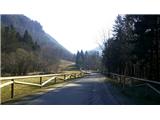 2
2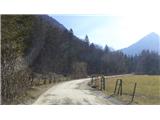 3
3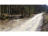 4
4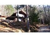 5
5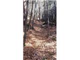 6
6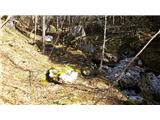 7
7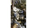 8
8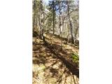 9
9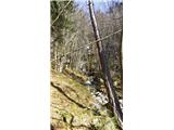 10
10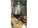 11
11 12
12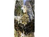 13
13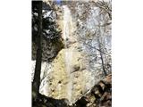 14
14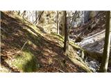 15
15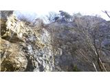 16
16
Discussion about the trip Poljana (Završnica) - Waterfall below Kurica
To post a comment you must log in:
If you do not yet have a username, you must first
register.