Starting point: Poljana (447 m)
| Latitude/Longitude: | 46,5447°N 14,873°E |
| |
Walking time: 45 min
Difficulty: easy marked way
Elevation gain: 227 m
Elevation difference along the route: 235 m
Map: Koroška 1:50.000
Recommended equipment (summer):
Recommended equipment (winter): ice axe, crampons
Views: 558
 | 2 people like this post |
Access to starting point:
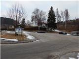
A) First, we drive to Ravne na Koroškem, and then we continue driving towards Mežica. After Prevalje we will get to the smaller settlement Poljana, where we park on a parking lot opposite the church of St. John the Baptist. Next to the parking lot is the NOB monument and Kocka bar.
B) From Črna na Koroškem we drive towards Mežica and further towards Ravne na Koroškem. In the settlement Poljana, only a little after the crossroad, where a road towards Austria branches off to the left, before the church of St. John the Baptist we turn left onto the parking lot next to the NOB monument and next to Kocka bar.
C) From the direction of Austria through the border crossing Holmec we drive into Slovenia, and after a few kilometers at the crossroad we turn left towards Ravne na Koroškem. Only a little after the crossroad, where we join the road Mežica - Prevalje, before the church of St. John the Baptist we turn left onto the parking lot next to the NOB monument and next to Kocka bar.
Route description:
From the starting point, we carefully cross the quite busy road Prevalje - Mežica, and then at the crossroad of two macadam roads we continue on the left one, which continues behind the church of St. John the Baptist. Behind the church, we once again continue right, and then we easily descend to the bridge over the river Meža. On the other side of the bridge we go left, after that on a tree we notice a signpost, which directs us right into the forest. After a short ascent on a cart track the path splits, and we choose the slightly left path in the direction of Leše churches (right Volinjak).
We continue on a cart track which ascends diagonally towards the left, and at the crossings we follow the yellow signs. Higher up the forest ends and in front of us we already notice the Leše churches, to which only a short walk remains.
Description and pictures refer to the condition in the year 2017 (February).
Photos:
 1
1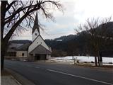 2
2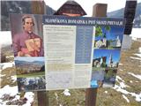 3
3 4
4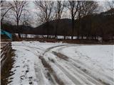 5
5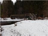 6
6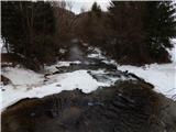 7
7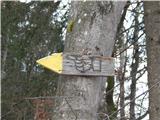 8
8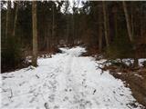 9
9 10
10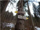 11
11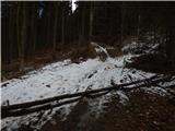 12
12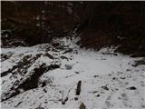 13
13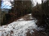 14
14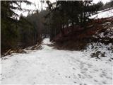 15
15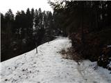 16
16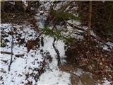 17
17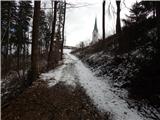 18
18 19
19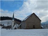 20
20
Discussion about the trip Poljana - Leše churches
To post a comment you must log in:
If you do not yet have a username, you must first
register.