Polhov Gradec (Blagajev grad) - Polhograjska Gora (Sveti Lovrenc)
Starting point: Polhov Gradec (Blagajev grad) (377 m)
| Latitude/Longitude: | 46,0679°N 14,3137°E |
| |
Walking time: 1 h 5 min
Difficulty: easy marked way
Elevation gain: 447 m
Elevation difference along the route: 447 m
Map: Ljubljana - okolica 1:50.000
Recommended equipment (summer):
Recommended equipment (winter):
Views: 44.193
 | 3 people like this post |
Access to starting point:
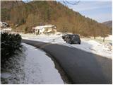
A) From Dobrova, Horjul or Gorenja vas we drive to Polhov Gradec; there from the main crossroad we continue in the direction of Črni Vrh. After a short ascent we arrive at the Polhov Gradec mansion, where the road leads us through the walls; then behind the walls we turn left and park at a suitable place by the road, where there are also hiking signposts (a smaller parking lot is also before the walls of the Polhov Gradec mansion).
B) From Črni Vrh we descend to Polhov Gradec; there before the walls we turn right and park at a suitable place by the road.
Route description:
Near the mansion we notice signs for Polhograjska gora (Sveti Lovrenc). At first, we follow the asphalt road which after a few dozen steps of walking brings us to the beekeepers' home in front of which parking is prohibited.
Ahead the footpath begins, which immediately starts to ascend steeply. The ascent on the steep path through the forest is shortened by altitude markers every 100 altitude meters. The steepness then slowly starts to decrease and the path brings us to a wide cart track, which we follow for only a few steps, because it ends at the open-doors farm. Further we continue past the chapel on the left or right path. Both paths bring us in approximately five minutes of ascent to the panoramic peak.
Photos:
 1
1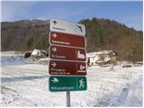 2
2 3
3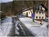 4
4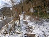 5
5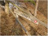 6
6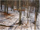 7
7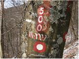 8
8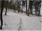 9
9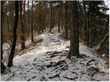 10
10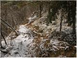 11
11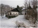 12
12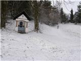 13
13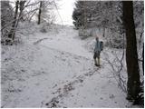 14
14 15
15
Discussion about the trip Polhov Gradec (Blagajev grad) - Polhograjska Gora (Sveti Lovrenc)
|
| Enka18. 06. 2011 |
Steep, but very nice trail.
|
|
|
|
| Kokta2. 06. 2012 |
Nice trail, despite the bad weather.
|
|
|
|
| Holcar212. 02. 2013 |
How much snow is there on Lovrenc, does anyone know?
|
|
|
|
| svizica13. 02. 2013 |
Track is made, despite approx. 30 cm you reach roots and rocks, careful on descent.
|
|
|
|
| KARAMELICA9. 11. 2014 |
For a long time we have been thinking about going to Polhograjska Gora. Since the days are getting shorter every day and today the weather was not very reliable, this hike was the best choice for us. We parked right in the parking lot by the homestead and past the beekeeping home climbed into the hill. Fortunately the weather held, there were no views anyway, but there was recreation. That counts too.
|
|
|
|
| Blagajana4. 01. 2020 |
Very popular path, yet so few reports. The path is really steep to warm you up well. It's good training to strengthen legs for skiing or later longer hikes to higher areas. Otherwise path dry today, warmer at the top than in the valley, especially where fog hasn't cleared yet. Nice views.
|
|
|
To post a comment you must log in:
If you do not yet have a username, you must first
register.