Starting point: Podsreda (246 m)
| Latitude/Longitude: | 46,03999°N 15,58968°E |
| |
Walking time: 2 h 45 min
Difficulty: easy unmarked way
Elevation gain: 281 m
Elevation difference along the route: 375 m
Map:
Recommended equipment (summer):
Recommended equipment (winter):
Views: 21
 | 1 person like this post |
Access to starting point:
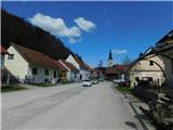
We drive to the center of the Podsreda settlement, where we park at one of the parking lots in the town center. We can also park on the outskirts of the settlement near the cemetery, sports field, or fire station.
Route description:
From the center of Podsreda, we follow the signs for Grad Podsreda, where after the NOB monument we carefully cross the main road, then continue along the side road heading south. A gentle descent follows past a few houses, then the road forks and we choose the left road, along which there are signs for Levstikov mlin (straight to Grad Podsreda). A little further, we cross the Bistrico river over a bridge, and immediately after the bridge we arrive at Levstikov mlin.
We bypass the mill on the right side; a little further when we reach the main road, we follow it right in the direction of Bistrica ob Sotli, walking along it for about ten minutes, then go right over the bridge onto the gravel road, along which higher up continue individual tourist signs for Svete gore, while at the bridge the signs are only for Levstikov mlin and Kolarjevo domačijo.
Here the path first leads right of the house, a little further it enters the forest and initially continues along the Stopnica valley, which higher up becomes the Mačjeg potoka gully, where it soon turns left and climbs the slope along which we ascend transversely higher up to the left. Later, at around 400 meters above sea level, we reach a small intersection where we choose the right, upper road along which we start to ascend more steeply. A few minutes higher, a nice view opens up briefly, then we return to the forest and join a somewhat wider marked road leading from Grad Podsreda to Svete gore.
We follow the road left (right to Grad Podsreda) and cross the slopes eastward for a while, then turn right as the road turns south. Here the path leads past a bed of wild garlic, then we continue with occasional views to the intersection and junction at Tabla, where we continue on the left road (here a fairly overgrown path from Osredka pri Podsredi joins from the right on parts).
At the junction there is also an information board Bukovi gozdovi Orlice, which we bypass on the left side, then continue along the gravel road heading northeast. We continue through the forest for some time, then at the first or last house in the village Zagaj we reach the asphalt road, along which we continue.
The path ahead leads with nice views of Veliki Špiček; in the hamlet Vrhovnica a marked path from Bizeljskega joins from the right.
We continue straight, and also at the next intersection go straight, then through the forest to the preval Svete Gore, where we join the path from the direction of Bistrica ob Sotli and the Bizeljska vas pass.
Here we go slightly left, then ascend to the summit of Svete gore left along the footpath or straight along the steep road. In both cases it is a little more than five minutes to the top, but it is definitely worth doing a loop trail.
Starting point - Levstikov mlin 0:10, Levstikov mlin - start of gravel road 0:15, start of gravel road - junction east of Vranskih pečin 0:45, junction east of Vranskih pečin - Tabla 0:35, Tabla - Vrhovnica 0:30, Vrhovnica - preval Svete Gore 0:20, preval Svete Gore - Svete gore 0:10.
Description and photos refer to the condition in March 2026.

Along the route: Levstikov mlin (240m), Odcep z asfaltne ceste (230m), Razpotje vzhodno od Vranskih pečin (510m), Tabla (500m), Vrhovnica (473m), Preval Svete Gore (455m)
Photos:
 1
1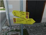 2
2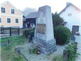 3
3 4
4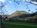 5
5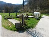 6
6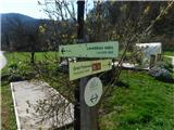 7
7 8
8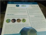 9
9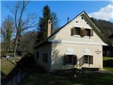 10
10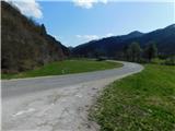 11
11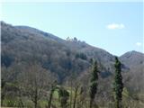 12
12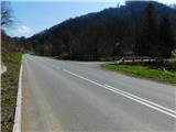 13
13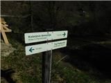 14
14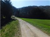 15
15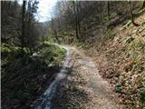 16
16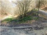 17
17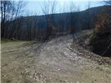 18
18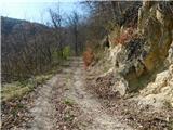 19
19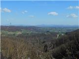 20
20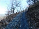 21
21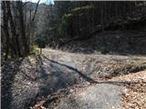 22
22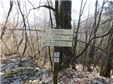 23
23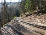 24
24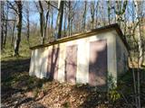 25
25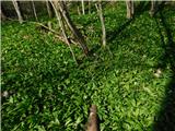 26
26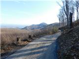 27
27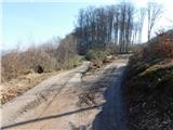 28
28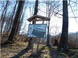 29
29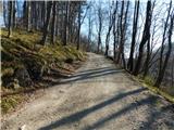 30
30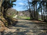 31
31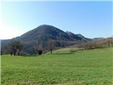 32
32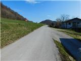 33
33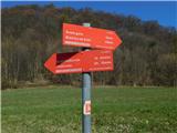 34
34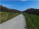 35
35 36
36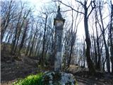 37
37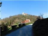 38
38 39
39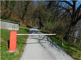 40
40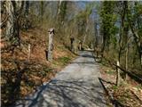 41
41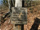 42
42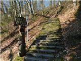 43
43 44
44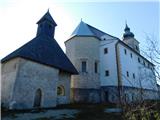 45
45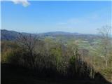 46
46
Discussion about the trip Podsreda - Svete gore
To post a comment you must log in:
If you do not yet have a username, you must first
register.