Starting point: Podsabotin (136 m)
Walking time: 2 h
Difficulty: easy marked way
Elevation gain: 473 m
Elevation difference along the route: 473 m
Map:
Recommended equipment (summer):
Recommended equipment (winter):
Views: 17.415
 | 3 people like this post |
Access to starting point:
From the direction of Bovec-Tolmin along the Soška cesta we drive towards Nova Gorica to the traffic-light intersection above the cemetery in Solkan. Here we turn right and drive over the bridge across the river Soča into Goriška Brda to Podsabotin (6 km from Solkan).
From other directions we drive to Nova Gorica and follow the signs Bovec-Tolmin. If the route takes us through Nova Gorica and Solkan, then at the end of Solkan we drive left over the bridge across the river Soča into Goriška Brda. If we drive past Nova Gorica we follow the signs for Bovec-Tolmin and via the Solkan bypass we reach the traffic-light intersection above the cemetery in Solkan. Here we turn left and then immediately right over the bridge across the river Soča into Goriška Brda to Podsabotin (6 km from Solkan).
The road starts ascending right behind the bridge. After two large turns we drive past the parking lot on our left and 300 m higher on our right we notice stairs that lead to Sabotin via the Southern Path. Soon after the stairs we enter Italy, where the road flattens. After approximately 1.6 km of driving through the «corridor» we are again on the Slovenian side. On our left is a smaller parking lot, and on the right the path Za koridorjem ascends to Sabotin via stairs. Further, the road descends in a few turns to Podsabotin, an elongated village with several hamlets that once belonged under Šentmaver / San Mauro (I). The road winds through the valley of the stream Pevmica past the cemetery and retirement home (both on our right). Just before the road starts ascending towards Hum, on our right we will notice a bus stop. Here a narrower road branches off to the hamlet Podsenica (Podsabotin 11a - 21), at the intersection we will also notice the sign that marks the cycling and hiking path to Sabotin. Opposite the bus stop along the road there is some space for parking. Since a bus stops here during school hours, park so that the bus has enough space to stop.
Route description:
The path from Podsabotin is at least in the first part more interesting for cyclists than for hikers. Hikers mostly join it at the intersection where the path from Podsabotin joins the road to Sabotin. Here the mountain path ascends to the ridge and continues along the path that leads from the hunting lodge or from Korada.
The path from Podsabotin is most interesting if we arrive at the starting point by bus and then walk the entire Sabotin ridge to Solkan. Unfortunately, access by bus is possible only during school hours. If we arrive at the starting point by car, we will have to return at least partly along the same path.
Along this path as well we will need good footwear and on warmer days plenty of liquid, as Sabotin is not dangerous due to its height but due to the heat. The most suitable time to visit Sabotin is from September to May. The path is most beautiful in spring when cherries bloom and buds open on the trees, or in autumn when the ridge is colored in glowing shades of sumac. In winter we will be rewarded with the most beautiful views and the most colorful sunsets. When a strong north wind or bora blows on winter days, it is better to avoid the path over the ridge.
In summer it is best to drive to Sabotin by car. An asphalt road from Goriška Brda leads to the mountain hut and refreshment hut, which are in the premises of the former guardhouse right below the summit of Sabotin. The road to Sabotin branches off the main road Dobrovo-Plave, specifically 1 km above Gonjače (from the direction of Nova Gorica or Dobrovo) and 1 km below Vrhovlje (direction Plave or Korada).
In the refreshment hut there is a mini museum, and a guided tour of the caverns, which are illuminated and arranged, is also possible.
***
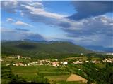
From the starting point at the bus stop in Podsabotin the path steeply ascends along the asphalt road through the hamlet Podsenica past a smaller church and the monument to the fallen fighters in NOV and the victims of fascism from Podsabotin. Above the hamlet the road ascends past an olive grove and vineyard. Above the olive grove we can continue along the cart track marked with the sign Karnjuka (one of the paths through the Brda brajde marked with old cherry names), or continue ahead along the road, as the cart track only slightly shortens the ascent and joins the road at (before) the last house. From this part of the path we can already, with good visibility, enjoy views of Nova Gorica and Gorica with Goriški grad and the ossuary at Oslavje; on the other side it is visible to the hunting lodge.
Above the house the asphalt ends after 1 km and we continue along the gravel road. At the first junction we turn left. The path ascends another 300 m or so to the next junction, where we turn left again. We can also drive here by car if the steep and narrow road through the village and the poorer gravel further on do not bother us. Park so as not to block tractor access to the cart tracks. From Podsabotin to here it is approximately 0.5 hours of walking.
Further on the road levels out and in a few steps brings us to the last house next to a larger pond on our right. On the left, past cherry trees, a view opens to Brda with the most prominent church of St. Cross above Kojsko and the tower in Gonjače. The path begins to ascend gently and brings us to the next junction. We continue straight past the hunting observation post. The path along the cart track or poorer gravel road moderately ascends to the intersection where it joins the asphalt road to Sabotin.
Cyclists continue riding along the road, while hikers are directed by a mountain sign on the other side of the road towards the ridge. A shorter and steeper ascent follows along the trail to the ridge, where we join the path from the hunting lodge or from Korada. To the hunting lodge it is 20-30 min, to Korada approximately 3 hours. From Podsabotin to the ridge it is approximately 1 hour of walking, and another 1 hour to the summit of Sabotin.
Ahead of us is the most beautiful part of the path along the panoramic northern ridge of Sabotin. This part of the path is among the less visited and therefore the most pristine of all equipped paths on Sabotin. The path along the rocky ridge requires some attention, in between we can enjoy vast views from the sea and Dolomites to the Tolmin Mountains and Spodnje Bohinjske gore. The path mostly ascends gently to moderately along the northern edge of the ridge and is very exposed to the north wind and bora. On warmer days cold air rising from the Soča winding below can be felt here. On the opposite bank of the Soča rise the Vodice, on which a mausoleum to General Mauriziu Ferrente Gonzaga is built. Behind Vodice our gaze stops at the mighty Krn. Ahead is the endless ridge of Sabotin, to its left we gradually approach Sv. Gora with the basilica, to its right Škabrijel becomes increasingly visible with every step. After approximately 45 min the path ascends past a half-ruined pyramid that was erected after World War I when an open-air museum was set up on Sabotin.
Behind the pyramid the path slowly retreats from the ridge and through a sparse woodland heads towards the former guardhouse – now the mountain hut and refreshment hut. The path crosses two shooting trenches and brings us to the former guardhouse in a few minutes. Alternatively, after the second shooting trench we can ascend to the top of the ridge and continue along an unmarked trail along the ridge to see a few more remnants from World War I.
From the mountain hut/refreshment hut a 10-15 minute ascent separates us from the summit of Sabotin.
***
In good weather it is best to continue from the summit of Sabotin along the ridge all the way to the church of St. Valentin (approximately 20-25 min). If a strong bora is blowing, the path is also below the ridge on the Italian side. If we came to the starting point by public transport, we continue the descent to Solkan along the Southern Path (30-40 min). If we have a car in Podsabotin, from the church we continue along the cart track on the Italian side. The cart track crosses the southern slopes below Sabotin and brings us in good 10 minutes to the asphalt road leading from Šentmaver to the Italian guardhouse. Along the road we continue with a gentle descent to the left to the next curve No. 5 (10 min), where we rejoin the Slovenian side. We continue along the cart track past the bench (here we cross the Za koridorjem path) and in a few steps arrive at the road to Sabotin, where we turn left towards Podsabotin. Right there are another 800 m to the hut/refreshment hut on Sabotin.
To the intersection for Podsabotin it is 30 min of walking along the asphalt road (2.2 km). The path takes us past two pyramids. At the first pyramid we can ascend back to the ridge along the nicely cleaned shooting trench and continue walking in the arrival direction.
***
If the weather is not favorable or we run out of strength, from the summit we can also descend past the Italian guardhouse and along a trail that crosses the karst scrub to the right join the Za koridorjem path. Along the path we descend to the first junction at the bench, where we join the road to Sabotin.
***
If we return from the summit to the mountain hut/refreshment hut, to the starting point instead of along the asphalt road we can at least walk part of the path along the trail that starts on the stairs below the mountain hut or at the shooting trench below the refreshment hut, and brings us to the curve with the chapel in the rock wall. From there we can continue along the trail that begins descending right below the curve or join the shooting trench along a stake-marked pathlet, along which we descend to the road (or we can ascend back to the ridge). Both paths bring us to the first pyramid, from where we continue another 1.8 km (20 min) along the asphalt road to the intersection for Podsabotin.
Sabotin is the last Alpine and the first Mediterranean hill. Excellent energies flow through it and slowly soothe the memory of the bloody history. Let us tread respectfully upon it and enjoy its immeasurable beauties as well as its natural science and cultural-historical attractions.

Photos:
 1
1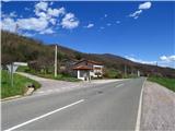 2
2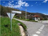 3
3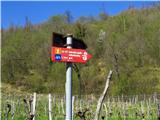 4
4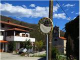 5
5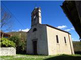 6
6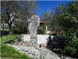 7
7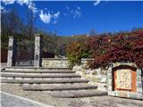 8
8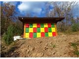 9
9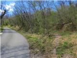 10
10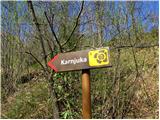 11
11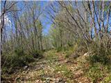 12
12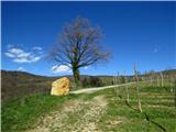 13
13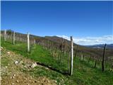 14
14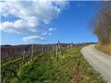 15
15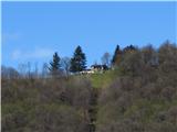 16
16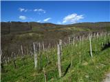 17
17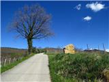 18
18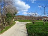 19
19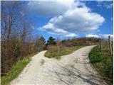 20
20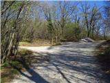 21
21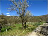 22
22 23
23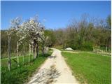 24
24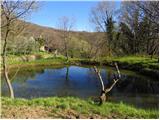 25
25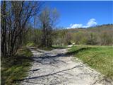 26
26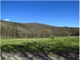 27
27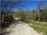 28
28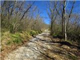 29
29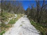 30
30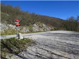 31
31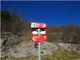 32
32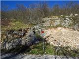 33
33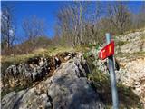 34
34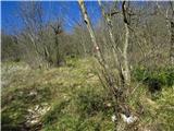 35
35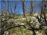 36
36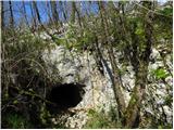 37
37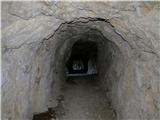 38
38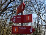 39
39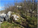 40
40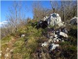 41
41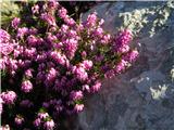 42
42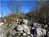 43
43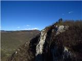 44
44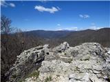 45
45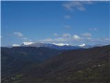 46
46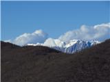 47
47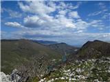 48
48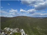 49
49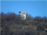 50
50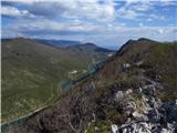 51
51 52
52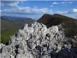 53
53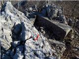 54
54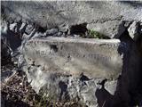 55
55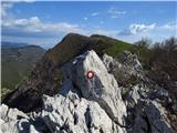 56
56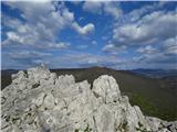 57
57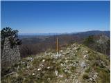 58
58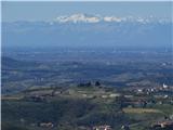 59
59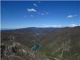 60
60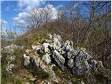 61
61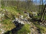 62
62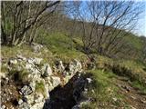 63
63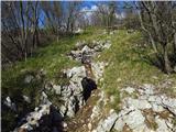 64
64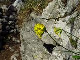 65
65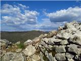 66
66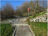 67
67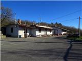 68
68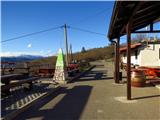 69
69 70
70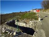 71
71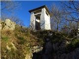 72
72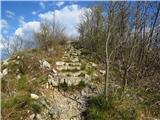 73
73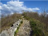 74
74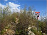 75
75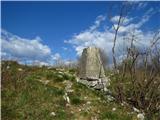 76
76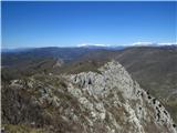 77
77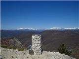 78
78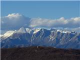 79
79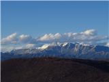 80
80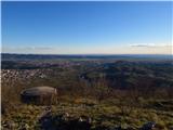 81
81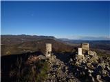 82
82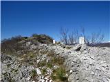 83
83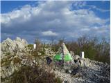 84
84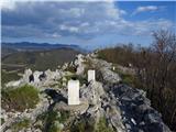 85
85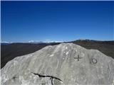 86
86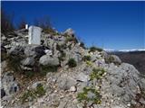 87
87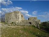 88
88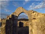 89
89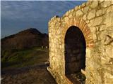 90
90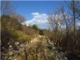 91
91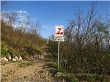 92
92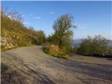 93
93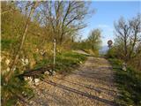 94
94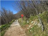 95
95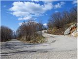 96
96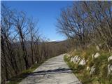 97
97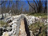 98
98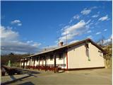 99
99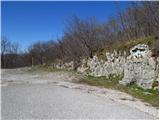 100
100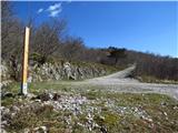 101
101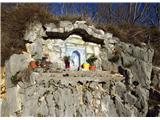 102
102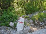 103
103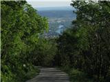 104
104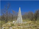 105
105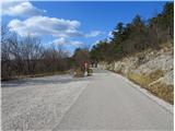 106
106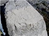 107
107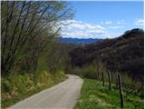 108
108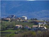 109
109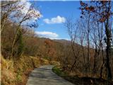 110
110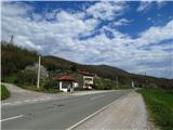 111
111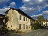 112
112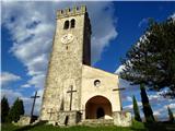 113
113 114
114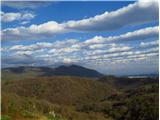 115
115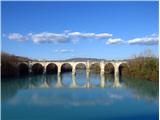 116
116
Discussion about the trip Podsabotin - Sabotin
To post a comment you must log in:
If you do not yet have a username, you must first
register.