Podnanos - Sveti Miklavž above Vipava
Starting point: Podnanos (175 m)
| Latitude/Longitude: | 45,7972°N 13,9725°E |
| |
Walking time: 1 h 5 min
Difficulty: easy marked way
Elevation gain: 263 m
Elevation difference along the route: 300 m
Map: Nanos 1:50.000
Recommended equipment (summer):
Recommended equipment (winter):
Views: 4.956
 | 2 people like this post |
Access to starting point:
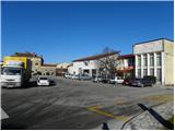
From Razdrto we drive on the highway towards Nova Gorica or vice versa and we go to the exit Vipava. When we leave the highway we get to an old road which we follow in the direction of Podnanos. When we get to Podnanos we turn left towards the nearby primary school, post office and store. We park on a large parking lot before the mentioned buildings.
Route description:
Near the information board about Nanos we notice the first signs for Abram, hunting cottage and mountain hut Vojkova koča, which point us on the road which continues by nearby school sports field. After the sports field we get to a smaller crossroad, where signs for Nanos point us right, and we continue straight on the road which turns to the left and at the nearby house ends. We continue over a smaller bridge and then immediately after it right, where for a short time we walk directly next to the water. A little further, we join the asphalt road, and it brings us to a smaller crossroad, where we continue right, and then a little further it also crosses the stream Močilnik. The road further leads past wine cellar Furlan, behind which settlement slowly ends. At the end of the settlement, we get to a crossroad, where we continue right in the direction of "run" and intervention access to highway over Rebrnice. We still continue on the asphalt road, and it a few tens of meters further brings us to the next crossroad, where we continue right again in the direction of "hike and run" (left leads the road towards the nearby houses). Only a little further, the path on running route branches off to the right, and we continue on the asphalt road, on which we ascend above the highway. On the other side of the highway, which we cross by the edge of entrance into a tunnel, asphalt ends, and the road turns to the left and it brings us to the smaller crossroad, where we continue sharply right. From the macadam road only a few steps higher, in the middle of sharp left turn, marked path branches off to the right, which leads towards Abram (path over Konj), hunting cottage Vojkovo and mountain hut Vojkova koča na Nanosu.
From the mentioned crossing, we continue in the direction of Sveti Nikolaj and Gradiška Tura and we still continue on the macadam road which we follow to the spot, where it starts descending.
At the spot, where the road starts descending, cart track branches off to the right, on which we continue the ascent, and there we quickly get to a marked crossing. We again continue left (right Abram and hunting cottage - path joins the path which branched off to the right from ours immediately above the highway), and by the path, we notice a notification that we are entering the bear area. Further, we are for some time ascending on a cart track which is ascending diagonally towards the left. The path ahead (also until now) is relatively poorly marked, and it leads past several unmarked crossings. To not go astray from the right path, it is good that at the crossings we choose the cart track which is ascending diagonally towards the left. After approximately 1 hour of walking, we step on a somewhat wider path (poor road), which we follow to the left, and there in 5 minutes we walk to the church of St. Miklavž.

Photos:
 1
1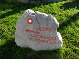 2
2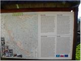 3
3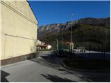 4
4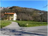 5
5 6
6 7
7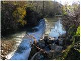 8
8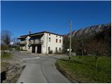 9
9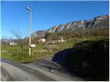 10
10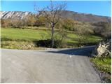 11
11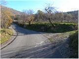 12
12 13
13 14
14 15
15 16
16 17
17 18
18 19
19 20
20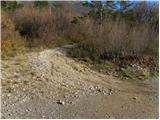 21
21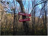 22
22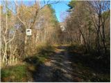 23
23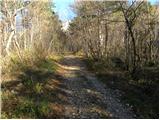 24
24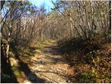 25
25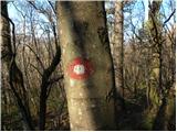 26
26 27
27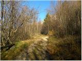 28
28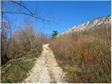 29
29 30
30 31
31 32
32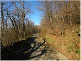 33
33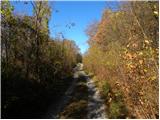 34
34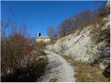 35
35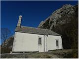 36
36
Discussion about the trip Podnanos - Sveti Miklavž above Vipava
|
| darinka425. 05. 2018 |
I took a little look at the path yesterday when I was at the church. The wider path comes from Podnanos. However, it is longer than the one starting from kamp tura. If you have nice weather, the tour is really pleasant.
|
|
|
|
| valerija11225. 05. 2018 |
I've already walked this path, next time I'll really look for that one from the church to Gradiška tura.
I'll choose a nice morning so there's no crisis if I get a little lost.
|
|
|
|
| darinka426. 05. 2018 |
If you go from the direction of kamp tura towards the little church, you can hardly miss the junction. It's written on the pillar, similar to the descriptions of climbing walls on pillars all the way.
|
|
|
|
| mirank26. 05. 2018 |
In my opinion, you can't get lost on the 15-20 min walk that the path from tura to there takes.
|
|
|
|
| valerija11224. 07. 2018 |
Darinka, thanks for the idea and tips.
This morning I went from Gradišče to the chapel, then to Gradiška tour and back via Plaz. Nice tour, shade helped it wasn't too hot.
|
|
|
To post a comment you must log in:
If you do not yet have a username, you must first
register.