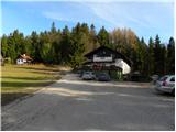
Starting point: Podmeja (724 m)
| Latitude/Longitude: | 46,1861°N 15,0618°E |
| |
Walking time: 1 h
Difficulty: easy marked way
Elevation gain: 358 m
Elevation difference along the route: 375 m
Map:
Recommended equipment (summer):
Recommended equipment (winter): ice axe, crampons
Views: 311
 | 1 person like this post |
Access to starting point:
A) From the highway Ljubljana - Celje we take the exit Šempeter and continue driving towards Prebold and later Trbovlje. We then follow the serpentine road to the pass Podmeja, where we park on the parking lot near the hunting lodge.
B) From Zasavje we first drive to Trbovlje, then continue driving towards Prebold. When we come to the pass Podmeja, we park on the parking lot near the hunting lodge.
Route description:
From the pass Podmeja we first walk to the hunting lodge, where on the left side we will notice signposts for Mrzlica, which direct us to the right into the forest. The path, which moderately ascends, quickly brings us to the indistinct Svinski vrh (766 m), from which the path gradually begins to descend. After a few minutes of descent, we step out of the forest and the path brings us to the road which leads towards Mrzlica. We follow the mentioned road to the right, and it brings us past a hamlet with a few houses into the forest, where it then moderately ascends. Higher, the road levels out and leads us from the forest to the scenic grassy slopes of Kriška planina, from which a beautiful view opens up to the peaks surrounding Savinjska dolina. Here, paths from the starting points in Marija Reka and Prebold via Kriška planina join us from the left. We continue straight along the road until the next marked junction, where a path through a forest logging trail joins from the left, with starting points in Marija Reka, Prebold, and Matke.
We don’t walk along the road for long, as signs for the Prebold mountain trail soon direct us left onto a footpath leading toward the summit of Homič (straight along the road to Mrzlica). The path ahead becomes quite steep and leads us along the forested ridge of Homič, whose summit we reach after approximately ten minutes of ascent from the point where we left the road.

Photos:
 1
1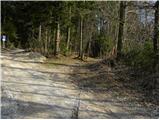 2
2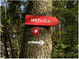 3
3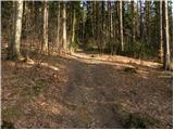 4
4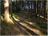 5
5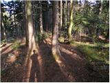 6
6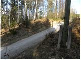 7
7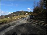 8
8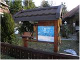 9
9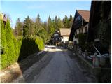 10
10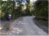 11
11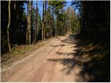 12
12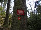 13
13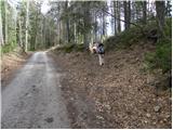 14
14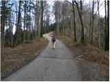 15
15 16
16 17
17 18
18 19
19 20
20 21
21 22
22 23
23 24
24 25
25 26
26 27
27
Discussion about the trip Podmeja - Homič
To post a comment you must log in:
If you do not yet have a username, you must first
register.