Podkraj / Unterort - Alpengasthof Siebenhütten (Walter Mory Klettersteig)
Starting point: Podkraj / Unterort (650 m)
| Latitude/Longitude: | 46,5426°N 14,7744°E |
| |
Route name: Walter Mory Klettersteig
Walking time: 3 h 15 min
Difficulty: very difficult marked way
Via ferrata: C
Elevation gain: 1058 m
Elevation difference along the route: 1070 m
Map: Koroška 1:50.000
Recommended equipment (summer): helmet, self belay set
Recommended equipment (winter): helmet, self belay set, ice axe, crampons
Views: 4.791
 | 2 people like this post |
Access to starting point:
A) Through the Jezerski vrh border crossing we drive into Austria, then after approximately 6 km past Železno Kaplo / Bad Eisenkappel we turn right towards Velikovec / Völkermarkt. We follow the main road towards Velikovec for 2 km, then we turn right again, this time in the direction of Pliberk / Bleiburg. Further, we drive through the Podjuna valley, then at the next major intersection we turn right towards Pliberk. The road ahead leads through several roundabouts, and we follow it further in the direction of the Peca / Petzen ski area. Further, we drive through Bistrica pri Pliberku / Feistritz ob Bleiburg to a large parking lot at the bottom station of the cable car to Peca. From the Jezerski vrh border crossing to the starting point it is approximately 40 km.
B) From Dravograd or Slovenj Gradec we drive to Ravne na Koroškem, then we continue driving in the direction of the Holmec border crossing. When we enter Austria we first drive towards Pliberk / Bleiburg, then we follow the signs for the Peca / Petzen ski area. Further, we drive through several villages, and we follow the road to a large parking lot at the bottom station of the cable car to Peca. From the Holmec border crossing to the starting point it is approximately 8 km.
Route description:
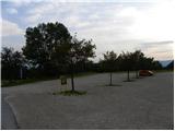
From the parking lot, we first walk to the bottom station of the circular-cable car to Peca, then head to the path marked with nos. 3, 7 and 8. The path initially leads along a wide cart track, along which we quickly reach the ski slope. We continue along the left edge of the ski area, then the path turns slightly to the right and takes us into a dense forest. Here it flattens and joins a cart track, along which we slightly descend to the nearby marked junction.
From the junction, we continue along the left ascending road, where the signs for paths nos. 3 and 7 also direct us. Just a few minutes higher, the road splits into two parts, where we continue left on path no. 3 (to the right initially slightly downhill path no. 7, which leads towards Veški planini). Some 100 m higher, we join a marked path leading from the village Rute / Ruttach, so further on we cross a poor forest road several times. Higher up, the road along which we occasionally continue the path for some time finally ends, and we proceed between two rocks into the forest. The path ahead steeply ascends through the forest, which on hot days provides pleasant shade. Higher up, the forest gradually thins, and fine views open up towards Podjuna and the Golica range. A little further on, the trail turns sharply to the left and brings us below the steep slopes of Mala Peca, where in the middle of the right-hand bend, the climbing path named Walter Mory Klettersteig branches off to the left, leading to the upper station of the circular-cable car.
At the junction, we continue left towards the climbing path and then begin to ascend in zigzags towards the wall where the climbing path starts.
Before entering the climbing section of the path, we equip ourselves with a helmet and a set for self-protection.
The climbing path initially ascends diagonally across the rocky slope, aided by a steel cable and a few pegs. The path then turns right and ascends a slippery slope with plenty of sand and earth. This is followed by a slightly less steep traverse to the left and then a steep ascent to the right along a short gully. At the top of the gully, the path becomes less demanding for a short time and leads us to a junction.
If the path seemed too demanding to us, we continue left on the easier path; otherwise, we can continue right on the harder path. The harder path then, after a short traverse and ascent over crumbly slopes, brings us to the logbook box, which is located before the most demanding part of the path. Here the path ascends almost vertically, aided by numerous pegs. This is followed by a steep ascent along the steel cable on an indistinct rocky gully. The climbing path then ends, and after a short ascent we reach the viewpoint where there are several benches.
We continue along a wide gentle path, which brings us to a macadam road where there is a marked junction. We continue straight along the steep road to the upper station of the cable car, which we already see ahead.

Photos:
 1
1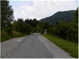 2
2 3
3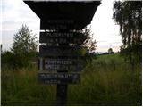 4
4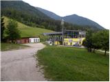 5
5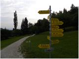 6
6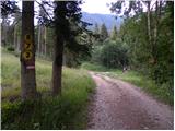 7
7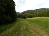 8
8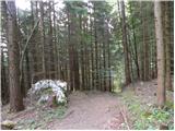 9
9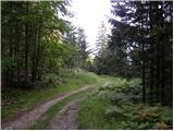 10
10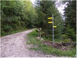 11
11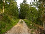 12
12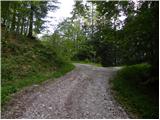 13
13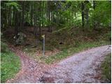 14
14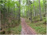 15
15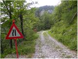 16
16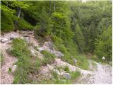 17
17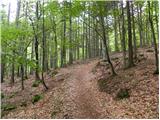 18
18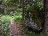 19
19 20
20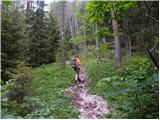 21
21 22
22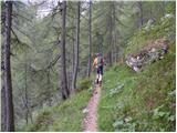 23
23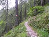 24
24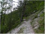 25
25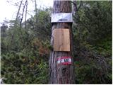 26
26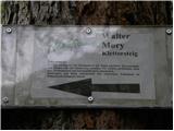 27
27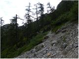 28
28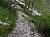 29
29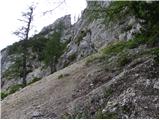 30
30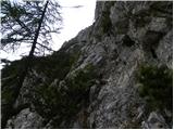 31
31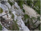 32
32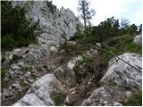 33
33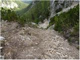 34
34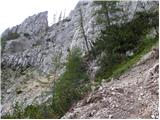 35
35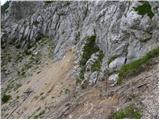 36
36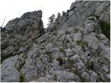 37
37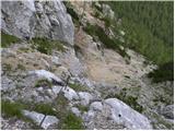 38
38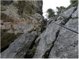 39
39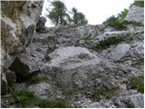 40
40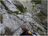 41
41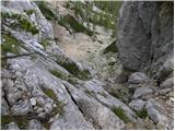 42
42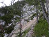 43
43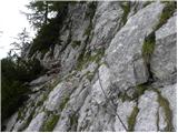 44
44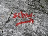 45
45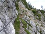 46
46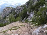 47
47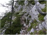 48
48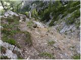 49
49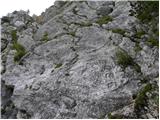 50
50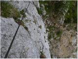 51
51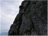 52
52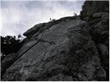 53
53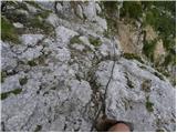 54
54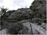 55
55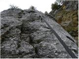 56
56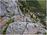 57
57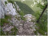 58
58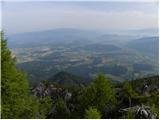 59
59 60
60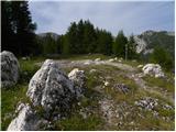 61
61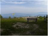 62
62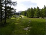 63
63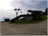 64
64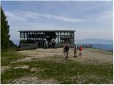 65
65
Discussion about the trip Podkraj / Unterort - Alpengasthof Siebenhütten (Walter Mory Klettersteig)
|
| klm20. 07. 2011 |
Path rating is C/D, same as Cjajnik. But the latter is nevertheless "nicer". At least not so "gravelly"...
|
|
|
|
| Matjaz_6511. 09. 2011 |
some photos from the circular tour ... Walter Mory climbing path .. Bistriška špica .. Veška kopa and planina 
|
|
|
To post a comment you must log in:
If you do not yet have a username, you must first
register.