Podkanja vas / Wildenstein - Hochobir (Ojstrc)
Starting point: Podkanja vas / Wildenstein (511 m)
| Latitude/Longitude: | 46,5388°N 14,509°E |
| |
Walking time: 5 h
Difficulty: easy marked way
Elevation gain: 1628 m
Elevation difference along the route: 1645 m
Map: Karavanke - osrednji del 1:50.000
Recommended equipment (summer):
Recommended equipment (winter): ice axe, crampons
Views: 2.170
 | 2 people like this post |
Access to starting point:
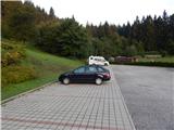
A) Via the Ljubelj border crossing we drive into Austria, then in the settlement Podljubelj / Unterloibl we turn right towards the Hofer store. When we arrive in Borovlje / Ferlach, at the crossroads slightly behind the railway track we turn left (to the right of the crossroads there is the Eurospar store), and at the next crossroads after a few hundred metres we turn right towards Železne Kaple / Bad Eisenkappel. Towards Železne Kaple we drive to the settlement Podkanja vas / Wildenstein, where signs for Podkanjski slap / Wildensteiner Wasserfall direct us right. There follows some ascent on a somewhat narrower road, then we arrive at a nicely arranged parking lot (at the starting point there are also a guesthouse and museum).
B) Via the Jezerski vrh border crossing we drive into Austria, then past Železno Kaplo we continue left towards Celovec / Klagenfurt and Borovlje / Ferlach. We continue along the main road towards Borovlje / Ferlach, but drive to the settlement Podkanja vas / Wildenstein, where signs for Podkanjski slap / Wildensteiner Wasserfall direct us left. There follows some ascent on a somewhat narrower road, then we arrive at a nicely arranged parking lot (at the starting point there are also a guesthouse and museum).
C) We drive to Podjuno, then follow signs for Železno Kaplo / Bad Eisenkappel. Past the settlement Miklavčevo / Miklauzhof, we leave the road towards Železna Kapla and continue right towards Celovec / Klagenfurt and Borovlje / Ferlach. We continue along the main road towards Borovlje / Ferlach, but drive to the settlement Podkanja vas / Wildenstein, where signs for Podkanjski slap / Wildensteiner Wasserfall direct us left. There follows some ascent on a somewhat narrower road, then we arrive at a nicely arranged parking lot (at the starting point there are also a guesthouse and museum).
Route description:
From the starting point we continue on a wide tourist path towards Podkanjski slap and Obir. First we ascend in a few hairpin turns, then after a short panoramic section the path enters the forest and narrows somewhat. After a few minutes of further walking, a marked path to Obir branches off to the right from the wide path, we continue straight and after one more minute arrive at an arranged viewpoint on Podkanjski slap.
From the viewpoint we return to the last junction, then continue on the marked path towards Obir. From the point where we leave the wide tourist path, we begin to ascend steeply, on steeper sections helped by steps and occasional steel cables (easy in dry conditions). After a few minutes the slope's steepness eases, the path turns right, first crossing a cart track, then a bit further leading us to a forest road which we follow left. We walk along the road to a right-hand bend, at the start of which a marked footpath continues straight ahead. Further on we cross the forest road several times, along which the path occasionally runs. There follows a somewhat longer ascent through the forest, arriving at a marked junction on a small level area.
From the junction we take the left path (right to Jagovčeva planina, from there possible ascent to Mali Obir or descent to Borovniško pregradno jezero), which continues along a small valley, higher up returning to the road which we follow left, quickly arriving at the abandoned Hofovška planina.
Above the planina we finally leave the road and ascend an increasingly steep path. Higher we reach a forested ridge, where a path from the village Reberca / Reehberg joins from the left.
We continue right on a fairly level path, which shortly after crosses a pasture fence, then begins to fade on the extensive pastures. Across the pasture we carefully follow the otherwise sparse markers, then upon re-entering the forest join a better-trodden path leading from or past Kapelška koča / Eisenkappler Hütte.
We continue towards Obir, ascending above the treeline in a few hairpin turns. There follows some easy walking and the path leads us to the indistinct summit of Kraguljše, from where a fine view opens up.
Further the level path first leads past a small marsh, then gradually begins to ascend moderately. Higher the path becomes somewhat steeper and with fine views of surrounding mountains and valleys leads us to the ruins of the former Rainer Schutz Hütte at 2040 m. From the ruins in a few minutes we ascend to the main ridge of Obir, continuing right (left to Kravji vrh and Šajda saddle). There follows an ascent somewhat right of the ridge; we stick to the marked path without taking shortcuts, as warned by a sign in German. The moderately steep path then in a few more minutes brings us to Ojstrc, the highest peak of Obir.
Description and pictures refer to the condition in 2017 (August).

Photos:
 1
1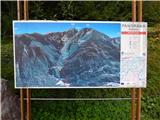 2
2 3
3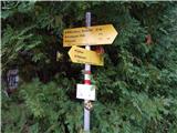 4
4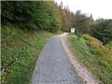 5
5 6
6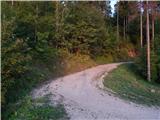 7
7 8
8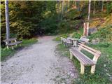 9
9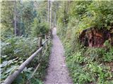 10
10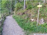 11
11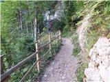 12
12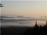 13
13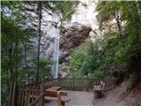 14
14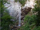 15
15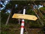 16
16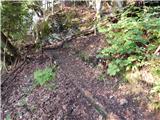 17
17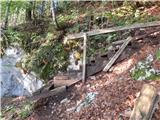 18
18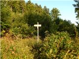 19
19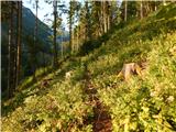 20
20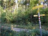 21
21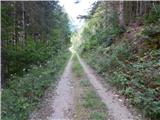 22
22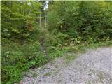 23
23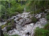 24
24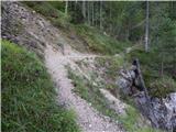 25
25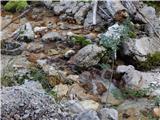 26
26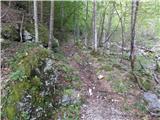 27
27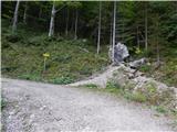 28
28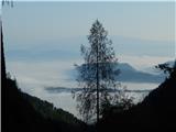 29
29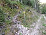 30
30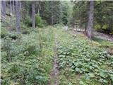 31
31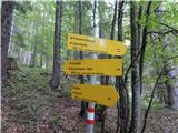 32
32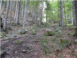 33
33 34
34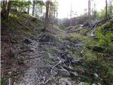 35
35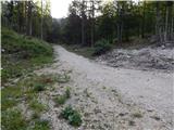 36
36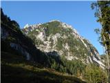 37
37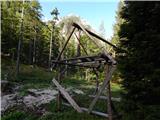 38
38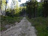 39
39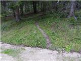 40
40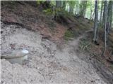 41
41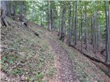 42
42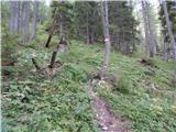 43
43 44
44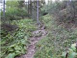 45
45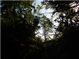 46
46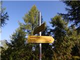 47
47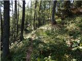 48
48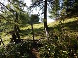 49
49 50
50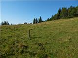 51
51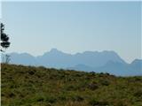 52
52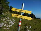 53
53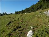 54
54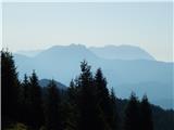 55
55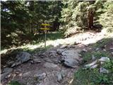 56
56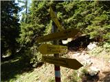 57
57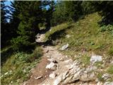 58
58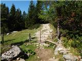 59
59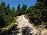 60
60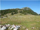 61
61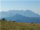 62
62 63
63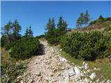 64
64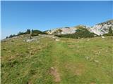 65
65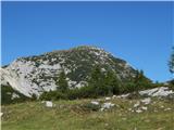 66
66 67
67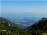 68
68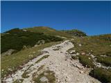 69
69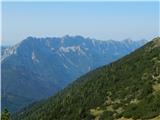 70
70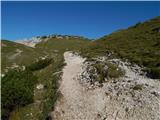 71
71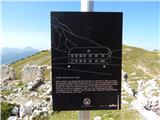 72
72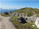 73
73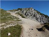 74
74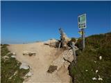 75
75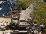 76
76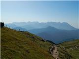 77
77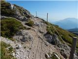 78
78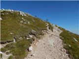 79
79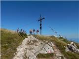 80
80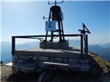 81
81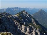 82
82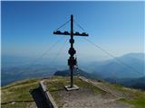 83
83
Discussion about the trip Podkanja vas / Wildenstein - Hochobir (Ojstrc)
|
| jax16. 09. 2017 |
From this side the access to Obir via Jagovčevo sedlo and then along the unofficially marked path on the northern ridge is actually nicer. Some scrambling, but nothing particularly difficult. Descent then here. Nice circular tour :-)
|
|
|
|
| Domch10. 10. 2019 |
On Tuesday I did the ascent and descent along this path. To the top about 3 hours of good walking. Some overgrown sections on the path and at the top of Krtolovca a lot of fallen trees on the path, but with a bit of ingenuity it's doable. On the descent I decided to try to Jagovčeva planina and maybe Mali Obir, but the initial joy of easy ascent on the bulldozer road quickly ended, as the road ends a little below the saddle. No markers, because there is a lot of fallen forest. I tried a bit directly through the forest and grass up, but then I decided not to risk it. At Hoffmanova koča I checked everything for markers, but due to fallen trees and the new road there are none anywhere.
|
|
|
|
| bojank6. 12. 2019 |
For the ascent yesterday I used exactly 5 hours. I lost some time at altitude cca 1200 m, where windthrow uprooted quite a few trees and the passage is awkward. Probably this part of the path can be bypassed to the right along the forest road? Walking the ridge was really fairy-tale - 20-30 cm of trodden snow, sun, no wind, clear views in all directions.
|
|
|
To post a comment you must log in:
If you do not yet have a username, you must first
register.