Starting point: Podhočar (1090 m)
| Latitude/Longitude: | 46,1968°N 13,9971°E |
| |
Walking time: 1 h 50 min
Difficulty: easy marked way
Elevation gain: 540 m
Elevation difference along the route: 540 m
Map: Škofjeloško in Cerkljansko hribovje 1:50.000
Recommended equipment (summer):
Recommended equipment (winter): ice axe, crampons
Views: 28.644
 | 1 person like this post |
Access to starting point:
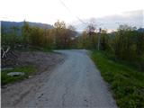
From Podbrdo, Soriška planina or Železniki we drive to Petrovo Brdo, and from there we continue towards the south, on the road which continues in the direction of the settlement Podporezen and starts ascending. The path ahead leads us on an asphalt road which higher brings us to a crossroad, where we continue straight or slightly left (by the crossroad there are only signs for the right road which lead towards the farm Pr Robarju and nearby cross). We follow the asphalt, but relatively steep road all the time to the farm Podhočar (last farm), where on an appropriate place a few meters below the farm we park.
Route description:
From the spot where we've parked, we walk to the farm, and there on the house we notice signs for Porezen, which point us to the right on a cart track which continues behind the house. We continue on the cart track (path which leads left through a meadow is closed), which passes into the forest and starts moderately ascending. After a few minutes of the ascent the cart track starts turning to the left and brings us to an indistinct ridge, where the path turns a little more to the left to the nearby meadow. When we reach the edge of the meadow, from where a view towards Blegoš opens up, we go right and the path takes us back into the forest.
In the forest, the cart track changes into a pleasant footpath, which in a gentle ascent leads us through an indistinct small valley.
On the part where the small valley starts changing into a gentle slope we join a better beaten path from Petrovo Brdo.
The path ahead moderately to steeply ascends through the forest and in a few hairpin turns leads us on the slopes of the less known, but panoramic summit Hoč (1514 m). Next follows a crossing in a gentle ascent towards the right, and then the path brings us out of the forest on a smaller saddle between the already mentioned Hoč and Pohoški Kup (Glava).
On the saddle a nice view opens up towards Blegoš on the left and Spodnje Bohinjske gore and Triglav on the right. The path ahead temporarily returns into the forest, and then passes on more and more panoramic slopes, through which we gently to moderately ascend. At the old Italian barracks the path from Pohoški Kup (peak is situated a little above the barracks) passes on a gently sloping ridge of Porezen, where the path from Davča joins.
We continue straight or slightly right and continue the path on a bad road, on which in 3 minutes of additional walking we arrive at Dom na Poreznu.
Behind the hut we continue slightly left (straight past the bivouac and WC Podbrdo, Hudajužna, Jesenica and Kojca - path which bypasses the peak Porezen) and in approximately 5 minutes of a diagonal ascent we ascend to the panoramic peak Porezen.
Description and pictures refer to the condition in the year 2015 (May).

Photos:
 1
1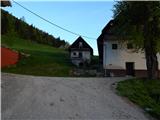 2
2 3
3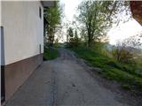 4
4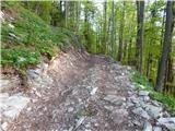 5
5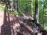 6
6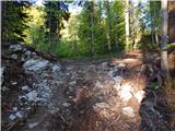 7
7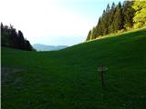 8
8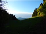 9
9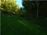 10
10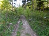 11
11 12
12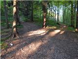 13
13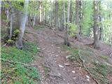 14
14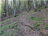 15
15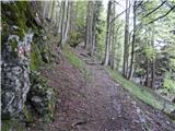 16
16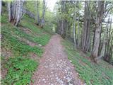 17
17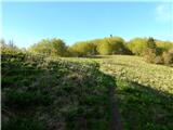 18
18 19
19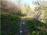 20
20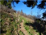 21
21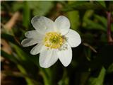 22
22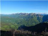 23
23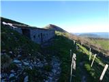 24
24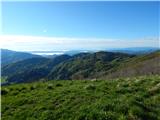 25
25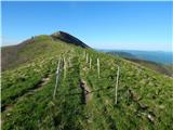 26
26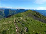 27
27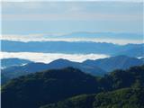 28
28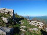 29
29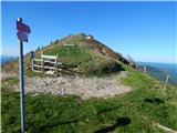 30
30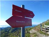 31
31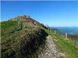 32
32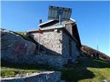 33
33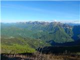 34
34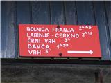 35
35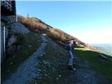 36
36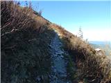 37
37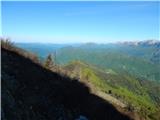 38
38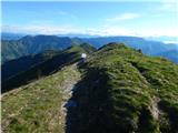 39
39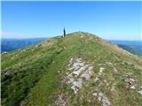 40
40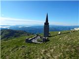 41
41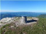 42
42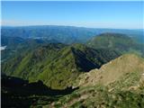 43
43 44
44
Discussion about the trip Podhočar - Porezen
|
| Si-Dro9. 08. 2016 |
Closest path to Porezen. Suitable also for children used to hills. Everyone who walks this path usually continues with something else the same day. Plenty of enjoyment.
|
|
|
|
| bperc19. 01. 2020 |
At the mentioned parking lot, parking is supposed to be prohibited. At least it's marked that way with a sign. Parking is possible a bit lower, at the sign, Porezen 2 hours and 15 minutes. But that's not a marked parking lot.
|
|
|
|
| ločanka27. 03. 2022 09:51:06 |
Parking is now possible. Since it's private property, you pay a voluntary contribution of 2 euros. Well, it's recommended.
|
|
|
|
| Borut12. 10. 2024 09:02:47 |
I'm wondering if this path is already suitable for hiking one or two days after rain (meant due to mud and slippery terrain).
|
|
|
|
| ločanka2. 10. 2024 10:00:01 |
It could be quite muddy. I would recommend parking a bit lower by the road where there's space for a few cars and from there go right towards the marked path coming from Petrov brdo.
|
|
|
To post a comment you must log in:
If you do not yet have a username, you must first
register.