Starting point: Podgozd (209 m)
| Latitude/Longitude: | 45,7971°N 14,9659°E |
| |
Walking time: 1 h 50 min
Difficulty: easy marked way
Elevation gain: 679 m
Elevation difference along the route: 679 m
Map: Dolenjska - Gorjanci, Kočevski Rog 1:50.000
Recommended equipment (summer):
Recommended equipment (winter): ice axe, crampons
Views: 15.690
 | 1 person like this post |
Access to starting point:
A) First, we drive to Žužemberk, and then we continue driving towards Dvor and Soteska. When we arrive in Dvor, we continue right in the direction of Kočevje. After crossing the river Krka, the road ascends steeply and leads us to the settlement Jama, where we continue left in the direction of Podgozd. When we arrive in Podgozd, at the crossroads we follow the road along which there are blazes or signs for Sveti Peter. We park a little behind the "last" house, at a suitable place next to the wooden hiking sign for Sveti Peter.
B) From Novo mesto or Bela krajina we drive to Soteska, and from there we continue driving towards Žužemberk. When we arrive at the settlement Dvor, we continue left in the direction of Kočevje. After crossing the river Krka, the road ascends steeply and leads us to the settlement Jama, where we continue left in the direction of Podgozd. When we arrive in Podgozd, at the crossroads we follow the road along which there are blazes or signs for Sveti Peter. We park a little behind the "last" house, at a suitable place next to the wooden hiking sign for Sveti Peter.
C) First, we drive to Kočevje, and then we continue driving in the direction of Novo mesto and Žužemberk. After the settlement Lašče the road starts to descend more steeply towards the valley of the river Krka, but we do not descend completely into the valley along the road, since in the settlement Jama we continue right towards Podgozd. When we arrive in Podgozd, at the crossroads we follow the road along which there are blazes or signs for Sveti Peter. We park a little behind the "last" house, at a suitable place next to the wooden hiking sign for Sveti Peter.
Route description:
From the starting point, we continue on a marked path in the direction of Sveti Peter, where the path at first leads along a wide cart track, from which we soon go left onto a path that continues alongside the forest. The path, from which we first get a bit of a view of the other side of the river Krka, where Plešivica is clearly visible, quickly enters the forest, where the first station of the Way of the Cross stands (14 crosses accumulate to the top, equal to the 14 stations of the Way of the Cross).
We then ascend along a trail that leads through the forest, higher joining a cart track. During the ascent along the cart track, at junctions we carefully follow the blazes, higher also crossing a macadam road. After the road we ascend moderately for some time, then reach a wider cart track along which a marked path leads us to the next road, alongside which there are occasional Stations of the Cross the whole time. We continue along the ascending road for some time, which we soon leave as the blazes lead us left onto a path that brings us to the next road after a few minutes. When we step onto the mentioned road, we take a few steps to the left, then at the 9th station continue right again onto a footpath or cart track. A few minutes higher we cross a macadam road for the last time, and the path then ascends first moderately, then steeply. Higher, a mesh fence appears to the right of the path, along which we then ascend steeply along a path to Sveti Peter, on which there is a lookout tower and, a little to the right of it, a pleasant shelter that is usually open on Sundays.
The description and pictures refer to the condition in 2016 (September).

Photos:
 1
1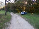 2
2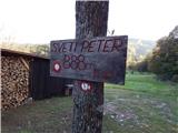 3
3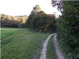 4
4 5
5 6
6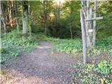 7
7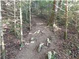 8
8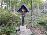 9
9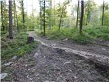 10
10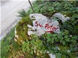 11
11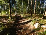 12
12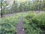 13
13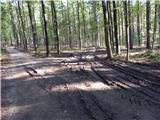 14
14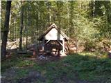 15
15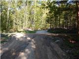 16
16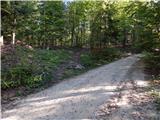 17
17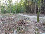 18
18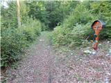 19
19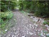 20
20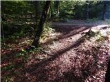 21
21 22
22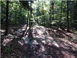 23
23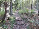 24
24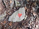 25
25 26
26 27
27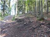 28
28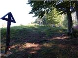 29
29 30
30 31
31 32
32
Discussion about the trip Podgozd - Sveti Peter
|
| Matjaž9692. 01. 2023 12:10:26 |
The path is excellently marked, impossible to miss. Shortly after the start there is an abyss on the left side, marked with warning signs. Worth seeing. Walking time is shorter, it could be stated as 1.5h.
|
|
|
To post a comment you must log in:
If you do not yet have a username, you must first
register.