Podgorje - Kojnik (steep path)
Starting point: Podgorje (518 m)
| Latitude/Longitude: | 45,5353°N 13,9435°E |
| |
Route name: steep path
Walking time: 1 h
Difficulty: easy marked way
Elevation gain: 284 m
Elevation difference along the route: 284 m
Map:
Recommended equipment (summer):
Recommended equipment (winter):
Views: 15.116
 | 3 people like this post |
Access to starting point:
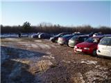
From the highway Ljubljana - Koper we go to the exit Kozina. We follow the road ahead towards Koper to the village Petrinje, where we go left in the direction of Podgorje. The road, which at first steeply ascends, soon brings us to the next crossroads, where we continue left. Further ahead we drive to the village Podgorje, where we park on a large parking lot near the sports field.
Access from Koper: On the old road we drive towards Postojna and only a little after the village Črni Kal a road branches off sharply to the right towards the village Podgorje. We follow this road to a large parking lot near the sports field, which is situated in the village Podgorje.
Route description:
From the parking lot, we turn left on an asphalt road, where already after a few meters we notice a signpost, which points us to the left. We continue on a cart track, where we follow the blazes. After some time from the cart track we turn onto a footpath on which the trail blaze directs us. Next follows a steep ascent through the forest. Out of the forest we then pass to a clearing, where a wonderful view opens up. Then we again walk for some time through the forest after which we pass to a clearing. We continue ahead, just before the top there is also a smaller pine forest. After a few meters of walking, we arrive at the top, where there are situated the logbook and a stamp.
Photos:
 1
1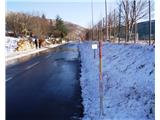 2
2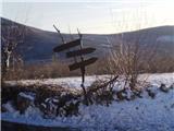 3
3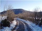 4
4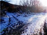 5
5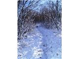 6
6 7
7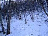 8
8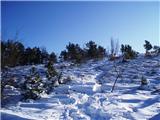 9
9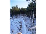 10
10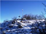 11
11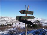 12
12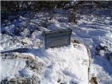 13
13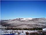 14
14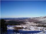 15
15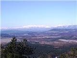 16
16 17
17
Discussion about the trip Podgorje - Kojnik (steep path)
|
| gattina7720. 10. 2014 |
no markings. I went and in the forest there were many crossroads, but no markings. so I walked 3 hours everywhere and don't even know if I was on Kojnik. didn't find the top of Kojnik hill
|
|
|
|
| Kigeot14. 11. 2014 |
I was thinking of going to Kojnik these days. Hm, does anyone have advice on how to find the right trail? If someone knows the trail, take me with you 
|
|
|
|
| ana16. 11. 2014 |
Today we went along the described path to Kojnik and further to Golič. The path is really nicely marked, nice sections, we'll return.
|
|
|
|
| Kigeot18. 11. 2014 |
oh, super, thanks! winter time is great for hills in Primorska, in the high mountains it's already serious frost
|
|
|
|
| Kigeot18. 02. 2015 |
Today I finally went to Kojnik via this path. The lower part is completely flat (gravel road), several forks, few signs, but if you stick to the left side or always head somewhat towards the hill, there are no problems. After 15 min. you reach the trail through the forest, it starts ascending and there it's really well marked, no chance to get lost.
Kojnik, as the "little brother" of Slavnik, always seemed somewhat pointless to me and today I got confirmation once again that there are no pointless mountains, that nature is always beautiful... Great path, also for beginners and those with less fitness.
|
|
|
|
| DuŠaN_K4. 02. 2019 |
January 2018 - the path is newly very well marked with signs and markers, commendable!
the summit however neglected, no stamp, no summit book, broken wooden signs (picture 12), also the surveying authority`s signal (metal pole on top) could be painted
|
|
|
|
| velkavrh19. 11. 2025 11:03:33 |
Yesterday we retirees from UD Medvode went on this path. It was very cold and extremely windy. Somewhere in the middle of the path winter appears - snow. Not much - only about 10 cm. With the cold wind it creates real winter. The path is really well marked and trodden. Beautiful views, we saw the sea - gorgeous. We finished in Kozina at Mahnič's. I can only comment that they are nice.
|
|
|
To post a comment you must log in:
If you do not yet have a username, you must first
register.