Pod Zjabci - Planina Za skalo
Starting point: Pod Zjabci (745 m)
| Latitude/Longitude: | 46,3261°N 13,6982°E |
| |
Walking time: 2 h 15 min
Difficulty: easy marked way
Elevation gain: 765 m
Elevation difference along the route: 765 m
Map: TNP 1 : 50.000
Recommended equipment (summer):
Recommended equipment (winter): ice axe, crampons
Views: 17.506
 | 2 people like this post |
Access to starting point:
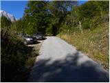
A) First, we drive to Kranjska Gora, then continue driving over the Vršič pass towards Bovec. Soon after the Berebica gallery, we arrive in the village of Soča, where we turn left over the bridge across the Soča River (direction tourist farm Jelinčič and camp Korita). After the bridge, we do not turn left towards the camp, but continue driving straight on the ascending asphalt road. Further, we ascend over expansive meadows, in the middle of which stand some individual cottages, then the road passes into the forest. Higher up, the road turns quite to the left and brings us to Pod Zjabcev, where we notice mountain signposts for Planina Za skalo, Dom na Komni and Triglavska jezera. We park in a suitable place by the road.
B) From the Primorska side, we first drive to Bovec, then continue driving towards Trenta. Towards the end of the village of Soča, we turn right in the direction of tourist farm Jelinčič and camp Korita. After the bridge, we do not turn left towards the camp, but continue driving straight on the ascending asphalt road. Further, we ascend over expansive meadows, in the middle of which stand some individual cottages, then the road passes into the forest. Higher up, the road turns quite to the left and brings us to Pod Zjabcev, where we notice mountain signposts for Planina Za skalo, Dom na Komni and Triglavska jezera. We park in a suitable place by the road.
Route description:
From Pod Zjabcev we head onto the marked path, which bypasses the nearby cottages on the right side. Behind the cottages, the path enters the forest and quickly brings us to a smaller junction, where we continue right across the stream. On the other side of the stream, the path turns left and begins to ascend moderately through dense forest. We continue the ascent along an old mule track, which is already quite eroded in several places, and which higher up brings us to a short steep rocky section. A well-maintained and wide mule track leads us through the mentioned section, and the path above it brings us to a vantage point from which a beautiful view opens onto Bavški Grintavec.
From the vantage point, the path returns to the forest and quickly climbs to an old trough with water (there is a small spring by the path here, which dries up in dry periods). Above the trough, the path turns slightly left, then ascends in numerous zigzags through the forest. Higher up, the trail levels out somewhat and brings us to a less noticeable junction, where an abandoned path to Planina Za skalo branches off to the left.
From here we continue straight ahead, and a somewhat steeper path brings us, after 10 minutes of further walking, to the next junction, which is this time completely unmarked. Here, an unmarked trail branches off to the right, leading to the nearby hunting hut and further to Planina za Črnim vrhom; to the left, a hunting path branches off to Planina Za skalo, while we continue straight to the next nearby junction, which is somewhat better marked.
Here we continue left towards Planina Za skalo (straight ahead the path continues towards Komna and the Triglav Lakes) along the path that crosses the slopes to the left. Soon we step out of the forest, where the trail gently descends to the left (here another, unmentioned trail joins from the left), and we continue along the initially clearly visible trail, which descends to Planina Za skalo and the TNP hut there.

Photos:
 1
1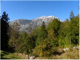 2
2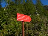 3
3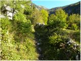 4
4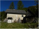 5
5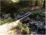 6
6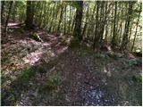 7
7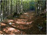 8
8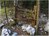 9
9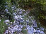 10
10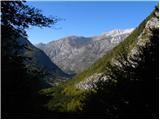 11
11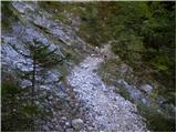 12
12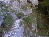 13
13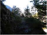 14
14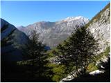 15
15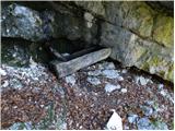 16
16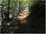 17
17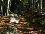 18
18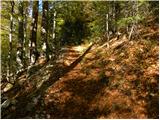 19
19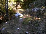 20
20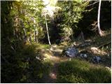 21
21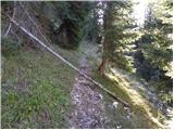 22
22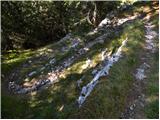 23
23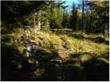 24
24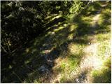 25
25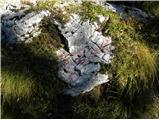 26
26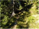 27
27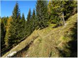 28
28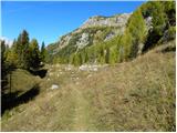 29
29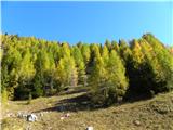 30
30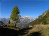 31
31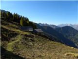 32
32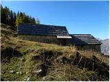 33
33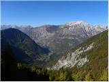 34
34
Discussion about the trip Pod Zjabci - Planina Za skalo
|
| ziga00129. 06. 2013 |
I can't find the trail description anywhere -> Dom pri Krnskih jezerih - Planina za črnim vrhom - Planina pod skalo. Interested in the difficulty and time? thanks
|
|
|
|
| ljubitelj gora5. 11. 2015 |
There is also a hunters' path to Planina Za skalo. Picture 1: with a car you can go higher to the sharp left bend, there is a barrier on the right. At the bend there is parking, on foot along the closed road, then after a few meters right down, across a wooden footbridge, where there is a sign for Planina Za skalo. If there is no sign there, the hunters' path continues above the weekend hut. More pictures: https://picasaweb.google.com/114400986607884783562/VrhoviNadTravnikovoDolino1112015
|
|
|
|
| IgorZlodej5. 11. 2015 |
Krnska jezera - Planina za Črnim Vrhom - Planina za Skalo around 2.5 to 3 hours. Nice path (mulatiera) easy and unmarked. From Planina za Skalo reckon another 1.5 hours descent to Vas na Skali, a bit more to Vrsnik (Jeglič).
|
|
|
|
| Loerst2. 07. 2018 |
As the mountain lover wrote a while ago - you can also reach Planina pod Skalo via the hunting trail (unmarked but clearly visible and maintained) from Vas pod Skalo, about 3 km by car further along the road from the starting point described here. Park when you see the barrier. The path thus lengthens by about a kilometer but reduces by about 250 elevation meters, making it much more knee-friendly.
|
|
|
|
| JanG6. 11. 2025 11:53:50 |
Hi, does anyone know if there's a source of drinking water at Planina Za skalo or nearby?
|
|
|
|
| padez6. 11. 2025 15:14:46 |
Yes, sometimes something flows into the trough under the rock along the path below the pasture (picture 16) and also above that rocky step above the pasture there's a small spring that dries up in summer. Otherwise, why not fill water from the stream below by the houses?
|
|
|
|
| mirank6. 11. 2025 17:26:15 |
Better choose the starting point as described by LG above and you'll save almost an hour of walking. There, right after the ramp, cross the stream directly, but you really can't rely on that little cold spot by the path to Travniška dolina.
|
|
|
|
| JanG6. 11. 2025 20:16:10 |
Thanks to both for the replies.
|
|
|
To post a comment you must log in:
If you do not yet have a username, you must first
register.