Pod Zjabci - Lanževica (on Rapallo border)
Starting point: Pod Zjabci (745 m)
| Latitude/Longitude: | 46,3261°N 13,6982°E |
| |
Route name: on Rapallo border
Walking time: 4 h
Difficulty: difficult pathless terrain
Elevation gain: 1258 m
Elevation difference along the route: 1300 m
Map: Julijske Alpe - zahodni del 1:50.000
Recommended equipment (summer):
Recommended equipment (winter): ice axe, crampons
Views: 9.826
 | 2 people like this post |
Access to starting point:
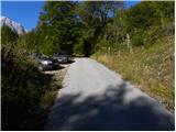
A) First, we drive to Kranjska Gora, and then we continue driving through the Vršič pass towards Bovec. Soon after the gallery Berebica, we arrive at the village Soča, where we turn left over the bridge across the river Soča (direction tourist farm Jelinčič and camp Korita). After the bridge, we don't turn left towards the camp, but we continue driving straight on an ascending asphalt road. Further, we ascend over expansive meadows, in the middle of which stand some individual huts, and then the road passes into the forest. Higher, the road turns quite to the left and brings us to Pod Zjabcev, where we notice mountain signposts for Planina Za skalo, Dom na Komni and Triglavska jezera. We park in a suitable place by the road.
B) From the Primorska side, first we drive to Bovec, and then we continue driving towards Trenta. Towards the end of the village Soča, we turn right in the direction of tourist farm Jelinčič and camp Korita. After the bridge, we don't turn left towards the camp, but we continue driving straight on an ascending asphalt road. Further, we ascend over expansive meadows, in the middle of which stand some individual huts, and then the road passes into the forest. Higher, the road turns quite to the left and brings us to Pod Zjabcev, where we notice mountain signposts for Planina Za skalo, Dom na Komni and Triglavska jezera. We park in a suitable place by the road.
Route description:
From Pod Zjabcev we head onto the marked path, which bypasses the nearby huts on the right side. Behind the huts, the path enters the forest and quickly brings us to a smaller junction, where we continue right across the stream. On the other side of the stream, the path turns left and begins to ascend moderately through dense forest. We continue the ascent along an old mule track, which in several places is already quite damaged; higher up, it brings us to a short steep rocky section. A well-maintained and wide mule track leads us through the mentioned section, and the path above it brings us to a viewpoint from which a beautiful view opens onto Bavški Grintavec.
From the viewpoint, the path returns to the forest and quickly ascends to an old water trough (here by the path is a small spring, which dries up in dry periods). Above the trough, the path turns slightly left, then ascends in numerous zigzags through the forest. Higher up, the trail levels out somewhat and brings us to a less noticeable junction, where an abandoned path to Planina Za skalo branches off to the left.
From here we continue straight ahead, and a somewhat steeper path, after 10 minutes of further walking, brings us to the next junction, this time completely unmarked. Here an unmarked trail branches off to the right, leading to the nearby hunting hut and further to Planina za Črnim vrhom; to the left a hunting path branches off to Planina Za skalo; we continue straight to the next nearby junction, which is somewhat better marked.
Here we continue straight or slightly right along the marked path towards Triglavska jezera and Komne. We follow the gentle trail, which through coniferous forest brings us to a fork.
From the fork we take the right path towards Komne (left Triglavska jezera); it bypasses Dol za Bajarjem on the right side. On the other side of the valley, the path begins to ascend, first gently, then more steeply. The steepness soon eases, and the increasingly scenic path leads us into a series of small basins, through which we gently climb to Oslova škrbina.
From Oslova škrbina, the marked path begins to descend towards the Lepa Komna plateau, but at this point we leave it and continue the ascent to the right across pathless terrain.
From Oslova škrbina we continue roughly west to southwest, higher almost south; our orientation ahead should be the ridge that continues to the summit of Lanževica.
From the saddle we first ascend easily passable pathless terrain, then a steep slope blocks the easy passage. Here we have two options for continuing. We can climb straight up the fairly steep and partly crumbly slope, or continue slightly left and ascend beside and partly through dwarf pines to the ridge, where a somewhat more difficult variant joins. Further on, both paths run along and occasionally beside the ridge, which is no longer particularly demanding. Higher up, we can bypass a short steep section on the right via a small scree field, then continue along the ridge, where we can spot old border stones from the former Rapallo border. We follow this increasingly panoramic and in the upper part also easily passable "path" all the way to the 2003 m high Lanževica.

Along the route: Oslova škrbina (1825m)
The trip can be extended to the following destinations: Velika Baba
Photos:
 1
1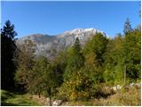 2
2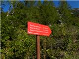 3
3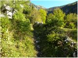 4
4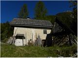 5
5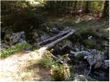 6
6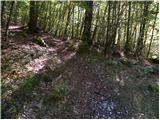 7
7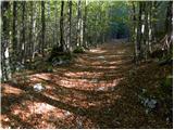 8
8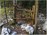 9
9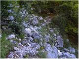 10
10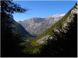 11
11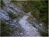 12
12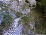 13
13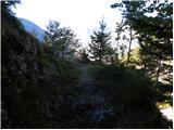 14
14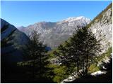 15
15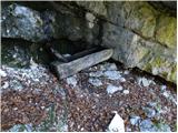 16
16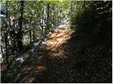 17
17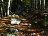 18
18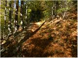 19
19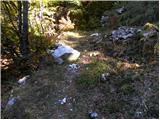 20
20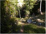 21
21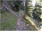 22
22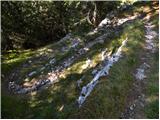 23
23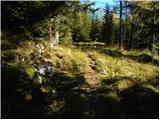 24
24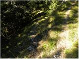 25
25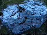 26
26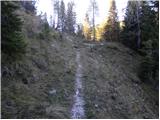 27
27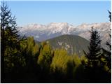 28
28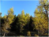 29
29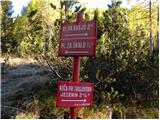 30
30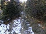 31
31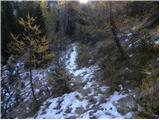 32
32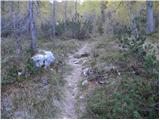 33
33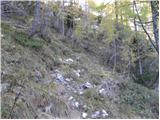 34
34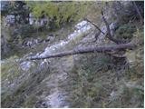 35
35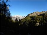 36
36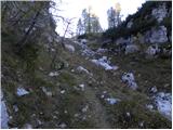 37
37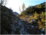 38
38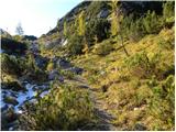 39
39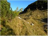 40
40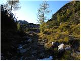 41
41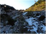 42
42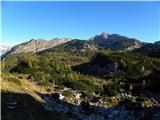 43
43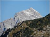 44
44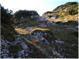 45
45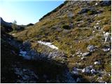 46
46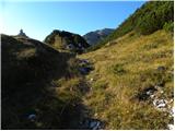 47
47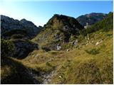 48
48 49
49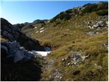 50
50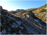 51
51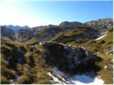 52
52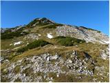 53
53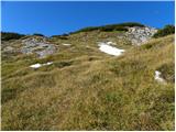 54
54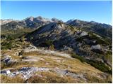 55
55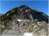 56
56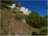 57
57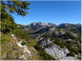 58
58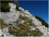 59
59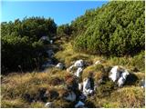 60
60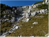 61
61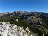 62
62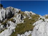 63
63 64
64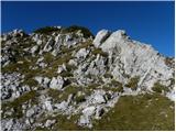 65
65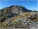 66
66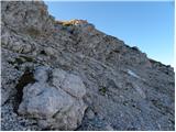 67
67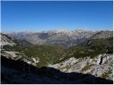 68
68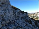 69
69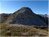 70
70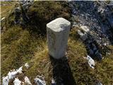 71
71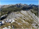 72
72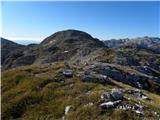 73
73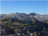 74
74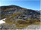 75
75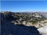 76
76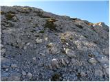 77
77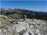 78
78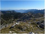 79
79
Discussion about the trip Pod Zjabci - Lanževica (on Rapallo border)
|
| Zgembo30. 04. 2017 |
Maybe someone knows where to get the stamp?
|
|
|
|
| darinka426. 11. 2021 13:39:06 |
The described lower stream bed where water should flow was dry. Maybe there's more water in spring. We were a bit disappointed because for the second time, mainly due to snow, we didn't decide to go along the ridge from Oslove škrbine all the way to the top. Especially because you don't know how the snow is on the path. Third time maybe in spring it will be easier. Also the path that branches off to Kaluder past the hunting hut and the abandoned pasture behind Črnim vrhom then gets lost. If someone goes there, they should have navigation. You rarely meet anyone on these paths.
|
|
|
|
| mirank26. 11. 2021 14:09:11 |
I've never gone from this starting point and it doesn't appeal to me either, though every year we head to those areas at least once. We always start at the ramp! As for the trail, in many places I use the tactic of following others and shouting "this way is trodden"
|
|
|
|
| darinka44. 10. 2023 09:47:24 |
He who waits will get it. Yesterday we managed to walk the path along the Rapallo border in beautiful autumn idyll. From Pod Zjabci we headed to Mala Vrata. We had already walked there when we went to Kal. Then off-path, past the border stones of the former Rapallo border. All the way to the top of Lanževica. We descended via the path we already knew under Baba and Kaludrom. I wouldn't even call it a path anymore, because it no longer exists. Although once drawn in Garmin, they no longer exist because they have overgrown. And there are more ruins there every year. Even though we had walked there before, we were looking for passages. We lost about half an hour as if we had gone on the left side during the descent from Lanževica. The tour wasn't short either. It came to about 17 km of walking and almost 1600 m ascent.
|
|
|
To post a comment you must log in:
If you do not yet have a username, you must first
register.