Pod Peco/Koprein-Petzen - Topitza
Starting point: Pod Peco/Koprein-Petzen (1280 m)
| Latitude/Longitude: | 46,5072°N 14,6961°E |
| |
Walking time: 1 h 15 min
Difficulty: easy marked way
Elevation gain: 369 m
Elevation difference along the route: 369 m
Map: Kamniške in Savinjske Alpe 1:50.000
Recommended equipment (summer):
Recommended equipment (winter): ice axe, crampons
Views: 7.480
 | 1 person like this post |
Access to starting point:
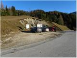
Via the border crossing Jezersko or Pavličevo sedlo, we drive to Železna Kapla, and there at the beginning of the settlement we notice signs for Lepeno/Leppen, which direct us to the right. The mentioned road then takes us through the mentioned village to the village Pod Peco/Koprein-Petzen, where it starts to ascend more steeply. The road higher up levels out and brings us to the inn Riepl, where we park at the parking lot next to the information boards.
Route description:
From the parking lot, we first descend a few steps along the asphalt road, then turn onto the macadam road in the direction of Topica. The road first gently ascends across a panoramic grassy slope, then passes into the forest, where after a few minutes of walking the signs direct us right onto a footpath. The path continues through dense coniferous forest along a trail covered with numerous needles, offering us pleasant soft walking. A little higher, the path levels out and brings us to a larger clearing, where we notice an animal feeding station. Just a few dozen steps further, we leave the wide cart track and continue the ascent on the marked hiking path, which begins to ascend moderately along the edge of the forest. Higher up, the path brings us to a ridge, where it turns left and levels out completely. The path ahead leads past a hunting observation post and continues along the ridge on a relatively fresh clearing. After a few minutes of easy walking, the path turns right and begins to ascend steeply along the edge of the very steep western slopes of Topica. Higher up, the path slightly levels out and passes onto partly unvegetated slopes, from which a nice view opens up mainly towards the south. During the ascent on the mentioned slope, we will notice a salt lick; the path, just a little above it, turns left. There follows a few minutes of gentle ascent to the left, and the path brings us to a junction, where the path from the valley of the Lobnik stream joins. Here we continue right, and after a few more minutes of walking we step onto the summit of Topica.

Photos:
 1
1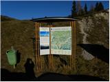 2
2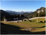 3
3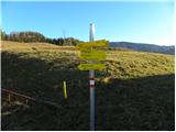 4
4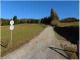 5
5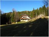 6
6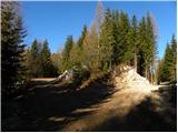 7
7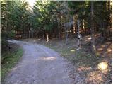 8
8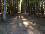 9
9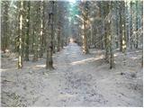 10
10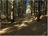 11
11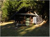 12
12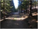 13
13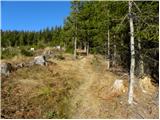 14
14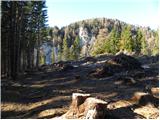 15
15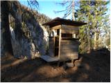 16
16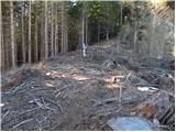 17
17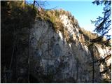 18
18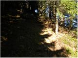 19
19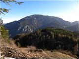 20
20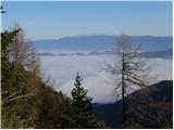 21
21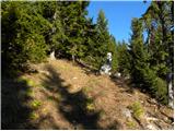 22
22 23
23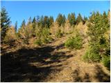 24
24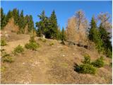 25
25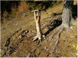 26
26 27
27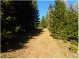 28
28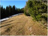 29
29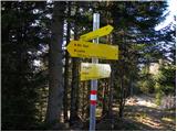 30
30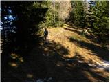 31
31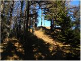 32
32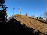 33
33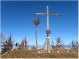 34
34 35
35
Discussion about the trip Pod Peco/Koprein-Petzen - Topitza
|
| Tadej23. 11. 2009 |
On the return from Topica, it's worth visiting the first church of all faiths for peace and the nearby Peršman memorial home; the latter is open only from May to October on Saturdays and Sundays.
|
|
|
|
| kregl23. 11. 2009 |
Do you happen to know the approach from the Slovenian side, i.e., if I come from Črna - Koprivna - through Luže... how far is it then to your "starting point"?
|
|
|
|
| Tadej23. 11. 2009 |
From the border crossing at planina Luža to the starting point is about 30 minutes.
|
|
|
|
| Lunca22. 10. 2017 |
It can also be done as a loop. Yesterday start at Riepel inn. To the top of Topica, then on to Ojstra. From Ojstra we then continued towards Zelezna kapla, but only to the junction where you reach path 603, which connects Zelezna kapla and Peco. Then back via path 603 to the starting point. On the way we also visited Persman museum. The museum is really worth seeing, the guide friendly, one of the rare ones. The path is excellently marked all the way.
|
|
|
|
| S57S27. 10. 2025 07:40:47 |
|
|
|
To post a comment you must log in:
If you do not yet have a username, you must first
register.