Pod Krnico - Tolsta Košuta - western peak
Starting point: Pod Krnico (1250 m)
| Latitude/Longitude: | 46,4346°N 14,4083°E |
| |
Walking time: 2 h 20 min
Difficulty: partly demanding unmarked way
Elevation gain: 789 m
Elevation difference along the route: 830 m
Map: Karavanke - osrednji del 1:50.000
Recommended equipment (summer):
Recommended equipment (winter): ice axe, crampons
Views: 24.198
 | 3 people like this post |
Access to starting point:
From the Ljubljana-Jesenice highway, take the Ljubelj exit. From this road, before the gas station, turn right towards Tržič. The road then quickly brings us to Tržič, and we follow it further in the direction of the villages Jelendol and Medvodje. In the village Medvodje, turn left towards Košuta (direction Dolga njiva and Košutnikov turn) onto the forest road which we follow to the junction at Košutnik (1082 m). Here we go right and drive on the occasionally bad road to the parking lot at a smaller quarry.
Route description:
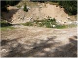
From the parking lot, we head onto the cart track that branches off to the left from the road. The cart track goes into the forest and ascends moderately, first crossing a smaller and then a larger stream. The cart track, which has some shortcuts, makes some turns and after good 15 minutes brings us to the pastures of the mountain pasture Spodnja Dolga njiva.
After a short walk across the mountain pasture, the path brings us to a junction where there are signposts. We head right in the direction of the Košutnikov turn eastern approach path. The gentle path brings us after a few dozen steps to the shepherd's hut on the mountain pasture Spodnja Dolga njiva (shepherd hut of open type).
Further, we continue upwards across the mountain pasture, in the middle of which runs a wide cart track that after good 15 minutes of walking brings us out of the forest onto the mountain pasture Zgornja Dolga njiva.
The steepness of the path, which has been moderate until now, eases and the path soon brings us through nice grassy terrain to the central part of the mountain pasture, where the blazes end. We continue straight ahead (left Košutnikov turn) along a slightly ascending path that runs along a smaller but very pronounced torrent gully. A little further ahead, the unmarked path splits into two parts.
We continue left (slightly right Mala Košuta) along the path that begins to ascend through a belt of dwarf pines. If we lose the correct path here, we will have to push through the belt of dwarf pines or find a better passage lower down. Above the dwarf pines, the path brings us to a pasture fence, where a nice view opens onto the Austrian side (we can also reach here via a nicely passable gully or scree slope that branches off to the left from the middle of the mountain pasture Zgornja Dolga njiva; across the mentioned passage, the path is somewhat shorter but also steeper). The path ahead, as does the ridge, turns slightly to the left and begins to ascend steeply across increasingly steep grassy slopes. The path continues ascending along the edge of the eastern ridge of Košuta on the steep southern slopes of Tolsta Košuta. The very steep path, which is dangerous for slipping when wet, turns left a little higher (withdraws from the cliffs above us) and after a further short ascent brings us to the eastern peak of Tolsta Košuta.
From the eastern peak of Tolsta Košuta, we continue along a poorly traceable trail towards the west. The path ahead first descends along a steep grassy slope to the saddle between the two Tolste Košute. Here we can observe a smaller natural window behind which the path begins to ascend again. After a few minutes of further walking, we step onto the western peak of Tolsta Košuta without major difficulties.
In hot days, we can observe a larger number of snakes on the path or beside it (be careful).
Starting point - Spodnja Dolga njiva 20 minutes, Spodnja Dolga njiva - Zgornja Dolga njiva 25 minutes, Zgornja Dolga njiva - Tolsta Košuta (eastern peak) 1:20, Tolsta Košuta (eastern peak) - Tolsta Košuta (western peak) 15 minutes.

Photos:
 1
1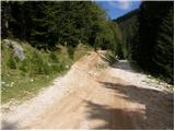 2
2 3
3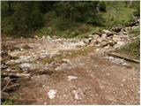 4
4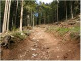 5
5 6
6 7
7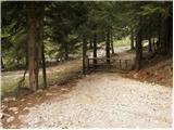 8
8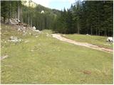 9
9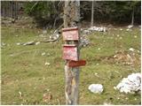 10
10 11
11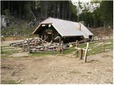 12
12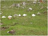 13
13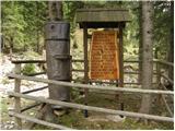 14
14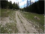 15
15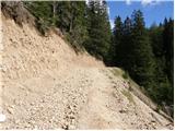 16
16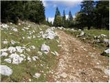 17
17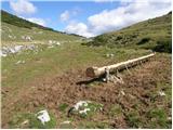 18
18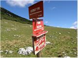 19
19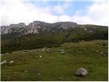 20
20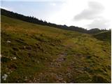 21
21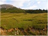 22
22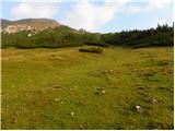 23
23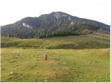 24
24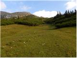 25
25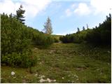 26
26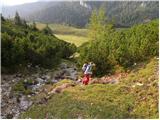 27
27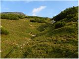 28
28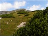 29
29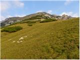 30
30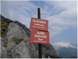 31
31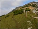 32
32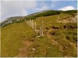 33
33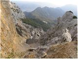 34
34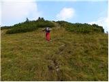 35
35 36
36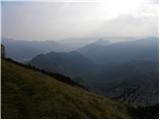 37
37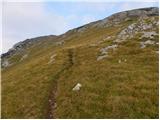 38
38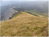 39
39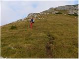 40
40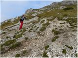 41
41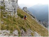 42
42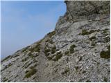 43
43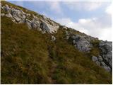 44
44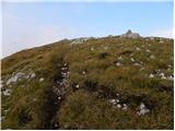 45
45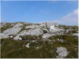 46
46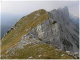 47
47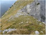 48
48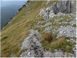 49
49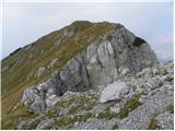 50
50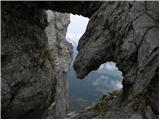 51
51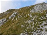 52
52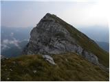 53
53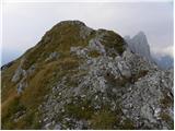 54
54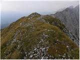 55
55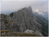 56
56
Discussion about the trip Pod Krnico - Tolsta Košuta - western peak
|
| sergejom2. 10. 2010 |
How long does it take to walk along the ridge from the western peak of Tolsta Košuta to Košutnikov turn?
|
|
|
|
| klm3. 10. 2010 |
Ridge traverse Košutnikov turn - Tolsta Košuta I did years ago via the described route. Requires climbing up to grade II difficulty (at one spot). Which side we do the tour from ultimately doesn't matter, as technical difficulties are roughly equal from both sides. We can start from the top of Tolsta Košuta and continue towards Košutnikov turn (and further all the way to Veliki vrh).
In short, at the saddle above the crumbly East Gully of Košutnikov turn, turn right and climb up the grassy slope to the 30-meter rock barrier of the western Gamsovka (Freibachwand, 2065 m; there are four Gamsovkas represented by four more prominent rock towers). We climb it in easy grade II climbing via the southwest wall (border stone XXIV / 43, peg for belay; this is only relevant if going in the opposite direction). Follows a short descent and along the narrow ridge to the second Gamsovka, which must be climbed via its crumbly southwest slope. On its ridge, then always go on the south side. Soon follows descent into a small notch, from which via a short rock step we climb to a narrow grassy ridge, along which we go towards the third Gamsovka. Behind it hides the fourth - last - tower. After it follows a 10-meter rock barrier that must be overcome, then only undulating grassy slope. Here the climbing part ends. In gentle ascents and descents continue via steep grassy and partly rocky slopes of the western (2026 m), central (2005 m) and eastern Obliča (Doborwaspitzen, 2015 m; border stone XXIV / 42) to the western summit of Tolsta Košuta. From it go past the natural window to the eastern summit. That's it. Time depends on several factors, but we estimate it between 1:45 and 2:15 h.
|
|
|
|
| Tere9. 09. 2022 12:06:59 |
Hello,
I would like information, is it possible to pass from Tolsta Košuta to Košutnikov turn without alpinism equipment, and does it have ropes and pegs?
Thanks in advance for the information. 
|
|
|
|
| garmont9. 09. 2022 12:22:38 |
The “path”, or rather the ridge between the two mentioned peaks, is an easier alpinistic route and as such, of course, is not equipped with ropes and pegs. Rope is recommended…
|
|
|
|
| Tere9. 09. 2022 12:28:49 |
thanks a lot for the info, since I'm going alone, better to descend by the path, even though I thought of going along the ridge to avoid descending......
|
|
|
To post a comment you must log in:
If you do not yet have a username, you must first
register.