Pod Krnico - Planina Spodnja Dolga njiva
Starting point: Pod Krnico (1250 m)
| Latitude/Longitude: | 46,4346°N 14,4083°E |
| |
Walking time: 20 min
Difficulty: easy marked way
Elevation gain: 150 m
Elevation difference along the route: 150 m
Map: Karavanke - osrednji del 1:50.000
Recommended equipment (summer):
Recommended equipment (winter):
Views: 45.095
 | 3 people like this post |
Access to starting point:
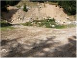
From the highway Ljubljana - Jesenice we go to the exit Ljubelj. From this road, before the gas station, we turn right to Tržič. The road then quickly brings us to Tržič, and we follow it further in the direction of the villages Jelendol and Medvodje. In the village Medvodje we turn left towards Košuta on the forest road which we follow to a crossroad at Košutnik (house) approximately at 1000 m. Here we go right and drive to the parking lot at a smaller quarry.
Route description:
From the parking lot, we go on a cart track which branches off left from the road. The cart track goes into the forest and is moderately ascending, first crossing a smaller and then a bigger stream. The cart track, which has some shortcuts, makes some turns and after a good 15 minutes brings us to the pastures of the mountain pasture Spodnja Dolga njiva.
After a short walk on the mountain pasture, the path brings us to a crossing, where there are signposts. We go right in the direction of the path Košutnikov turn eastern approach. The gently sloping path, after a few dozen steps of walking, brings us to the shepherd's hut on the mountain pasture Spodnja Dolga njiva.

The trip can be extended to the following destinations: Tegoška planina (1 h 50 min),
Planina Pungrat (2 h 20 min),
Planina Ilovica (3 h 15 min),
Dom na Kofcah (3 h 25 min),
Zavetišče na planini Šija (3 h 10 min),
Planina Zgornja Dolga njiva ( 25 min),
Mala Košuta ( 55 min),
Plešivec (1 h),
Tolsta Košuta - western peak (2 h),
Tolsta Košuta - eastern peak (1 h 45 min),
Koschutnikturm (Košutnikov turn)
Photos:
 1
1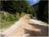 2
2 3
3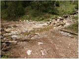 4
4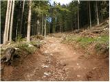 5
5 6
6 7
7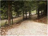 8
8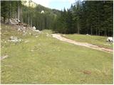 9
9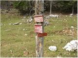 10
10 11
11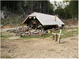 12
12
Discussion about the trip Pod Krnico - Planina Spodnja Dolga njiva
|
| jana196614. 07. 2012 |
Today it was really impossible to predict which direction one would head. So the path led us only to the alpine pasture, from where the first drops chased us away at 12. The morning was just right for alpine idyll and excellent offer at Planina Spodnja Dolga njiva. Until today, the raw struklji at Kofce were the best, but here they have something even more - check it out yourselves. Worth all praise, you can get goodies to take away - milk, curd, cream... and even if one indulges occasionally, it's worth it. The path was more of a walk this time, but still satisfying. Praise to the staff for friendliness at the alpine pasture! Otherwise, continuing the path from there...
|
|
|
To post a comment you must log in:
If you do not yet have a username, you must first
register.