Starting point: Plužna (450 m)
| Latitude/Longitude: | 46,336°N 13,5133°E |
| |
Walking time: 30 min
Difficulty: partly demanding unmarked way
Elevation gain: 100 m
Elevation difference along the route: 130 m
Map: Julijske Alpe - zahodni del 1:50.000
Recommended equipment (summer): helmet, lamp
Recommended equipment (winter): helmet, ice axe, crampons, lamp
Views: 5.372
 | 3 people like this post |
Access to starting point:
First, we drive to the center of Bovec, where we head up the road that goes past the church ahead towards Kaninska vas. We follow the road ahead, which soon brings us to a junction, where we continue left downwards towards the village Plužna (straight ahead the road to Kanin). The road then brings us to the village Plužna, where in the middle of the village we turn sharply right upwards. The road then brings us to the last house in the village, behind which the road starts descending and after 100 meters of descent brings us to the signposts, where near them we park on a small parking lot.
Route description:
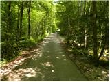
From the starting point, we continue straight downwards (left downwards waterfall Virje) on the road which soon flattens, crosses a bridge and behind it brings us to a smaller junction. We continue right (left accumulation lake 1 minute) on a gently sloping path, which after a few minutes of additional walking brings us to the spring of Glijun.
At the mentioned spring we notice signs for karst cave Srnica, which point us slightly left on a footpath which starts moderately ascending through a dense forest. Higher, the path flattens a little, crosses a lane of bushes and then turns a little towards the left. Next follows crossing of a short panoramic scree, and then the path brings us to the torrent bed of cave Srnica. At the beginning of the mentioned torrent bed the path turns to the right and steeply ascends to the entrance into cave Srnica. The last meters below the entrance into the cave are secured with a rope.
Photos:
 1
1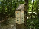 2
2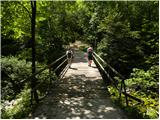 3
3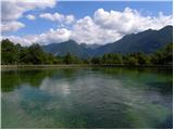 4
4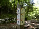 5
5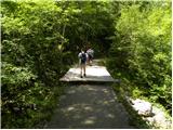 6
6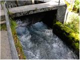 7
7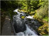 8
8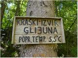 9
9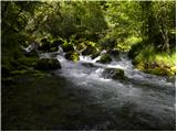 10
10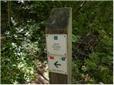 11
11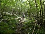 12
12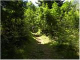 13
13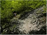 14
14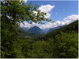 15
15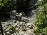 16
16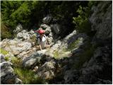 17
17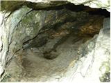 18
18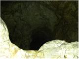 19
19
Discussion about the trip Plužna - Srnica cave
|
| francimedved1. 07. 2014 |
From Gljun onwards the path is poorly marked, so the hiker is often in doubt if they are on the right path.
|
|
|
To post a comment you must log in:
If you do not yet have a username, you must first
register.