Plockenpass - Monte Coglians (Hohe Warte) (via Rifugio Marinelli)
Starting point: Plockenpass (1360 m)
| Latitude/Longitude: | 46,6027°N 12,9447°E |
| |
Route name: via Rifugio Marinelli
Walking time: 5 h
Difficulty: difficult marked way
Elevation gain: 1420 m
Elevation difference along the route: 1500 m
Map: Tabacco 9
Recommended equipment (summer): helmet
Recommended equipment (winter): helmet, ice axe, crampons
Views: 21.241
 | 3 people like this post |
Access to starting point:
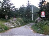
From Trbiž/Tarvisio we head onto the highway towards Udine. At Carnico we leave the highway and first follow the signs towards Tolmezzo, then the signs for Austria and the mountain pass Pso di Croce Carnico / Plöckenpass. Still on the Italian side of the pass, we park on a large parking lot.
Route description:
At the parking lot, we head onto a narrow road following the signs for Rifugio Marinelli (path 146). Already after a few dozen meters, we come to a junction where we go right onto a military mule track, on which we then ascend through sparse forest and meadows below the steep slopes of the mountain Creta di Collinetta (2238m). The military mule track turns into a footpath and soon we also come to a junction, where the path to the mentioned mountain branches off to the right. We continue on the left path, which continues slightly ascending through the meadows. On a smaller level area, the path to Cresta Verde (2150m) branches off to the right. We continue on path 146 towards the Marinelli hut, to which we have just under two hours. Here the path becomes somewhat steeper and ascends through lightly overgrown dwarf pines and high grass. When we emerge from the dwarf pines, the path becomes flatter and to the right branches off the path to Creta di Collina (2659m). Here, while crossing quite steep slopes, we begin to descend, aided by some fixed safety devices. This is followed by a descent through a natural window and crossing steep slopes covered with nettles, which brings us to a junction. The right path leads to Cima di Mezzo (2713m), while we continue on the left path towards the hut. The path begins ascending again through meadows and just before the hut we reach a mountain road closed to traffic, from which a view opens towards Monte Coglians. The road soon ends and to the hut only a few minutes of steep ascent remain. At the hut, we follow the signs for Monte Coglians and begin ascending through steep meadows. The path then turns slightly to the left, where after a short, slightly exposed ridge we enter an entirely new world. Mighty grass-covered slopes are almost instantly replaced by bare rock. While crossing the slopes below Coglians, we come again to a junction, where we turn left (path 143); the right path (143a) leads to Pilastro del Coglians (2750m). Initially we still cross slopes below Coglians, then the path turns slightly to the right and from the left the path from Lake Wolayer See joins. Here we begin to ascend slightly slippery scree, which becomes quite steep in the upper part. In the final section the path turns left, followed by a steep ascent with some easy scrambling to the very panoramic summit.

Photos:
 1
1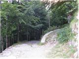 2
2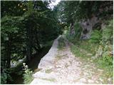 3
3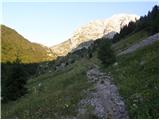 4
4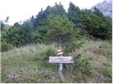 5
5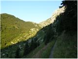 6
6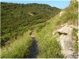 7
7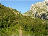 8
8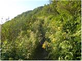 9
9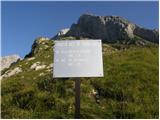 10
10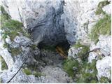 11
11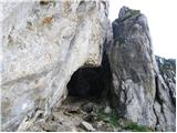 12
12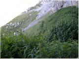 13
13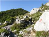 14
14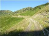 15
15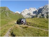 16
16 17
17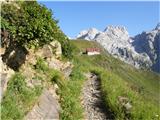 18
18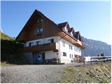 19
19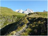 20
20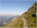 21
21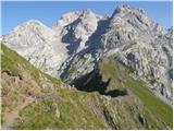 22
22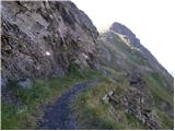 23
23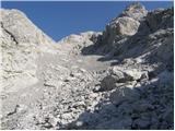 24
24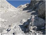 25
25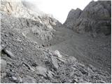 26
26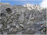 27
27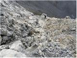 28
28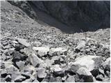 29
29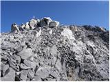 30
30 31
31
Discussion about the trip Plockenpass - Monte Coglians (Hohe Warte) (via Rifugio Marinelli)
|
| GORNIK 124. 06. 2009 |
Is it still too early for the summit? Thanks.
|
|
|
|
| triglavski25. 06. 2009 |
Why would it be too early? If you're asking, at least ask what you really want to know, one time you're interested up to Marinelli hut, another time the Coglians summit. I won't answer quiz questions.
|
|
|
|
| VanSims8. 07. 2012 |
Come on, a bit more understanding for those who want some information. The person probably meant to go to Coglians, and if due to snow it wouldn't be possible, then just to Marinelli.
|
|
|
|
| enigma9. 07. 2012 |
Anyone who wants to reach Coglians via a non-climbing path
should go via Tolmezza to Colino, then on foot along the road to Rifugio Marinelli, from there everything is well marked to Coglians, just be early enough so the sun doesn't catch you on the steep scree field, the tour is for those with a bit more strength in their legs, as the gradient from the middle of the path
to the summit doesn't ease up. No panic regarding snow.
|
|
|
|
| atoamac5. 09. 2022 16:50:31 |
Is the Lambertenghi - Romanin hut by Lake Volaia open this year?
|
|
|
|
| jaz5. 09. 2022 17:32:38 |
The hut is closed, it was last year too, the problem is money for renovation. Regards!
|
|
|
To post a comment you must log in:
If you do not yet have a username, you must first
register.