Plaz Črlovec - Vrtaška planina
Starting point: Plaz Črlovec (920 m)
| Latitude/Longitude: | 46,4311°N 13,8784°E |
| |
Walking time: 1 h 45 min
Difficulty: difficult unmarked way
Elevation gain: 542 m
Elevation difference along the route: 555 m
Map: TNP 1:50.000
Recommended equipment (summer): helmet
Recommended equipment (winter): helmet, ice axe, crampons
Views: 2.940
 | 1 person like this post |
Access to starting point:
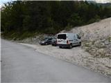
We drive to Mojstrana, and then we follow the signs for the valley Vrata. On the road through the valley Vrata we drive to the road sign 8 km or a few 10 meters ahead to the gully Plaz Črlovec, where the described path begins. Parking in the area of TNP is allowed only on marked parking spots.
Route description:
From the gully Plaz Črlovec we return on the road a few 10 meters back, and then we continue on a side road which continues towards the northeast. The path ahead leads us past the gate, and after the gate an unmarked path branches off to the left, which leads towards Kukova špica and Njivice, and we continue straight and still walk on the road. While walking on the road, the path leads us past the mountain pasture Višek, and behind it we quickly get to the stream Peričnik, which we cross over the footbridge. On the other side of the stream we walk only a short time on the road, and then we go left on a well-beaten forest path, on which we start ascending through the forest. After a few minutes, the path splits, and we continue left (straight well-beaten shortcut (the path via the shortcut is shorter by approximately 10 minutes and also easier)) on the made path, which gradually starts to ascend steeply. After a short ascent, we get to the vantage point, and above the vantage point the path becomes quite steep. For some time we ascend steeply, and then we get below the cliffs of Lengarjev Komen (1520 m), where we continue right. Next follows crossing of partly vegetated scree and behind it also a few grooves and gullies, where the footpath is narrower and mainly in wet dangerous for slipping. When the slope becomes less steep, the shortcut joins from the right, and the path gradually becomes steeper again. Higher, we ascend steeply again, and the slope also becomes steep. Next follows some diagonal ascent, and then we get to a steel cable, which helps us with the short steep ascent on the exposed slope. When the fixed safety gear ends we are on a nice vantage point, from which a nice view opens up on the valley Vrata and the mountains above it. Next follows crossing of a grazing fence, and then we continue right and walk a few minutes without major changes in altitude. After a few minutes, we go slightly left and ascend to the shepherd cottage on the mountain pasture Vrtaška planina.
Description and pictures refer to the condition in the year 2018 (August).

Along the route: Planina Višek (975m)
Photos:
 1
1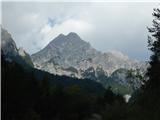 2
2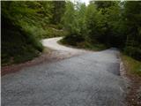 3
3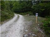 4
4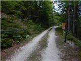 5
5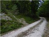 6
6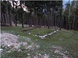 7
7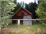 8
8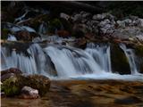 9
9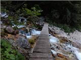 10
10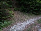 11
11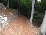 12
12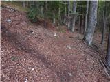 13
13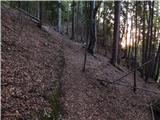 14
14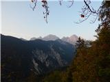 15
15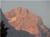 16
16 17
17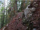 18
18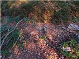 19
19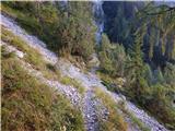 20
20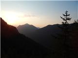 21
21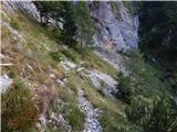 22
22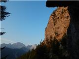 23
23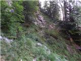 24
24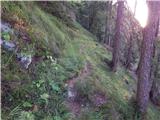 25
25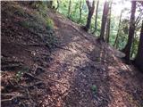 26
26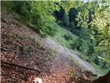 27
27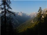 28
28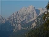 29
29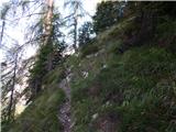 30
30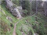 31
31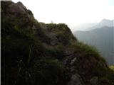 32
32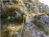 33
33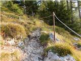 34
34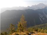 35
35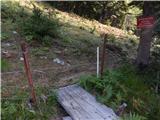 36
36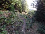 37
37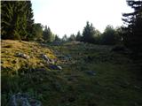 38
38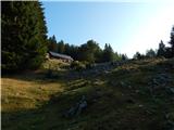 39
39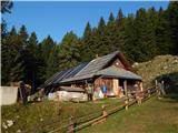 40
40
Discussion about the trip Plaz Črlovec - Vrtaška planina
|
| lepenatka21. 10. 2018 |
Very beautiful, varied and steep path.
Start is a bit different from the description: from Koča pri Peričniku past both waterfalls to the road, then continue along the bridge and the described path.
Yesterday was a wonderful day for hiking, colors magnificent, on the pasture quite a few hikers and real summer weather.
Shame it's over . .
|
|
|
|
| Jusk25. 01. 2020 |
Not exactly as per the trail description, start in Mojstrana, then unmarked path starting 5 min from end of Mojstrana towards upper Peričnik waterfall, midway junction to road from Črlovec.. then found junction in pic 12, off we go zigzag path full of detours around fallen trees, lots of them path narrow and sometimes exposed, met some chamois that trigger rocks (careful!!).. this path muddy.. at Vrtaška planina around 10cm snow, returned via marked path to Mojstrana. This path icy for a few minutes downhill, then dry and fine. path narrow and sometimes exposed, met some chamois that trigger rocks (careful!!).. this path muddy.. at Vrtaška planina around 10cm snow, returned via marked path to Mojstrana. This path icy for a few minutes downhill, then dry and fine.
|
|
|
|
| AlesTo26. 01. 2020 |
Great photos, you captured a wonderful day.
|
|
|
To post a comment you must log in:
If you do not yet have a username, you must first
register.