Starting point: Platak (1111 m)
| Latitude/Longitude: | 45,4251°N 14,5653°E |
| |
Walking time: 2 h 45 min
Difficulty: easy marked way
Elevation gain: 297 m
Elevation difference along the route: 420 m
Map:
Recommended equipment (summer):
Recommended equipment (winter):
Views: 5.337
 | 2 people like this post |
Access to starting point:
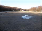
From the highway Zagreb - Reka we take the exit Kikovica, which leads us to the old road Zagreb - Reka. We follow the old road towards Zagreb, but only to the point where a road branches off to the left, ascending towards the ski slope Platak. We follow this road to a large parking lot, where we park.
Route description:
At the beginning of the parking lot, a road branches off to the right (in the direction of the ascent), which, after 100 meters of walking, brings us to the mountain hut Sušak na Platku. At the hut, we notice signposts for Risnjak, which direct us to the left onto a poorer road. Soon, the road brings us to a spot where it ends. We continue to the right on a marked cart track, which gently ascends through the forest and, after 15 minutes of further walking, brings us to the next road, where we continue to the left. This road also ends soon, and we continue the ascent in the direction of Risnjak. The still wide path higher up brings us to the next road, where we continue to the right and then immediately to the left onto a wide path in the direction of Risnjak. Next follows one hour of walking on a cart track, which ascends and descends a few times. After an hour and a half of walking from Platak, we reach the first major crossing, where we continue straight upwards again in the direction of Risnjak. The path ahead begins to ascend more steeply through the forested slopes of the Risnjak natural park. After a half-hour ascent, the path slightly descends and soon brings us to a crossing, where we continue right in the direction of Vidikovac. The path ahead moderately ascends through the forest to the upper slope of the mountain. After a few more strides, we reach a vantage point, where there is also a stamp. The true peak is two minutes further, but due to vegetation, it lacks a view.

Photos:
 1
1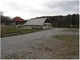 2
2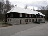 3
3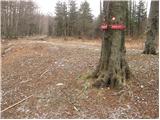 4
4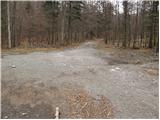 5
5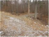 6
6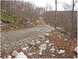 7
7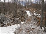 8
8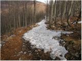 9
9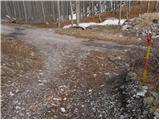 10
10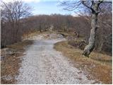 11
11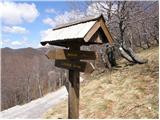 12
12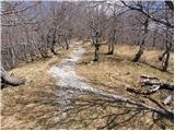 13
13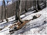 14
14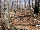 15
15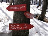 16
16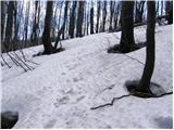 17
17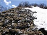 18
18 19
19
Discussion about the trip Platak - Vidikovac
|
| rokeg9. 07. 2023 21:54:48 |
Yesterday I was in these parts. No sign on picture 16, the path to the top itself is almost untraceable, no trace of the marker or inscription anywhere. I was also at the very summit, it's really quite overgrown.
Hut on Risnjak is closed and decaying, very sad to see. Really, don't know why? Most signs are on the ground and broken. Otherwise the path is relatively well marked. Descended via Lazac and over Mirnjak to Snježnik. Hut there also sadly decaying. Lively at Platak.
|
|
|
To post a comment you must log in:
If you do not yet have a username, you must first
register.