Starting point: Platak (1111 m)
| Latitude/Longitude: | 45,4251°N 14,5653°E |
| |
Walking time: 3 h 30 min
Difficulty: easy marked way
Elevation gain: 417 m
Elevation difference along the route: 620 m
Map:
Recommended equipment (summer):
Recommended equipment (winter): ice axe, crampons
Views: 27.175
 | 4 people like this post |
Access to starting point:
From the highway Zagreb - Reka we take the exit Kikovica, which leads us to the old road Zagreb - Reka. We follow the old road towards Zagreb, but only to the point where a road branches off to the left, ascending towards the ski slope Platak. We follow this road to a large parking lot, where we park.
Route description:
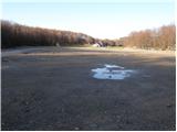
At the beginning of the parking lot, a road branches off to the right (in the direction of the ascent), which, after 100 meters of walking, brings us to the mountain hut Sušak na Platku. At the hut, we notice signposts for Risnjak, which direct us to the left onto a poorer road. Soon, the road brings us to a spot where it ends. We continue to the right on a marked cart track, which gently ascends through the forest and, after 15 minutes of further walking, brings us to the next road, where we continue to the left. This road also ends soon, and we continue the ascent in the direction of Risnjak. The still wide path higher up brings us to the next road, where we continue to the right and then immediately to the left onto a wide path in the direction of Risnjak. Next follows one hour of walking on a cart track, which ascends and descends a few times. After an hour and a half of walking from Platku, we reach the first major crossing, where we continue straight upwards again in the direction of Risnjak. The path ahead begins to ascend more steeply through the forested slopes of the Risnjak natural park. After a half-hour ascent, the path slightly descends and soon brings us to a crossing, where we continue straight in the direction of the mountain hut Risnjak. The path ahead continues descending for some time, then, with a few shorter ascents and descents, brings us to the next crossing, where we continue in the direction of the mountain hut. Only 15 minutes of moderate ascent follow, and the path brings us to the mountain hut.
From the hut, we continue on a path surrounded by dwarf pines in the direction of Risnjak. The relatively steep path, ascending with the help of two steel cables, brings us in a few minutes to a panoramic peak.

Photos:
 1
1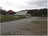 2
2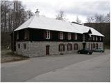 3
3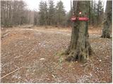 4
4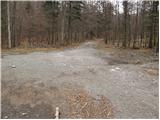 5
5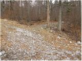 6
6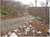 7
7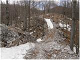 8
8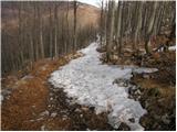 9
9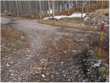 10
10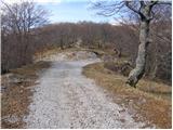 11
11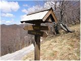 12
12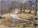 13
13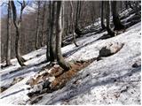 14
14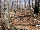 15
15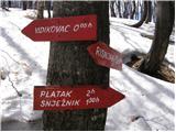 16
16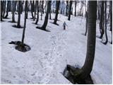 17
17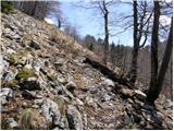 18
18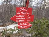 19
19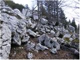 20
20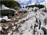 21
21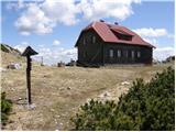 22
22 23
23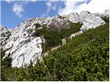 24
24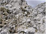 25
25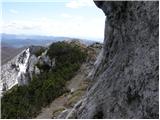 26
26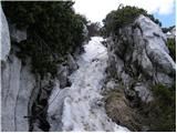 27
27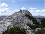 28
28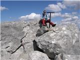 29
29
Discussion about the trip Platak - Veliki Risnjak
|
| kofram27. 02. 2013 |
Does anyone know if the hut on Risnjak is open on Sundays? Thanks for the information
|
|
|
|
| mishka1. 03. 2013 |
The hut on Risnjak is closed until 01.05.
|
|
|
|
| CarpeDiem24714. 07. 2016 |
Yesterday did this hike specifically from the Platak direction. For encouragement, I can tell you that for 3.5 hours you literally have nothing to do, realistically you can subtract (at least) an hour from that time 
|
|
|
|
| Grive6. 07. 2019 |
Hiked end of June. No hikers or wildlife on path. Met them (hikers only at hut, coming from Vilje direction. No offerings at hut. Path wonderful, up and down multiple times, always through forests except last 20 min from hut to summit in scrub. Add to description: at pic 7 turn right (down) ~20m then up. Summer overgrowth obscures macadam crossing, luckily had map. Or continue macadam to Cigoje junction (pic 11), but no signs without map.
|
|
|
|
| Grive6. 07. 2019 |
Correction: not Cigoje but Cajtige.
|
|
|
To post a comment you must log in:
If you do not yet have a username, you must first
register.