Platak - Snježnik (via crest)
Starting point: Platak (1111 m)
| Latitude/Longitude: | 45,4251°N 14,5653°E |
| |
Route name: via crest
Walking time: 1 h 30 min
Difficulty: easy marked way
Elevation gain: 395 m
Elevation difference along the route: 430 m
Map:
Recommended equipment (summer):
Recommended equipment (winter):
Views: 25.302
 | 2 people like this post |
Access to starting point:
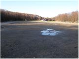
From the highway Zagreb - Reka we take the exit Kikovica, which leads us to the old road Zagreb - Reka. We follow the old road towards Zagreb, but only to the point where a road branches off to the left, ascending towards the Platak ski resort. We follow this road to a large parking lot, where we park.
Route description:
At the end of the large parking lot (on the right side in the direction of ascent) we will notice signposts for Snježnik, which direct us onto a forest road that gently ascends past the ski track. The road then enters the forest, where it begins to moderately ascend. After approximately 15 minutes of walking, the blazes direct us left upwards onto a rougher cart track, which quickly leads us to the next road. We continue left (badly marked) on the road, which after a few more minutes brings us to a crossing, where we continue right in the direction of "Snježnik over the ridge". The gradually worsening road in a few minutes brings us to the next crossing, where we continue left in the direction of Snježnik (right Risnjak). The worsening road we walk on, in a few dozen strides of a gentle ascent, brings us to a small saddle named Rimska vrata. Here we leave the road and continue slightly left on a footpath that ascends parallel to the road. The path quickly enters the forest, where it begins to ascend steeply. After a short ascent through the forest, the path brings us to the unvegetated slopes of Snježnik. The increasingly scenic path quickly leads us to the ridge, which we follow to the peak.

Along the route: Rimska vrata (1348m)
Photos:
 1
1 2
2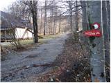 3
3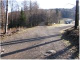 4
4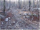 5
5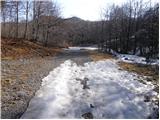 6
6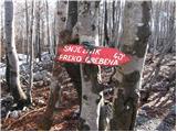 7
7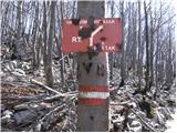 8
8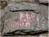 9
9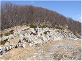 10
10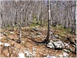 11
11 12
12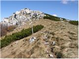 13
13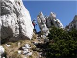 14
14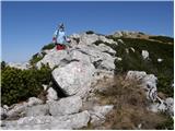 15
15 16
16
Discussion about the trip Platak - Snježnik (via crest)
|
| Okmodko7. 12. 2009 |
Is there any book down there?
|
|
|
|
| Marx23. 10. 2013 |
Dom pod Snežnikom looks quite nice in pictures, but in reality it unfortunately burned down a few years ago and now it's a locked ruin. In case of rain, you'll find some shelter under the roof. That's something to consider when visiting that beautiful mountain.
|
|
|
|
| Wine24. 10. 2013 |
the hut didn't burn down, but is destroyed due to disuse
|
|
|
|
| fiju-man11. 02. 2016 |
Strong wind and ice damaged the roof and as usual, there is no money in Croatia for such things. The hut is still falling apart   
|
|
|
To post a comment you must log in:
If you do not yet have a username, you must first
register.