Platak - Planinarski dom na Risnjaku
Starting point: Platak (1111 m)
| Latitude/Longitude: | 45,4251°N 14,5653°E |
| |
Walking time: 3 h 15 min
Difficulty: easy marked way
Elevation gain: 307 m
Elevation difference along the route: 500 m
Map:
Recommended equipment (summer):
Recommended equipment (winter):
Views: 11.557
 | 2 people like this post |
Access to starting point:
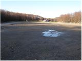
From the highway Zagreb - Reka we take the exit Kikovica, which leads us to the old road Zagreb - Reka. We follow the old road towards Zagreb, but only to the point where a road branches off to the left, ascending towards the ski slope Platak. We follow this road to a large parking lot, where we park.
Route description:
At the beginning of the parking lot, a road branches off to the right (in the direction of the ascent), which, after 100 meters of walking, brings us to the mountain hut Sušak na Platku. At the hut, we notice signposts for Risnjak, which direct us to the left onto a poorer road. Soon, the road brings us to a spot where it ends. We continue to the right on a marked cart track, which gently ascends through the forest and, after 15 minutes of further walking, brings us to the next road, where we continue to the left. This road also ends soon, and we continue the ascent in the direction of Risnjak. The still wide path higher up brings us to the next road, where we continue to the right and then immediately to the left onto a wide path in the direction of Risnjak. Next follows one hour of walking on a cart track, which ascends and descends a few times. After an hour and a half of walking from Platak, we reach the first major crossing, where we continue straight upwards again in the direction of Risnjak. The path ahead begins to ascend more steeply through the forested slopes of the Risnjak natural park. After a half-hour ascent, the path slightly descends and soon brings us to a crossing, where we continue straight in the direction of the mountain hut Risnjak. The path ahead continues descending for some time, then, with a few shorter ascents and descents, brings us to the next crossing, where we continue in the direction of the mountain hut. Only 15 minutes of moderate ascent follow, and the path brings us to the mountain hut.

Photos:
 1
1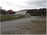 2
2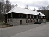 3
3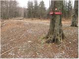 4
4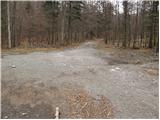 5
5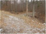 6
6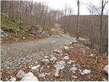 7
7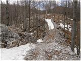 8
8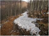 9
9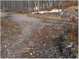 10
10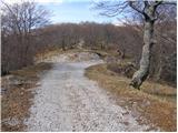 11
11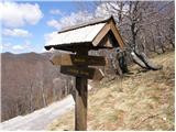 12
12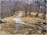 13
13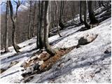 14
14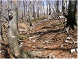 15
15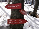 16
16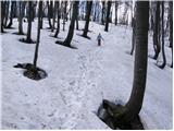 17
17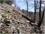 18
18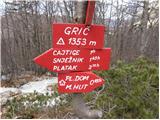 19
19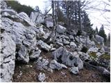 20
20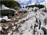 21
21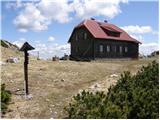 22
22
Discussion about the trip Platak - Planinarski dom na Risnjaku
|
| rokeg9. 07. 2023 21:56:45 |
Hut is closed and decaying. Maybe, does anyone know why?
Otherwise the path is solidly marked, only some signs broken or on the ground.
|
|
|
|
| bbugari19. 07. 2023 23:47:35 |
No interest in working at the hut. New, new, new weather... 
|
|
|
|
| rokeg22. 04. 2024 19:59:08 |
I was in these parts again yesterday. From local hikers I learned that the hut is closed because migrants allegedly broke into the hut and made total chaos. They say they broke quite a few things.
Signs have been put back on trees or poles. There was a little snow, powdery.
|
|
|
|
| jstern25. 04. 2024 14:46:31 |
Sadly, after the hut on Snježnik which has been decaying for 30 years, Risnjak is gone too. Shame for us Croats
|
|
|
To post a comment you must log in:
If you do not yet have a username, you must first
register.