Planinska Ravna - Boskovec (Sever way)
Starting point: Planinska Ravna (1140 m)
Route name: Sever way
Walking time: 1 h 25 min
Difficulty: easy marked way
Elevation gain: 447 m
Elevation difference along the route: 500 m
Map: Kamniške in Savinjske Alpe 1:50.000
Recommended equipment (summer):
Recommended equipment (winter):
Views: 19.586
 | 1 person like this post |
Access to starting point:
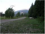
First, we drive to Mozirje, where at the roundabout we head in the direction of Golte and Šmihel. A little further, we come to an intersection at the inn, where we turn slightly right in the direction of Šmihel (left: cableway Golte). We follow the road ahead to the village, where on the right side of the road we notice a church. A little further, we come to the intersection, where we go left in the direction of Mozirska koča mountain hut, Golte (Here from the right joins the road from the Koroška side, by which access is possible for people from Koroška). The road then soon brings us to the next intersection, where we go left onto the lower road. The road then soon becomes macadam, and we follow it to a large parking lot before the gate. The parking lot is on the right side of the road and is partly overgrown with grass.
Route description:
At the beginning of the parking lot, we notice the mountain trail markers, which direct us right onto a footpath in the direction of Mozirska koča mountain hut. The path, which goes immediately into the forest, ascends moderately and brings us after a few minutes to a smaller junction, where we have two options for continuing. We can continue straight on the steep path or right on the gentle path. Both paths join after a few minutes and bring us higher to a nice vantage point, beside which a bench is placed. There follows only about 10 minutes of moderate ascent to Mozirska koča mountain hut.
From the hut, we continue left along the road to the chapel, where the signs for Boskovec (Severjeva pot) direct us slightly right into the forest. After a few steps, we cross a grazing fence, then the path ascends a little more steeply for a short time. Further, we cross a shorter panoramic slope, then the path in a gentle ascent again through the forest brings us to a poor forest road. Here to the right branches off the path to the vantage point (5 minutes), and we continue slightly left along the road, which gradually descends. After a few minutes of gentle descent, a cart track branches off to the left upwards in the direction of Boskovec. The ascent along the cart track does not last long as the blazes quickly direct us right onto a footpath, which through locally quite overgrown slopes brings us to a larger meadow a little below the summit. We continue along the right side of the meadow, where the path quickly brings us into the forest and then to a junction. The signpost for Boskovec directs us right onto the path, which ascends moderately and after a few dozen steps brings us to the summit.
Planinska Ravna - Mozirska koča 30 minutes, Mozirska koča - Boskovec 0:55.

Photos:
 1
1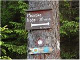 2
2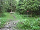 3
3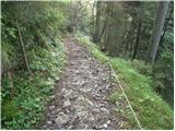 4
4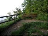 5
5 6
6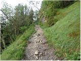 7
7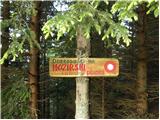 8
8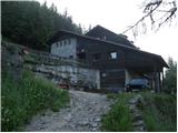 9
9 10
10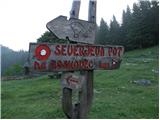 11
11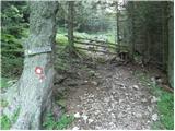 12
12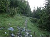 13
13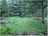 14
14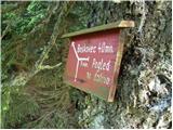 15
15 16
16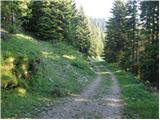 17
17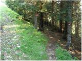 18
18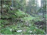 19
19 20
20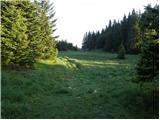 21
21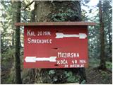 22
22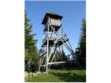 23
23
Discussion about the trip Planinska Ravna - Boskovec (Sever way)
|
| marinka6719. 05. 2013 |
The road from Šmihel is gravel only about a kilometer, then it's asphalt again all the way to the parking lot, where parking on the right side is no longer possible, but 100m further just before the barrier on the left there is an arranged parking lot. We didn't know until the end if we were on the right road, luckily we had a printed picture of the parking lot . .
It's a shame they don't repair the tower, which is sadly decaying.
Well, I think, finances.....
|
|
|
|
| radegunda29. 07. 2015 |
Is the path through Hleviška planina less overgrown? And what is the condition of the tower?
|
|
|
|
| geppo29. 07. 2015 |
The tower hasn't been there for quite some time. Otherwise, I haven't been on the path through Hleviška for a few months. I think you won't have any special problems.
lp
|
|
|
|
| radegunda29. 07. 2015 |
Well, this one is nice... I think we'll only go to the viewpoint for which there is a sign in picture 15. The viewpoint should probably still be there 
|
|
|
|
| geppo30. 07. 2015 |
The viewpoint still exists. Under it is Janez's bivouac, which you can visit..
regards
|
|
|
|
| Stamp4. 08. 2019 |
Are there views from or near Boskovec?
How about Mozirska koča - is it stocked with food?
|
|
|
|
| Stamp8. 08. 2019 |
We did a circular hike this Sunday. Impression - so-so, family walk, not difficult.. In winter, in the snow it's surely more interesting..
All photos HERE
and the track of the circular hike HERE
|
|
|
|
| nejcf16. 06. 2020 |
Last weekend after a multi-week break I was finally a bit higher up again. The described path is only a smaller part of the loop we hiked on the Golteh. Mozirska koča was closed, which we didn't expect and so we went without lunch.
|
|
|
To post a comment you must log in:
If you do not yet have a username, you must first
register.