Planina Zajavornik - Mrežce
Starting point: Planina Zajavornik (1292 m)
| Latitude/Longitude: | 46,3629°N 13,9491°E |
| |
Walking time: 1 h 55 min
Difficulty: easy marked way
Elevation gain: 673 m
Elevation difference along the route: 673 m
Map: TNP 1 : 50.000
Recommended equipment (summer):
Recommended equipment (winter): ice axe, crampons
Views: 50.237
 | 3 people like this post |
Access to starting point:
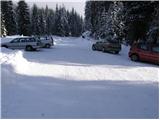
From the highway Ljubljana - Jesenice, we take the Lesce exit and follow the road in the direction of Bled, where at the signalized crossroads signs for Pokljuka direct us to the right. We follow this road, which in the lower part runs through some villages and later starts to ascend more steeply, to Mrzli Studenec (mountain pasture, which is located a good 50 meters behind the crossroads, where the road to Bohinj branches off to the left downward). In the middle of the mentioned mountain pasture, the road which leads to Medvedova konta, the monument Pri Rupah, and the mountain pasture Zajavornik branches off to the right from the main road. Here we turn right and follow the road in the following crossroads in the direction of the mountain pasture Zajavornik. The road then brings us to the parking lot near the mountain pasture Zajavornik.
Route description:
From the parking lot, we head onto the footpath in the direction of Blejska koča. The path, which initially ascends gently through the spruce forest, a little higher crosses a forest road, after which the path from the NOB monument (Pri Rupah) soon joins us from the left side. The fairly wide path, which all the time runs embraced by spruce forests, then brings us higher to the next junction, where we continue left in the direction of Lipanca (right Medvedova konta). We continue the ascent on a very wide cart track, which in a gentle ascent brings us in a few minutes to the grazing area of the mountain pasture Lipanca. Here the path turns right and leads us in a moderate ascent along the right lower edge of the mentioned mountain pasture. This is followed by crossing a grassy slope and the path, which brings us back into the forest, makes a sharp right turn at the NOB memorial plaque, after which we reach the shepherd's and mountain hut on the mountain pasture Lipanca.
From the hut, we continue left in the direction of Viševnik and Mrežce on the path, from which soon a path toward Rudno polje branches off to the left downward. We continue straight and the moderately steep path brings us after a short ascent to the next junction, where we continue right in the direction of Mrežce (straight Viševnik and Mrežce longer path). The path ahead starts to ascend steeply through increasingly sparse forest. Higher up, the steepness eases and beautiful views of the highest peaks of the Julian Alps begin to open up from the path. A little further on, the already mentioned longer path joins us from the left, but we continue right and after a few more minutes of walking step onto the panoramic summit of Mrežce.
Starting point - Blejska koča 1:00, Blejska koča - Mrežce 55 minutes.

The trip can be extended to the following destinations: Lipanski vrh
Photos:
 1
1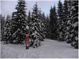 2
2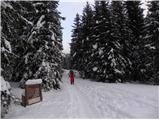 3
3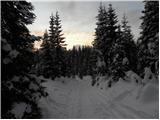 4
4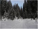 5
5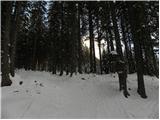 6
6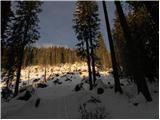 7
7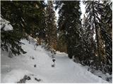 8
8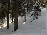 9
9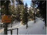 10
10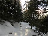 11
11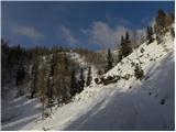 12
12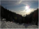 13
13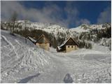 14
14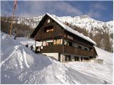 15
15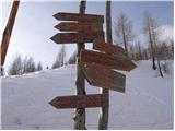 16
16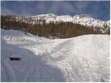 17
17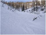 18
18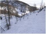 19
19 20
20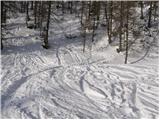 21
21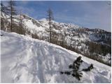 22
22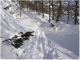 23
23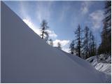 24
24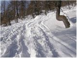 25
25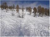 26
26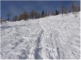 27
27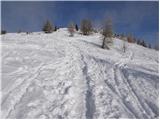 28
28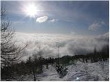 29
29 30
30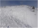 31
31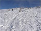 32
32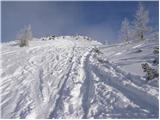 33
33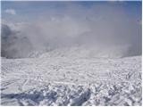 34
34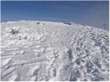 35
35 36
36
Discussion about the trip Planina Zajavornik - Mrežce
|
| heinz10. 12. 2008 |
Yesterday I did the mentioned route. Excellent for ski tourers, as even the foot walk in such nice weather as yesterday was a real pleasure. From Blejska Koča to the top it sinks in a bit (if you're not exactly light), but given the view of the white-clad Alps that you get at Mrežce, it pays off handsomely.
I recommend this nice winter trip!
|
|
|
|
| mate1235. 02. 2009 |
is the tour suitable these days (avalanches, snow)?
|
|
|
|
| Klin5. 02. 2009 |
I advise against it, better wait for better weather.
|
|
|
|
| mate1236. 02. 2009 |
Spot on, thanks - anyway there will be bad weather over the weekend
|
|
|
|
| andrejjerina7. 02. 2009 |
This week we spent the holiday week on Pokljuka. On Wednesday, Peter and I set off from the Šport Hotel towards Planina Javornik, but despite persistence, we abandoned our ski hike after about 100 meters due to too much fresh snow. Conditions have of course changed by now, as heavy rain fell yesterday and the fresh snow melted. In the high mountains, a lot of new snow has fallen in the meantime, so let it not be superfluous another warning to wait for a more favorable weather forecast, especially for better conditions regarding the risk of triggering snow avalanches. This year we are given to enjoy for a long time.. Best regards, Andrej
|
|
|
|
| lukk1. 02. 2011 |
I'm interested in what the conditions are like on this path and how much snow there is
|
|
|
|
| grega_p22. 02. 2012 |
The trail to Lipance is already excellently packed down, from there towards Mrežce there is noticeably more snow and it sinks in more too.
I turned back about half an hour before the summit because I didn't feel like being only half in the sun with my body
|
|
|
|
| Flora122. 02. 2012 |
Yesterday the snow was cracking a lot. Watch out for avalanches.
|
|
|
|
| Mima23. 02. 2012 |
I'm planning a hike to Mrežce on Saturday, wondering if the trail is already trodden and how much snow there is. Regards
|
|
|
|
| Pohodnica5623. 02. 2012 |
On Saturday I sweated a bit to Mrežce. As grega p says, packed to Lipance, sank in a little, but exactly at noon I was up. Views beautiful and sun too. How it will be this week with the thaw is a question.
|
|
|
|
| Nuši23. 10. 2012 |
On Sunday visited Mrežce, as the nice weather was inviting to nature. Actually, we only decided on the way to Gorenjska whether to go to Slemenova Špica or to Mrežce and the peaks around there. We anticipated crowds towards Vršič, so we headed to Pokljuka. And we didn't regret it. Spent a wonderful day.
|
|
|
|
| karlin6. 02. 2018 |
Yesterday, 5.2.2018, I did this ascent. I started from the Šport hotel (intersection where you turn from the main road towards Šport hotel), because the road from Mrzli studenec is plowed only to Kranjska dolina. The path is well trodden, mainly by ski tourers and snowshoers. Snow like in a real winter fairy tale. The path is trampled and "skied" to the top. Fog below, divine views above, due to slightly stronger wind.
|
|
|
To post a comment you must log in:
If you do not yet have a username, you must first
register.