Planina Ravne - Veliki vrh (Veža) (via Zelene trate)
Starting point: Planina Ravne (1500 m)
| Latitude/Longitude: | 46,3493°N 14,6997°E |
| |
Route name: via Zelene trate
Walking time: 2 h 15 min
Difficulty: easy marked way
Elevation gain: 610 m
Elevation difference along the route: 650 m
Map: Kamniške in Savinjske Alpe 1:50.000
Recommended equipment (summer):
Recommended equipment (winter): ice axe, crampons
Views: 39.423
 | 1 person like this post |
Access to starting point:
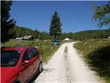
A) First, we drive to Kamnik, and then we continue driving towards Stahovica and mountain pass Črnivec. A few 100 meters before the mountain pass Črnivec we leave the main road which leads towards Gornji Grad and we continue driving sharply left in the direction of the mountain pass Volovljek (Kranjski Rak). From the mentioned mountain pass we continue straight (left road which leads to Velika planina, right Štajerski Rak) and start descending towards Luče. Lower down the road flattens a little and brings us into the valley Podvolovljek. Further we at first drive past the turn-off of the road which leads into the valley Lučka Bela, after that also past bar Pri Gamsu. After the bar, we need to pay attention, because only a few 100 meters further the road which leads towards the mountain pasture Podvežak and mountain pasture Ravne and farm Planinšek branches off to the left (by the spot where we leave the main road, there is a road sign approximately 11 km). Further, we drive on the initially still asphalt road which then ascends towards the plateau Dleskovška planota. Higher, the road towards Planinšek branches off to the right, and here we continue on the left upper road which a few 100 meters further from the turn-off towards the farm Planinšek becomes a macadam, and a little further it brings us to the next crossroad, where we continue straight in the direction of the mountain pasture Ravne (left mountain pasture Podvežak). Further on a somewhat rougher road, we then follow to the beginning of the mountain pasture Ravne, where we park on an appropriate place by the road.
From the main road to the mountain pasture Ravne is approximately 10 km, of this approximately 4 km macadam.
B) First, we drive to Luče, and then we continue driving towards Kamnik. When by the road we notice a road sign which shows 10.5 km, we need to pay attention to the right turn-off, because only a little further to the right the road towards the mountain pasture Podvežak and Ravne and farm Planinšek branches off. Further, we drive on the initially still asphalt road which then ascends towards the plateau Dleskovška planota. Higher, the road towards Planinšek branches off to the right, and here we continue on the left upper road which a few 100 meters further from the turn-off towards the farm Planinšek becomes a macadam, and a little further it brings us to the next crossroad, where we continue straight in the direction of the mountain pasture Ravne (left mountain pasture Podvežak). Further on a somewhat rougher road, we then follow to the beginning of the mountain pasture Ravne, where we park on an appropriate place by the road.
From the main road to the mountain pasture Ravne is approximately 10 km, of this approximately 4 km macadam.
Route description:
From the starting point through the mountain pasture we walk to the shepherd's hut, which we bypass on the right side, so that we continue in the direction of the mountain pasture Molička planina and mountain pasture Polšak (on the left side of the hut leads the path over Dolga trata). Behind the hut, the path is at first a little hard to follow, but we get help from the blazes, and a little ahead we join the cart track which from the road on the mountain pasture Ravne branches off at the right turn.
When we step on the cart track, we continue left, on it we at first walk without large changes in altitude, and then we start gently to moderately ascending. After a few minutes, we reach an indistinct saddle between Dleskovec on the left and Smrekovec on the right. Here from the right joins the path from the end of the road, and we continue straight over the grazing fence. Behind the grazing fence follows a short traverse, and then we get to the next marked junction, where we continue left in the direction of the Lučka koča, straight to mountain pasture Polšak.
The path ahead continues in a series of several smaller valleys, and then it brings us to the NOB monument, by which there are benches with a table. From here on, the path ascends a little steeper, and a little higher already first nice views open up towards Križevnik, Raduha and surrounding mountains. Higher, we for some time moderately ascend through belts of dwarf pines, and then the path flattens and brings us to Sedelce, where from the left joins the path over Dolga trata.
Here we continue straight and for a short time still continue on the marked path towards Korošica and mountain pasture Molička planina, and then we continue right in the direction of the marked path to Veliki vrh. The path ahead leads us through an indistinct valley to the east, then northeast of Veliki vrh. When the marked path to Veliki vrh turns left towards the slope, to the right a view opens up and passage to Jamarski bivouac on Dleskovška planota, to which is approximately 10 minutes of descent, and we continue on the mentioned marked path, which gradually passes to a steeper slope. Further, we ascend on a steep and occasionally poorly beaten path which leads towards the saddle between Veliki vrh on the left and Velika Zelenica on the right. Before the mentioned saddle, the path becomes even steeper, and then it suddenly flattens and brings us on ample grassy terrain.
Here we continue left towards Veliki vrh (right Velika Zelenica), which we already see in front of us and to which we ascend in a few minutes of moderate ascent.

Along the route: Sedelce (1840m)
Photos:
 1
1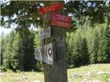 2
2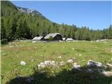 3
3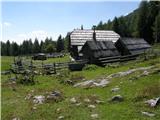 4
4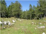 5
5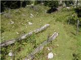 6
6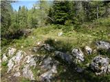 7
7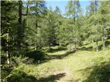 8
8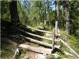 9
9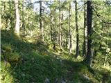 10
10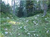 11
11 12
12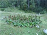 13
13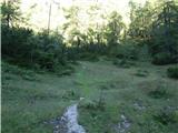 14
14 15
15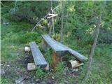 16
16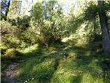 17
17 18
18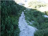 19
19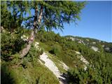 20
20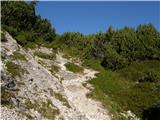 21
21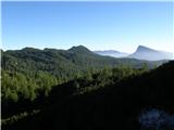 22
22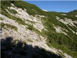 23
23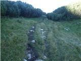 24
24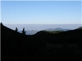 25
25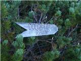 26
26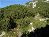 27
27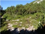 28
28 29
29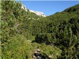 30
30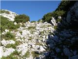 31
31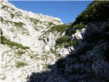 32
32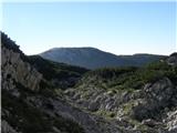 33
33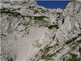 34
34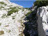 35
35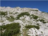 36
36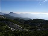 37
37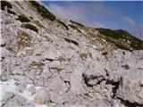 38
38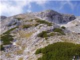 39
39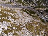 40
40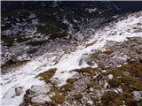 41
41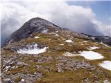 42
42 43
43
Discussion about the trip Planina Ravne - Veliki vrh (Veža) (via Zelene trate)
|
| klavdipo15. 07. 2008 |
Is there a stamp in the summit log box besides the book?
|
|
|
|
| fpetel115. 10. 2008 |
Today there was only the logbook and two mechanical pencils in the box. The first one I tried wrote.
|
|
|
|
| EUGEN10. 09. 2009 |
Great trip:
pl. Ravne, Polšakova planina, Križevnik, Poljske device, Veliki vrh, Dleskovec, pl. Ravne
|
|
|
|
| sla17. 12. 2009 |
Does anyone know what the conditions are like on the road through Črnivec to Povolovjek and to the starting point for Dleskova planota? How far can you get by car?
|
|
|
|
| Stingray28. 08. 2010 |
I attach a picture of the GPS export of the above described path in Google Earth:
|
|
|
|
| EUGEN28. 09. 2010 |
Was there this August on the peak (no logbook). I like returning to these beautiful areas.
|
|
|
|
| micamaca29. 09. 2010 |
Me too, me too peace and pure enjoyment without crowds on the "road", without endless "hi, hi, hi..." now and then you scare some rock partridge, and you meet a chamois mother with a little kid and then blissfully collapse on the grass on Dolge trate peace and pure enjoyment without crowds on the "road", without endless "hi, hi, hi..." now and then you scare some rock partridge, and you meet a chamois mother with a little kid and then blissfully collapse on the grass on Dolge trate aaaa aaaa
|
|
|
|
| aonuk117. 04. 2011 |
Sunday 17.4.2011 summited Veliki vrh and Dleskovec. Weather for this time excellent, warm, sunny, snow frozen, view also satisfactory.
|
|
|
|
| plavžar21. 10. 2012 |
The path is marked - verified!
|
|
|
|
| navdušena2. 07. 2015 |
Has anyone gone by car to Planina Ravne this year already? What's the road like?
|
|
|
|
| garmont2. 07. 2015 |
No problems, drivable for passenger cars.
|
|
|
|
| mpp16. 09. 2015 |
Up to the Planinšek farm at 1100m altitude, there is completely new asphalt. Further ahead, marking stakes are also visible. Obviously, they will still do some work.
The trail from the saddle to Veliki vrh is marked.
Also the trail Planina Ravne (1500m) - Dolga trata - Sedelce (1840m).
It is not yet shown on maps.
|
|
|
|
| Stamp30. 09. 2015 |
Hello
Does anyone perhaps have a Track from Planina Ravne via Dleškovec to Veliki Vrh?
So I don't wander in case of fog..
Thanks ...
|
|
|
|
| mornar26. 09. 2017 |
Please info on conditions on path from Planina Ravne to Veliki vrh. Lp.
|
|
|
|
| veja526. 09. 2017 |
On Saturday I was at Dleskovec and then towards Veliki vrh. Snow patches are already between Dleskovec and Veliki vrh. In the cirque, before crossing the last scree field, there is snow, as well as partially on the scree under the summit, which must be crossed to the left. Winter equipment is required for the ascent. If the snow freezes, it can be slippery.
Best regards! Venčeslav.
|
|
|
|
| mornar27. 09. 2017 |
Thanks Veja for the reply, at the same time I would also ask if there is a stamp at the top and how traceable the path is. Lp.
|
|
|
|
| malihodec3. 09. 2019 |
In the last week been up twice. Unfortunately I note that on the box containing the stamp and where the summit book should be, there is obviously no lid and no summit book for quite some time.
|
|
|
|
| drdivx4. 09. 2019 |
@malihodec
In the replica of Aljažev stolp there is also a stamp.
|
|
|
|
| frajer31. 01. 2020 |
Today I walked this trail. Orientation through the bushes is quite difficult, especially if it's your first time (thanks to the one who at least partially cleared the path). There is approx. 20-30 cm of snow, with an icy base underneath. Access to Veliki vrh is possible directly towards the summit or left of the summer path.
|
|
|
|
| J.P.14. 02. 2022 20:50:24 |
The car stayed ca. 4-5km below Planina Ravne due to snow and ice. We noticed several cars went higher too, probably could have gone another max 2km without issues.
Conditions were excellent this weekend. Wintery with plenty of sun. Recommend loop Pl.Ravne-Veliki vrh-Zelenica-Planina Podvežak. LP
|
|
|
|
| dleskovec15. 02. 2022 16:09:45 |
J.P. Pictures would be welcome; are there any?
|
|
|
|
| J.P.15. 02. 2022 18:52:54 |
|
|
|
|
| turbo15. 02. 2022 18:58:11 |
Adding photos here is not possible, they can be attached to the text in the Current Conditions forum.
|
|
|
|
| J.P.15. 02. 2022 19:28:03 |
Thanks turbo. I'll attach it there if I get something useful for the crowd. LP
|
|
|
|
| kayzelko23. 06. 2023 09:00:40 |
Hello,
has anyone been to Veliki vrh recently? Markings?
How is the road to Planina Ravne? Passable for a passenger car?
regards
|
|
|
|
| felix9. 10. 2023 09:15:12 |
Hi!
Is the road to Planina Ravne through Luče normally drivable?
Thanks and best regards.
|
|
|
|
| maj029. 05. 2024 18:14:03 |
Does anyone know if it will be possible to go this weekend without crampons/ice axe? Can you drive to planina Ravne by car?
|
|
|
|
| garmont9. 05. 2024 19:08:49 |
The road to Ravne is dry.
Veliki vrh still has a lot of snow from this side.
|
|
|
|
| michael6628. 08. 2024 18:27:15 |
Has anyone been recently by car to pl. Ravne? How is the road/gravel road?
|
|
|
To post a comment you must log in:
If you do not yet have a username, you must first
register.