Planina Ravne - Veliki vrh (Veža) (via Dleskovec)
Starting point: Planina Ravne (1500 m)
| Latitude/Longitude: | 46,3493°N 14,6997°E |
| |
Route name: via Dleskovec
Walking time: 2 h 45 min
Difficulty: easy unmarked way
Elevation gain: 610 m
Elevation difference along the route: 800 m
Map: Kamniške in Savinjske Alpe 1:50.000
Recommended equipment (summer):
Recommended equipment (winter): ice axe, crampons
Views: 9.744
 | 1 person like this post |
Access to starting point:
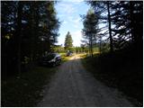
A) First, we drive to Kamnik, and then we continue driving towards Stahovica and the mountain pass Črnivec. A few hundred meters before the mountain pass Črnivec we leave the main road which leads towards Gornji Grad and we continue driving sharply left in the direction of the mountain pass Volovljek (Kranjski Rak). From the mentioned mountain pass we continue straight (left road which leads to Velika planina, right Štajerski Rak) and start descending towards Luče. Lower down the road flattens a little and brings us into the Podvolovljek valley. Further on we first drive past the turn-off of the road which leads into the Lučka Bela valley, after that also past the bar pri Gamsu. After the bar, we need to pay attention, because only a few hundred meters further the road which leads towards the mountain pasture Podvežak and Ravne and farm Planinšek branches off to the left (by the spot where we leave the main road there is a road sign approximately 11 km). Further, we drive on at first still asphalt road which then ascends towards the Dleskovška planota plateau. Higher, the road towards Planinšek branches off to the right, and here we continue on the left upper road, which a little further brings us to the next crossroad, where we continue straight in the direction of the mountain pasture Ravne (left mountain pasture Podvežak). Further on a little rougher road, which we then follow to the beginning of the mountain pasture Ravne, where we park on an appropriate place by the road.
From the main road to the mountain pasture Ravne is approximately 10 km.
B) First, we drive to Luče, and then we continue driving towards Kamnik. When by the road we notice a road sign which shows 10.5 km, we need to pay attention to the right turn-off, because only a little further to the right the road towards the mountain pasture Podvežak and Ravne and farm Planinšek branches off. Further, we drive on at first still asphalt road which then ascends towards the Dleskovška planota plateau. Higher, the road towards Planinšek branches off to the right, and here we continue on the left upper road, which a little further brings us to the next crossroad, where we continue straight in the direction of the mountain pasture Ravne (left mountain pasture Podvežak). Further on a little rougher road, which we then follow to the beginning of the mountain pasture Ravne, where we park on an appropriate place by the road.
Route description:
At the beginning of the mountain pasture Ravne (also Ravni) we notice wooden mountain signposts for Veliki vrh, Korošica, Molička planina and Dolga trata, which point us to the left towards the nearby cottage, which is situated on the edge of the mountain pasture. We bypass the cottage on the left side, and then we pass into a narrow strip of forest, where blazes lead left. The path ahead leads us through the clearing, through which it ascends diagonally into the forest. Further, we are ascending through the forest, where we soon cross a grazing fence. Higher, the forest starts to get thinner, or changing into a strip of dwarf pines. On some spots somewhat less beaten, but all the time easy to follow footpath higher flattens and brings us to the bottom edge of pastures Dolgih trat. Here the path entirely flattens and in a few dozen steps of additional walking brings us to the shepherd hut on Dolgih tratah.
At the shepherd hut, where there is a smaller marked junction we continue right in the direction of Dleskovec (left Molička planina, Veliki vrh and Korošica). Further unmarked footpath on the left side bypasses the nearby cross and passes into dwarf pines through which it starts moderately ascending. From the cross ahead for some time we follow beaten and partly cleared path, after that when it flattens and brings us to a smaller sinkhole, it suddenly almost entirely vanishes. Here we continue on the left side of the sinkhole and we ascend among dwarf pines on the left and scree on the right. Steep part quickly ends and "path" then quickly brings us to a panoramic peak.
From the top of Dleskovec we continue towards the north, where worse footpath, by which we notice a few smaller cairns, gradually brings us to a smaller valley. The footpath, which further moderately to occasionally somewhat more steeply descends, continues somewhat to the left of the valley, where it runs on a partly grassy slope surrounded by dwarf pines. Lower the footpath descends right into the valley, and then joins the marked path from the mountain pasture Ravne or from the end of the road somewhat above the mountain pasture.
We follow the marked path to the left, which soon brings us to a junction, where from the left joins a marked path over Dolga Trato. Here we continue straight, and we only a little further arrive at the place where to the right branches off the path to Veliki vrh.
At this spot we leave the wide path which leads towards Korošica and continue right following the signs Veliki vrh. Further, we ascend on a somewhat less beaten path which continues through a strip of dwarf pines. After approximately 15 minutes of additional walking the path passes into more rocky terrain, where the footpath becomes even somewhat less beaten. The path, which further is well marked with cairns and newer blazes, ascends on the right side of the scree, where it leads us below smaller cliffs. The steepness then eases and after approximately 10 minutes of additional walking we arrive in more grassy terrain. Here we head left upwards and continue on a less beaten footpath which leads towards the saddle between Veliki vrh on the left and Velika Zelenica on the right. In the upper part of the ascent we keep somewhat more to the right, since the slope below Veliki vrh is becoming very steep. When we pass the steep part the path suddenly flattens and brings us to expansive grassy slopes.
Here we continue left towards Veliki vrh (right Velika Zelenica), whose peak we already see, to which we ascend without major difficulties.

Photos:
 1
1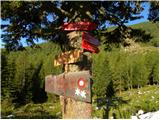 2
2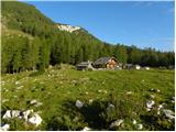 3
3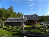 4
4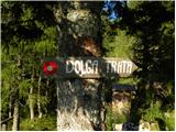 5
5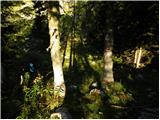 6
6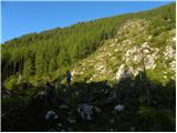 7
7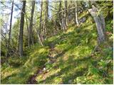 8
8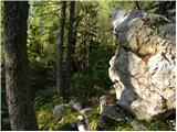 9
9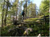 10
10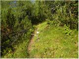 11
11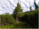 12
12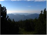 13
13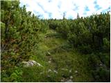 14
14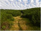 15
15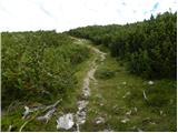 16
16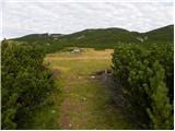 17
17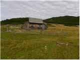 18
18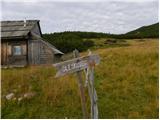 19
19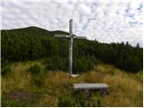 20
20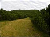 21
21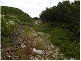 22
22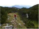 23
23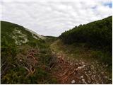 24
24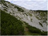 25
25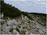 26
26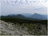 27
27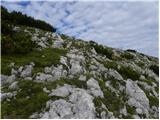 28
28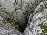 29
29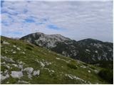 30
30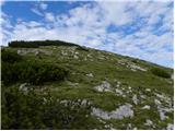 31
31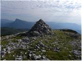 32
32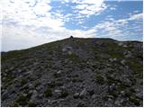 33
33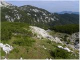 34
34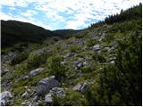 35
35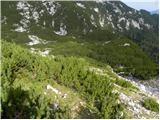 36
36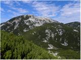 37
37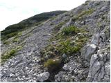 38
38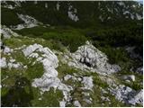 39
39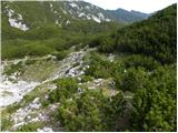 40
40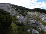 41
41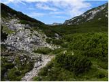 42
42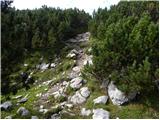 43
43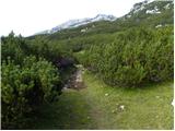 44
44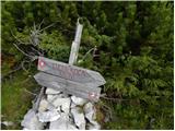 45
45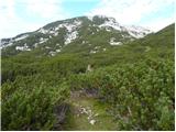 46
46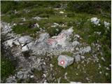 47
47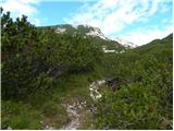 48
48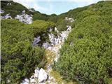 49
49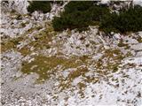 50
50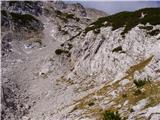 51
51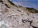 52
52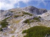 53
53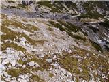 54
54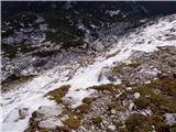 55
55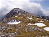 56
56 57
57
Discussion about the trip Planina Ravne - Veliki vrh (Veža) (via Dleskovec)
|
| LidijaJesih14. 10. 2012 |
The path to Planina Dolga trata is now marked, further to Dleskovec it is nicely traceable but not marked. Similarly unmarked is the descent from Dleskovec to the connecting marked path to Korošica, but on the other hand the path that branches off to Veliki vrh is marked. So the path is now mostly marked.
|
|
|
|
| Stamp28. 09. 2015 |
Does anyone perhaps have a Track (GPX or any other) of this route? It's nicely described here, you can't get lost, but I'd like something on GPS in case of fog or similar.
|
|
|
|
| KarmenT24. 07. 2022 20:26:19 |
We two didn't find the path that descends from the summit on the north side, but we did find a well-trodden path on the west side that leads to the marked path from Dolga trata. We met a local who said there are several possible paths.
|
|
|
To post a comment you must log in:
If you do not yet have a username, you must first
register.