Planina Ravne - Velika Zelenica (via Zelene trate)
Starting point: Planina Ravne (1500 m)
| Latitude/Longitude: | 46,3493°N 14,6997°E |
| |
Route name: via Zelene trate
Walking time: 2 h 15 min
Difficulty: easy marked way
Elevation gain: 614 m
Elevation difference along the route: 655 m
Map: Kamniške in Savinjske Alpe 1:50.000
Recommended equipment (summer):
Recommended equipment (winter): ice axe, crampons
Views: 39.882
 | 1 person like this post |
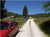
Access to starting point:
A) First, we drive to Kamnik, and then we continue driving towards Stahovica and the mountain pass Črnivec. A few hundred meters before the mountain pass Črnivec we leave the main road which leads towards Gornji Grad and we continue driving sharply left in the direction of the mountain pass Volovljek (Kranjski Rak). From the mentioned mountain pass we continue straight (left road which leads to Velika planina, right Štajerski Rak) and start descending towards Luče. Lower down the road flattens a little and brings us into the valley Podvolovljek. Further on we first drive past the turn-off of the road which leads into the valley of Lučka Bela, then also past the bar Pri Gamsu. After the bar, we need to pay attention, because only a few hundred meters further the road which leads towards the mountain pasture Podvežak and mountain pasture Ravne and farm Planinšek branches off to the left (by the spot where we leave the main road, there is a road sign approximately 11 km). Further, we drive on the initially still asphalt road which then ascends towards the plateau Dleskovška planota. Higher, the road towards Planinšek branches off to the right, and here we continue on the left upper road which a few hundred meters further from the turn-off towards the farm Planinšek becomes macadam, and a little further it brings us to the next crossroad, where we continue straight in the direction of the mountain pasture Ravne (left mountain pasture Podvežak). Further on a somewhat rougher road, then we follow to the beginning of the mountain pasture Ravne, where we park on an appropriate place by the road.
From the main road to the mountain pasture Ravne is approximately 10 km, of which approximately 4 km macadam.
B) First, we drive to Luče, and then we continue driving towards Kamnik. When by the road we notice a road sign which shows 10.5 km, we need to pay attention to the right turn-off, because only a little further to the right the road towards the mountain pasture Podvežak and Ravne and farm Planinšek branches off. Further, we drive on the initially still asphalt road which then ascends towards the plateau Dleskovška planota. Higher, the road towards Planinšek branches off to the right, and here we continue on the left upper road which a few hundred meters further from the turn-off towards the farm Planinšek becomes macadam, and a little further it brings us to the next crossroad, where we continue straight in the direction of the mountain pasture Ravne (left mountain pasture Podvežak). Further on a somewhat rougher road, then we follow to the beginning of the mountain pasture Ravne, where we park on an appropriate place by the road.
From the main road to the mountain pasture Ravne is approximately 10 km, of which approximately 4 km macadam.
Route description:
From the starting point through the mountain pasture we walk to the shepherd's hut, which we bypass on the right side, so that we continue in the direction of the mountain pasture Molička planina and mountain pasture Polšak (on the left side of the hut leads the path over Dolga trata). Behind the hut the path is at first somewhat difficult to follow, but the blazes help us, and a little ahead we join the cart track which from the road on the mountain pasture Ravne branches off at the right turn.
When we step on the cart track we continue left, on it we at first walk without major changes in altitude, then we start gently to moderately ascending. After a few minutes we reach an indistinct saddle between Dleskovec on the left and Smrekovec on the right. Here from the right joins the path from the end of the road, and we continue straight across the grazing fence. Behind the grazing fence follows a short traverse, then we arrive at the next marked junction, where we continue left in the direction of the Lučka koča, straight to mountain pasture Polšak.
The path ahead continues in a series of several smaller depressions, then it brings us to the NOB monument, by which there are benches with a table. From here the path ascends somewhat more steeply, and somewhat higher the first nice views open up towards Križevnik, Raduha and the surrounding mountains. Higher we moderately ascend for some time through belts of dwarf pines, then the path flattens and brings us to Sedelce, where from the left joins the path over Dolga trata.
Here we continue straight and for a short time still continue on the marked path towards Korošica and Molička planina, then we continue right in the direction of the marked path to Veliki vrh. The path ahead leads us through an indistinct depression eastward, then northeast of Veliki vrh. When the marked path to Veliki vrh turns left towards the slope, to the right a view and passage open up to the Jamarski bivouac on Dleskovška planota, to which there is approximately 10 minutes of descent, and we continue on the mentioned marked path, which gradually leads onto a steeper slope. Further we ascend on a steep and occasionally poorly trodden path which leads towards the saddle between Veliki vrh on the left and Velika Zelenica on the right. Before the mentioned saddle the path becomes even steeper, then suddenly flattens and brings us onto spacious grassy terrain.
Here we continue right towards Velika Zelenica (left Veliki vrh) on the grassy slopes of Velika Zelenica. We reach the panoramic peak after a few minutes of pleasant panoramic walking on the summit slope of the mountain.

Along the route: Sedelce (1840m)
Photos:
 1
1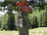 2
2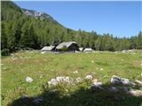 3
3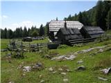 4
4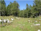 5
5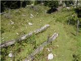 6
6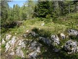 7
7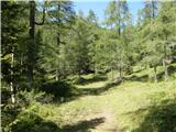 8
8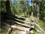 9
9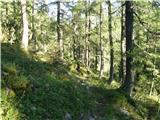 10
10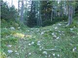 11
11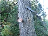 12
12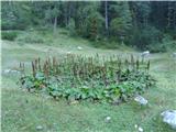 13
13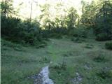 14
14 15
15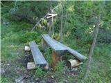 16
16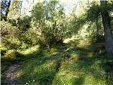 17
17 18
18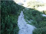 19
19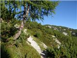 20
20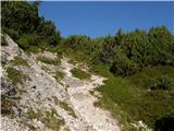 21
21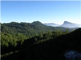 22
22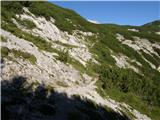 23
23 24
24 25
25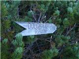 26
26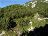 27
27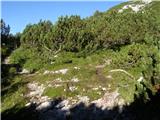 28
28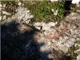 29
29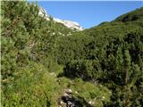 30
30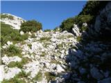 31
31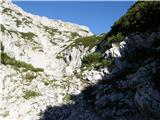 32
32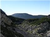 33
33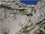 34
34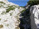 35
35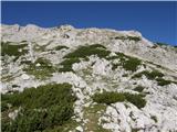 36
36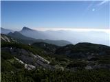 37
37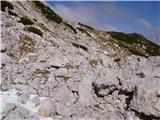 38
38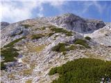 39
39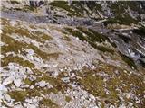 40
40 41
41 42
42 43
43 44
44
Discussion about the trip Planina Ravne - Velika Zelenica (via Zelene trate)
|
| Gost12. 11. 2007 |
 Really excellent excursion and of course excellent tips with descriptions and photos, really very commendable, practically on your site you find everything you're interested in to prepare well for the tour and of course other useful data that save you quite some time when searching for the starting point with the car to the parking lot especially for less known excursions, which are of course peaceful and beautiful precisely because of their peculiarities and therefore even more attractive! Best regards - Mario Really excellent excursion and of course excellent tips with descriptions and photos, really very commendable, practically on your site you find everything you're interested in to prepare well for the tour and of course other useful data that save you quite some time when searching for the starting point with the car to the parking lot especially for less known excursions, which are of course peaceful and beautiful precisely because of their peculiarities and therefore even more attractive! Best regards - Mario
|
|
|
|
| Gost13. 11. 2007 |
I'm interested in how the snow is like in this area. This year I hiked and summited Ojstrica and Dedec, but that was still in better conditions than now. Since I don't have crampons and an ice axe, I don't dare to go on the trail just like that, as I know someone will tell me that winter gear is needed, but now I avoid higher peaks and harder ascents where possible without crampons and ice axe. But I'm drawn to this Zelenica and I ask the guest who was probably on Zelenica, how are the conditions. Thanks!
|
|
|
|
| Stingray23. 08. 2010 |
Yesterday I went along the above-mentioned path. I noticed that to the very top between Velika Zelenica and Veliki vrh there are about 3 paths, which are marked with cairns above, but very hard to spot below (descent is thus easier than ascent in this case).
Some pictures are at:
http://www.facebook.com/album.php?aid=74503&id=1421460409&ref=mf
|
|
|
|
| Stingray28. 08. 2010 |
I am attaching a picture of the GPS export of the above-described path in Google Earth:
PICTURE
|
|
|
|
| mornar9. 06. 2019 |
I'm wondering if it's possible to reach Planina Ravne by minibus and what the road is like. Is the onward path well marked and followable. Thanks for the answer. Best.
|
|
|
|
| geppo9. 06. 2019 |
The road is asphalted, the last 4km is macadam. There are some potholes, but with slow driving on those sections it causes no problems - yesterday with a passenger car. The paths are well marked and followable.
best
some photos:/trenutnerazmere.asp?slo=1&gorovjeid=3&id=6802>Jarski bivak
|
|
|
|
| mornar9. 06. 2019 |
geppo thanks for the reply.
|
|
|
|
| jahorv31. 07. 2023 09:14:55 |
Hello,
I'm interested in the accessible path to Planina Ravne, as well as the condition of the path to Velika Zelenica.
Thank you for the information
|
|
|
|
| Janez Seliškar31. 07. 2023 10:59:12 |
Have a great trip on the path, everything is vehicle-accessible and walkable.
Of course report on the path, wherever you're going!
|
|
|
|
| jahorv1. 08. 2023 09:13:35 |
Thank you for your quick response and answer to the question, I will write a comment about the path.
|
|
|
To post a comment you must log in:
If you do not yet have a username, you must first
register.