Planina Polog - Vrh Planje (via planina Dobrenjščica)
Starting point: Planina Polog (457 m)
| Latitude/Longitude: | 46,238°N 13,7232°E |
| |
Route name: via planina Dobrenjščica
Walking time: 5 h 30 min
Difficulty: easy pathless terrain, partly demanding marked way
Elevation gain: 1514 m
Elevation difference along the route: 1514 m
Map: Julijske Alpe - zahodni del 1:50.000
Recommended equipment (summer):
Recommended equipment (winter): ice axe, crampons
Views: 3.327
 | 2 people like this post |
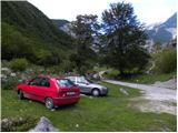
Access to starting point:
First, we drive to Tolmin, from there we follow the road in the direction of Zatolmin (leaving the main road at the traffic light). In Zatolmin we notice the signposts for Javorca, which direct us onto the ascending road towards Javorca. The occasionally quite narrow and in places precipitous road brings us after approximately 8 km of driving to a smaller junction, where the road towards Javorca branches off to the left uphill. We continue straight, following the road only for approximately 100 m, and then park at an appropriate spot by the barrier.
Route description:
From the starting point, we continue on a macadam road (the road is closed to public traffic), which after a few minutes of easy walking brings us to the central part of the mountain pasture, where a few cottages stand. Behind the mountain pasture, the road becomes somewhat worse, and after a few minutes of further walking it brings us to a junction, where the path to Planina na Prodih branches off to the right (access to the mountain pasture is very interesting, as we must cross the river Tolminka using a manual cableway). We continue straight, the road eventually turning into a cart track and higher up into a well-preserved mule track. The path then becomes somewhat steeper and brings us past two benches and higher past a fresh rocky outcrop (earthquake in Posočje 1998) to a grazing fence, over which we step onto the southern edge of Planina pod Osojnico. Just a few meters further, the path splits into two parts. We continue on the right lower path, by which in a gentle descent we quickly reach the hunting cottage at the source of Tolminka.
From the source of Tolminka we continue a gentle ascent across Planina pod Osojnico, and from the left the upper path soon joins us, which is exposed to active rockfall.
We continue in the direction "Planina Prode and Prehodci" along the path that brings us to a mighty torrent bed where there is another junction.
At the junction we continue right following the signs "Planina Prode" and beside the dam we cross the wide bed of the torrent. On the other side of the bed there is another junction. This time we continue left, right leads the path to Planina Prode. The path then briefly leads through the forest parallel to the torrent bed, then turns right and begins to ascend. Later the path brings us to a small clearing, then it begins to ascend somewhat more steeply through the forest. Further on we ascend in zigzags through the forest for quite some time. Higher up the forest becomes somewhat sparser on some sections and increasingly beautiful views begin to open up. The path then turns right and in ascent crosses the slopes towards the southeast. We emerge from the forest onto slopes somewhat overgrown with nettles and scrub, and the final ascent to the hunting cottage on Planina Dobrenjščica follows.
At the hunting cottage we continue left towards the northwest and the path soon brings us to a marked junction. Right uphill leads the path to Koča na planini Razor, while we continue left and further cross the slope towards the northwest. Along the path we will soon notice a poorly visible path that leads left downhill to the spring (marked with the inscription "Voda 40m"). From here we continue another good 100 meters along the path, then we will notice uphill to the right a narrow strip not overgrown with dwarf pines. Here we leave the marked path and head straight uphill along the dwarf pines. We then steeply ascend alongside the dwarf pines until we reach a less trodden path. On the path we continue right and then begin to ascend in zigzags. The path here is marked with a few cairns and brings us from the dwarf pines onto rocky slopes. The path becomes somewhat less visible and turns slightly right towards the east. Just below the ridge we will spot a military bunker towards which we ascend. From here a short ascent follows to the saddle between the peaks Kser and Vrh Škrli, where we join the marked path leading to Tolminski Kuk.
We continue right along the ridge in the direction of Tolminski Kuk and the path soon brings us to the indistinct peak named Kser.
The path ahead descends somewhat along the ridge and brings us to a small saddle. Further on we begin to ascend again, the path running mostly along the left side of the ridge. The quite steep path, slightly exposed in places, then brings us to the ridge. A short ascent along the ridge follows and the path brings us to the next peak (Vrh Planje 1971 m) from which a fine view of Tolminski Kuk opens up.

Photos:
 1
1 2
2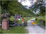 3
3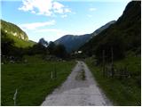 4
4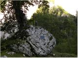 5
5 6
6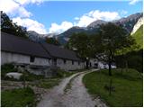 7
7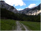 8
8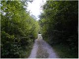 9
9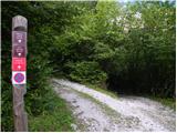 10
10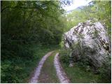 11
11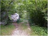 12
12 13
13 14
14 15
15 16
16 17
17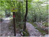 18
18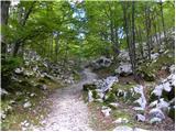 19
19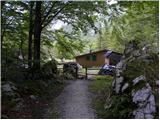 20
20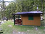 21
21 22
22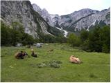 23
23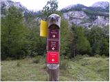 24
24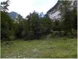 25
25 26
26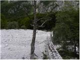 27
27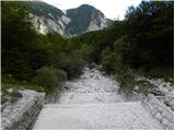 28
28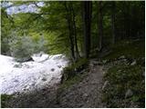 29
29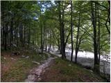 30
30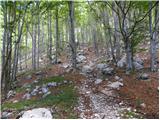 31
31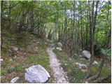 32
32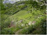 33
33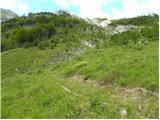 34
34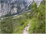 35
35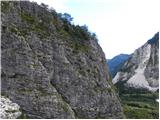 36
36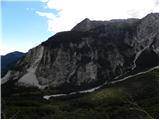 37
37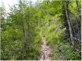 38
38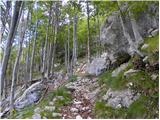 39
39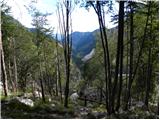 40
40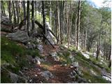 41
41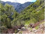 42
42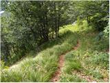 43
43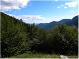 44
44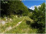 45
45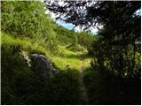 46
46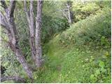 47
47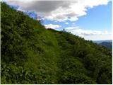 48
48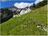 49
49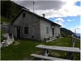 50
50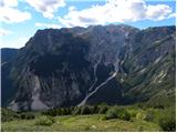 51
51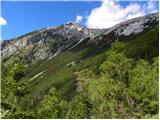 52
52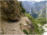 53
53 54
54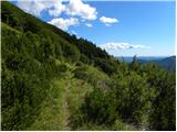 55
55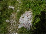 56
56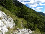 57
57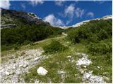 58
58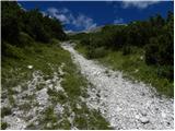 59
59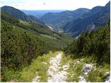 60
60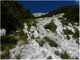 61
61 62
62 63
63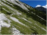 64
64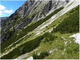 65
65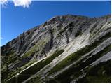 66
66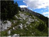 67
67 68
68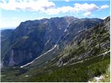 69
69 70
70 71
71 72
72 73
73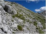 74
74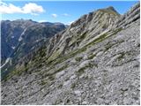 75
75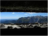 76
76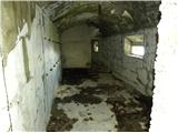 77
77 78
78 79
79 80
80 81
81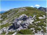 82
82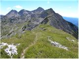 83
83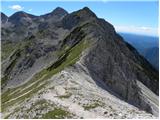 84
84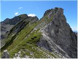 85
85 86
86 87
87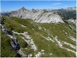 88
88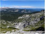 89
89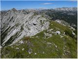 90
90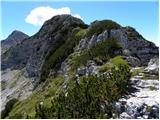 91
91 92
92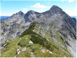 93
93
Discussion about the trip Planina Polog - Vrh Planje (via planina Dobrenjščica)
|
| oraigo25. 08. 2020 |
Hello.
I have a question about the passability of the unmarked section from the mulatjera to Vrh Škrli. Namely, recently I wanted to do the route from Prehodci - through Vrh Škrli - planina Govnjač - to Komna.
However, at the part where I should have started climbing steeply (picture 58) I encountered a pile of rocks and stones. Since I wasn't sure about the correct path, I turned back to Prehodci. Thanks for the answers and be well. Igor
|
|
|
|
| mirank25. 08. 2020 |
A few years ago I also looked for the junction of the mule track as mentioned by Mihelič in his description-of course I didn't find it, as everything below is overgrown with scree. The easiest way up is as described-that is, through this gully-gap in the scree. As soon as you peek out of the greenery, the old mule track is clearly visible and leads to a large bunker right below the ridge. How passable it is in dry conditions on the Bohinj side, I don't know
|
|
|
|
| pinkerton26. 08. 2020 |
That's right as mirank says.
Last year I went up and down here. You have to stick exactly to this scree tongue, especially on the descent, because all others end blindly in hopeless scree.
Here there used to be a wide Italian mule track, but it is already completely overgrown and impassable. For comparison, ortho photo and lidar, where its course is still beautifully visible
|
|
|
|
| pinkerton26. 08. 2020 |
Unfortunately I can't upload them 
|
|
|
|
| pinkerton26. 08. 2020 |
I put them in the profile
|
|
|
|
| oraigo26. 08. 2020 |
Thank you very much.
I will repeat it soon.
|
|
|
To post a comment you must log in:
If you do not yet have a username, you must first
register.