Planina Polog - Planina Dobrenjščica
Starting point: Planina Polog (457 m)
| Latitude/Longitude: | 46,238°N 13,7232°E |
| |
Walking time: 2 h 45 min
Difficulty: easy marked way
Elevation gain: 847 m
Elevation difference along the route: 850 m
Map: Julijske Alpe - zahodni del 1:50.000
Recommended equipment (summer):
Recommended equipment (winter): ice axe, crampons
Views: 9.107
 | 1 person like this post |
Access to starting point:
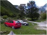
First, we drive to Tolmin, from there we follow the road in the direction of Zatolmin (we leave the main road at the traffic light). In Zatolmin we notice signposts for Javorca, which direct us onto an ascending road towards Javorca. The occasionally quite narrow and in parts precipitous road brings us after approximately 8 km of driving to a smaller intersection, where the road towards Javorca branches off to the left upwards. We continue straight, we follow the road only for approximately 100 m, and then at an appropriate place by the barrier we park.
Route description:
From the starting point, we continue on a macadam road (road is closed for public traffic), and after a few minutes of easy walking it brings us to the main part of the mountain pasture, where there are a few cottages. Behind the mountain pasture, the road becomes even a little worse, and after a few minutes of additional walking brings us to a junction, where the path towards the mountain pasture Planina na Prodih branches off to the right (access to the mountain pasture is very interesting, because we have to cross river Tolminka, and this is done by a manual cableway). We continue straight, and the road finally changes into a cart track and higher into a well-preserved mule track. After that, the path becomes a little steeper and past two benches and higher past a fresh rockfall (earthquake in Posočje 1998) brings us to a grazing fence, over which we step on the south edge of the mountain pasture Planina pod Osojnico. Only a few meters ahead, the path splits into two parts. We continue on the right lower path, on which in a gentle descent, we quickly arrive at the hunting cottage at the source of Tolminka.
From the source of Tolminka we continue a gentle ascent through the mountain pasture Planina pod Osojnico, and from the left soon joins the upper path, which is exposed to active rockfall.
We continue in the direction of "planina Prode in Prehodci" on the path which brings us to a mighty torrent where there is again a junction.
At the junction, we continue right following the signs »Planina Prode« and by the dam we cross a wide riverbed of a torrent. On the other side of the riverbed there is again a junction. This time we continue left, right leads the path towards the mountain pasture Planina Prode. The path then for a short time leads through the forest parallel with the riverbed of a torrent, and then turns to the right and starts ascending. Later, the path brings us to a smaller clearing, and then starts a little steeper ascending through the forest. Further, we ascend for quite some time in zig-zags through the forest. Higher the forest becomes on some sections a little thinner and increasingly beautiful views start to open up. The path then turns to the right and in ascent crosses slopes towards the southeast. Out of the forest we come onto slopes a little overgrown with nettles and bushes and the last ascent follows to the hunting cottage on the mountain pasture Planina Dobrenjščica (also Dobrenšca).

Photos:
 1
1 2
2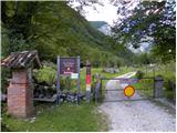 3
3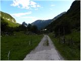 4
4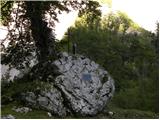 5
5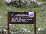 6
6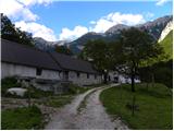 7
7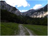 8
8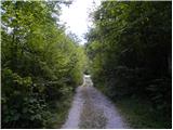 9
9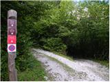 10
10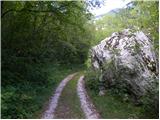 11
11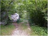 12
12 13
13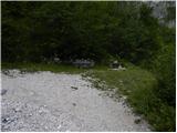 14
14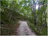 15
15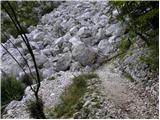 16
16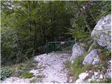 17
17 18
18 19
19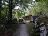 20
20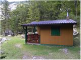 21
21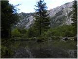 22
22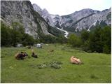 23
23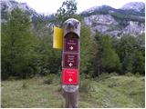 24
24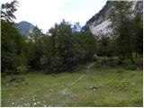 25
25 26
26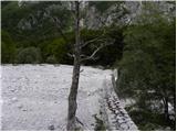 27
27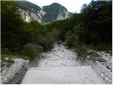 28
28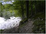 29
29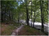 30
30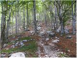 31
31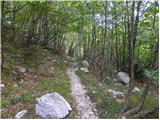 32
32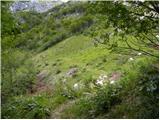 33
33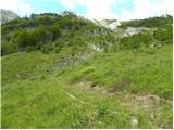 34
34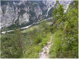 35
35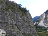 36
36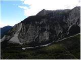 37
37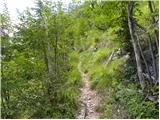 38
38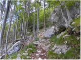 39
39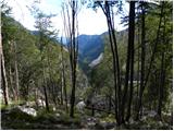 40
40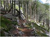 41
41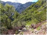 42
42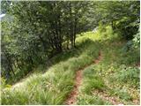 43
43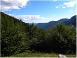 44
44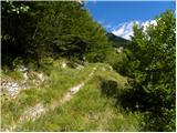 45
45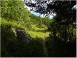 46
46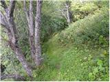 47
47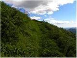 48
48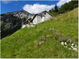 49
49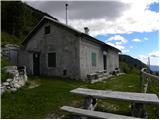 50
50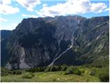 51
51
Discussion about the trip Planina Polog - Planina Dobrenjščica
|
| Bizy10. 04. 2011 |
As always, the less visited or less sung paths are also beautiful. This is one of them. On Saturday's almost hot weather (at times a light breeze nicely cooled) it was pure idyll up there.
|
|
|
|
| zwbgr3. 11. 2022 18:38:00 |
From the opposite bank, a path is visible that goes from Planina Prode up an obviously passable gully to Dobrenjščica. But who knows where the path branches off? I've already unsuccessfully searched for the junction twice from the Pl. Prode - Tolminka spring path.
|
|
|
|
| lojze18253. 11. 2022 19:17:10 |
From pl. Prode you go directly past the buildings roughly parallel to Tolminka or the path to the spring and a bit further past the water intake. Then you cross the stream bed where the path disappears and go a bit by nose, but cairns help, keep to the right. Higher up the path reappears. To the gully, which is a good landmark, you must arrive from the right looking up. Once you reach the gully, there are no more major issues ahead. You also have the description in the Brezpotja guide under the Mahavšček tour.
|
|
|
|
| mirank3. 11. 2022 19:55:45 |
We actually descended there from Dobrenjščica - a followable little path, but I think we only crossed the gully fairly close above the planina - we didn't descend along it. The hike got a bit extended due to a mistake right at the start; namely, when crossing the scree sl 26,27 in the above description, a path branches left to Prehodce and zg Prode (there's a hunting hut there). At a quick glance, it's identical to sl 30 and that misled us, so we then climbed to Dobrenjščica via Prehodce.
That branch - sl 30 is about 5 min further from the Prehodce branch in the direction of pl Prode, when crossing the second small narrow scree.
|
|
|
To post a comment you must log in:
If you do not yet have a username, you must first
register.