Planina pod Golico - Barentaler Kotschna/Struška
Starting point: Planina pod Golico (980 m)
| Latitude/Longitude: | 46,4706°N 14,0599°E |
| |
Walking time: 3 h
Difficulty: easy unmarked way
Elevation gain: 964 m
Elevation difference along the route: 964 m
Map: Karavanke - osrednji del 1:50.000
Recommended equipment (summer):
Recommended equipment (winter): ice axe, crampons
Views: 12.200
 | 1 person like this post |
Access to starting point:
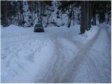
From the Ljubljana - Jesenice highway, take the Lipce exit (also Hrušica) and follow the road ahead towards Jesenice, where signs for Planina pod Golico direct us onto an ascending road (the turn-off is marked and located at the health center in Jesenice). The relatively steep road soon brings us to the mentioned village, where in May we can admire the blooming of daffodils on the surrounding meadows. From Planina pod Golico we drive on to the next intersection, where we notice numerous hiking signposts. Here we continue right and drive another good 50 m to the parking lot below the Savske jame.
Route description:
From the parking lot we continue on the lower road in the direction of Golica and the sledding track of Savske jame. After 10 minutes the sledding track turns left steeply upwards, but we continue on the wide road, which still moderately ascends along the stream. A little further we come to an intersection, where we continue straight (between both roads) in the direction of Golica. Further we ascend on a worse, quite overgrown cart track, which after 15 minutes of moderate ascent brings us to a macadam road, which we only cross. Next follows crossing of a grazing fence and the path brings us to the grassy slopes of Markljev rovt.
From Markljev rovt we continue slightly right (slightly left Golica) on a footpath which slightly ascends along the riverbed of a torrent. Higher the path becomes somewhat steeper, crosses the mentioned torrent and then turns right, where after a few minutes of further walking it joins the road from Pusti rovt.
We follow the road to the left, but only to a junction, where signs for Struška direct us right (left Golica). Just a few steps ahead we step on a newer forest road which we follow right (straight old path). This road, which first runs through the forest, higher over an avalanche slope, we follow all the way to Belska planina (Svečice) from which a beautiful view opens up.
From the mountain pasture we continue towards the east initially only slightly upwards. After five minutes of walking from the hut the path brings us to a less steep gully, where we continue left on a poorly visible unmarked path (straight planina Seča).
Further we ascend on a grass-covered gully surrounded by dwarf pines. The still hard-to-follow little path at the top of this gully turns right into the expansive world of Struška. The path ahead in moderate ascent crosses the southwestern slopes of Struška, which are partly covered with dwarf pines (because the path is hard to follow we can quickly stray into the dwarf pines). A little below the summit the "path" brings us to the ridge which we follow to the summit.
Orientation from the mountain pasture to the summit is somewhat harder, and in fog very difficult.

Photos:
 1
1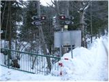 2
2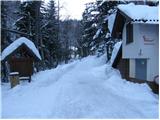 3
3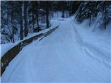 4
4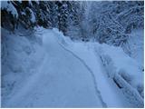 5
5 6
6 7
7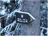 8
8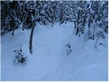 9
9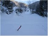 10
10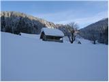 11
11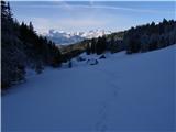 12
12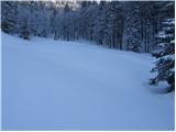 13
13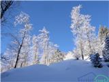 14
14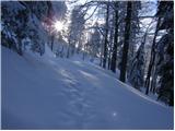 15
15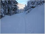 16
16 17
17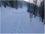 18
18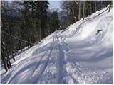 19
19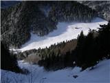 20
20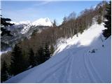 21
21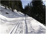 22
22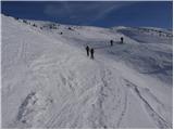 23
23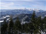 24
24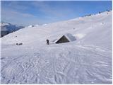 25
25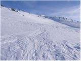 26
26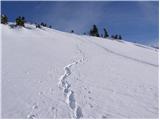 27
27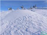 28
28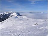 29
29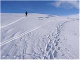 30
30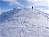 31
31 32
32
Discussion about the trip Planina pod Golico - Barentaler Kotschna/Struška
|
| Jusk1. 09. 2019 |
This morning from Planina pod Golico to sedlo Kočna, then further up, at the fork where the marked path goes straight I turn left onto the unmarked path through the bushes, after some time I spot the hut on Belska planina below me.. then through the labyrinth among the bushes to the top at the top horses kept me company continue to planina Seča, there along the 'road' back to Belska planina and on to sedlo Suha, from there back to Planina pod Golico (it started thundering quite seriously at the top horses kept me company continue to planina Seča, there along the 'road' back to Belska planina and on to sedlo Suha, from there back to Planina pod Golico (it started thundering quite seriously really very nice views the whole way recommend lp really very nice views the whole way recommend lp
|
|
|
|
| Jusk12. 07. 2020 |
I parked at the first parking lot under the cable car at Pl. pod Golico.. from there towards Križovec, Belska planina, Seča and along the border path through the scrub to the summit. Occasionally muddy path due to night rain, but no problem at the summit windy and cold, I was alone at the summit, plus about 20 lazy heifers lying in the grass for lovers of alpine plants Struška is the right place, full of flowers and blossoms everywhere return to Pl. pod Golico via sedlo Suha, Križovca.. pleasant hike
|
|
|
To post a comment you must log in:
If you do not yet have a username, you must first
register.