Starting point: Planina Kuk (1150 m)
| Latitude/Longitude: | 46,2112°N 13,7872°E |
| |
Walking time: 4 h 5 min
Difficulty: partly demanding marked way
Elevation gain: 902 m
Elevation difference along the route: 1000 m
Map: TNP 1:50.000
Recommended equipment (summer):
Recommended equipment (winter): ice axe, crampons
Views: 7.297
 | 2 people like this post |
Access to starting point:
Between Most na Soči and Tolmin, the road branches off to Poljubinj. From Poljubinj we drive further towards the village Ljubinj, where behind the church we turn left towards the mountain pasture Razor and Stador. The road brings us to the parking lot on the mountain pasture Stador, where nearby there is a mountain hut. We drive further to the mountain pasture Lom and further along the road following the signs to mountain pasture Razor. At an altitude of 1150 m we arrive at the mountain pasture Kuk, where there is a parking lot on which we park. Further driving is forbidden.
Route description:
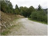
From the parking lot, we continue along the road closed to traffic, which after a few dozen steps brings us to the mountain pasture Kuk, where in summer we can buy homemade dairy products (sour milk, cheese, curd).
The road ahead starts to ascend gently and after a while brings us to the next barrier. After the barrier, the path enters the forest and ascends almost imperceptibly, occasionally even descending slightly. After one hour of walking, the path brings us to the mountain pasture Razor, where there is a mountain hut.
From the hut, we head along the path in the direction of Škrbina and Vogel. After a few minutes of gentle walking, the path brings us to the next junction, where we continue straight in the direction of Škrbina (right Vogel).
The path ahead turns slightly to the left and ascends moderately over slopes covered with dwarf pines. When the path brings us to the next junction at an altitude of approximately 1500 m, we continue left in the direction of Škrbina saddle (right Vrh nad Škrbino - south path). The path soon emerges from the dwarf pines onto interesting slopes, where on our right we will notice steep rock slabs that form an interesting wall for climbers, which is not overly steep. The path ahead ascends transversely across the scree to the Škrbina saddle, located at 1910 m.
When we step onto Škrbina, a beautiful view opens onto the Gorenjska side, and at the junction we continue left in the direction of Kuka (right Vrh nad Škrbino, straight down to mountain pasture za Migovcem, Komna, Vogel and Ukanc). The path ahead begins to ascend transversely across steep slabs, after which both the path and the slope flatten somewhat. The path ahead passes below the short wall of Vrh Kont, then begins to descend gently across occasionally steeper scree. Further on, on the Primorska side, the path crosses Podrto gora and Mali vrh, then returns to the main ridge of the Spodnje Bohinjske gore, which it reaches right at the saddle between Mali vrh and Zeleni vrh. From here we continue in the same direction, only now the path moves from the slopes onto a locally exposed ridge. We follow the marked path, which occasionally ascends quite steeply and then offers ever better views, all the way to the grassy Zeleni vrh.

Photos:
 1
1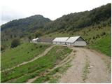 2
2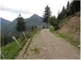 3
3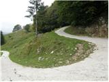 4
4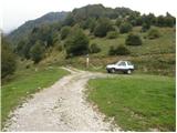 5
5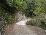 6
6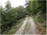 7
7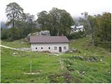 8
8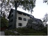 9
9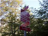 10
10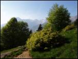 11
11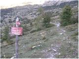 12
12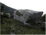 13
13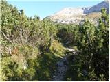 14
14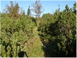 15
15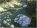 16
16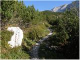 17
17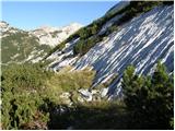 18
18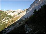 19
19 20
20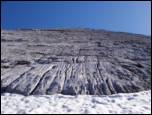 21
21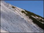 22
22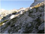 23
23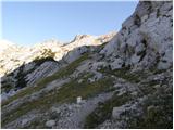 24
24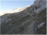 25
25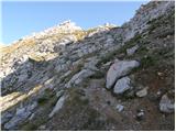 26
26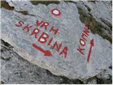 27
27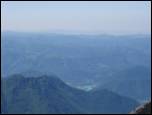 28
28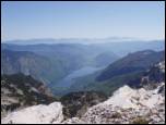 29
29 30
30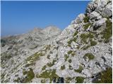 31
31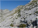 32
32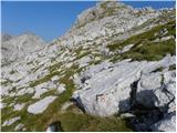 33
33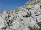 34
34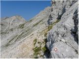 35
35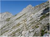 36
36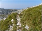 37
37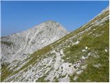 38
38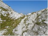 39
39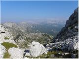 40
40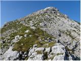 41
41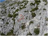 42
42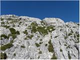 43
43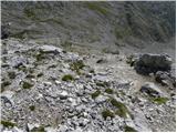 44
44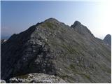 45
45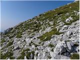 46
46 47
47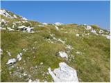 48
48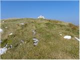 49
49 50
50
Discussion about the trip Planina Kuk - Zeleni vrh
|
| Enka27. 06. 2020 |
Yesterday via this path (en route) to Zeleni vrh. From Škrbina we hiked in fog the whole time, so it's really nice to see these photos, at least I know what it looks like . To Škrbina a bit annoying scree slope, then the path is great all the way to the top. Marked better in the opposite direction, but impossible to miss. The summit thrilled me, it's spacious, dotted with soft grass and plenty of flowers, definitely a better choice for a snack than Tolminski kuk, which is usually the main goal for those who stop here. . To Škrbina a bit annoying scree slope, then the path is great all the way to the top. Marked better in the opposite direction, but impossible to miss. The summit thrilled me, it's spacious, dotted with soft grass and plenty of flowers, definitely a better choice for a snack than Tolminski kuk, which is usually the main goal for those who stop here.
|
|
|
|
| darinka429. 12. 2022 13:19:29 |
In summer or on dry ground it's nice to traverse the entire ridge. From Vrh nad Škrbino all the way to Tolminski Kuk. Zeleni vrh is beautiful also in winter. Yesterday visibility wasn't good. I don't remember such dense fog around 12 o'clock under the summit. When nothing else remains but descent. Wait.
|
|
|
|
| padez30. 12. 2022 18:26:23 |
For one of the best ridge "walks" it is recommended to overnight on Planina Razor the first day, the second day very early ascend to Kuk and in a full day do the ridge tour via Vogel all the way to Bogatinsko sedlo and further to Komna. Overnight there, the next day via Skrbina to the starting point in Tolminske Ravne. The tour is long, full-day. No water, but the views are divine... Stable weather is essential...
|
|
|
|
| Darxta26. 08. 2024 10:20:06 |
The trail from Škrbina to the saddle between Zeleni and Mali vrh is very well and visibly marked. Beyond the saddle, however, the marks are not renewed and quite faded, so you need to look carefully at the rocks. Especially the junction in picture 42 can be easily missed.
|
|
|
To post a comment you must log in:
If you do not yet have a username, you must first
register.