Planina Kuk - Vrh nad Škrbino (direct way)
Starting point: Planina Kuk (1150 m)
| Latitude/Longitude: | 46,2112°N 13,7872°E |
| |
Route name: direct way
Walking time: 3 h 15 min
Difficulty: partly demanding marked way
Elevation gain: 904 m
Elevation difference along the route: 915 m
Map: TNP 1 : 50.000
Recommended equipment (summer):
Recommended equipment (winter): ice axe, crampons
Views: 21.452
 | 2 people like this post |
Access to starting point:
Between Most na Soči and Tolmin, the road branches off to Poljubinj. From Poljubinj we drive further towards the village Ljubinj, where behind the church we turn left towards Planina Razor and Stador. The road brings us to the parking lot on Planina Stador, where nearby there is a mountain hut. We drive further to Planina Lom and further along the road following the signs for Planina Razor. At an altitude of 1150 m we arrive at Planina Kuk, where there is a parking lot at which we park. Further driving is forbidden.
Route description:
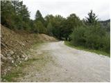
From the parking lot, we continue on the road closed to traffic, which after a few dozen steps brings us to Planina Kuk, where in the summer we can buy homemade dairy products (sour milk, cheese, curd).
The road ahead starts to ascend gently and after a while brings us to the next barrier. After the barrier, the path goes into the forest and ascends almost imperceptibly, occasionally even descending slightly. After one hour of walking, the path brings us to Planina Razor, where there is the mountain hut.
From the hut, we head onto the path in the direction of Škrbina and Vogel. After a few minutes of gentle walking, the path brings us to the next junction, where we continue straight in the direction of Škrbina (right to Vogel).
The path ahead turns slightly to the left and ascends moderately over slopes covered with dwarf pines. When the path brings us to the next junction at an altitude of approximately 1500 m, we continue right following the signs for Vrh nad Škrbino. The left path leads to the saddle Škrbina. The path then ascends slightly through the dwarf pines and turns slightly to the left. When we emerge from the dwarf pines, we continue ascending slightly and cross grassy slopes below the ridge. The path then crosses some scree fields, and soon after turns right and begins to ascend quite steeply up the grassy slopes. The path over the steep grassy slopes brings us to the ridge, where we join the climbing path from the saddle Škrbina. On the ridge, we then turn right and reach the summit in a few meters.
Planina Kuk - planina Razor 1:00 planina Razor - Vrh nad Škrbino 2:15.

Photos:
 1
1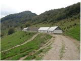 2
2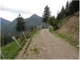 3
3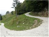 4
4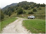 5
5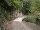 6
6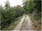 7
7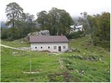 8
8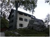 9
9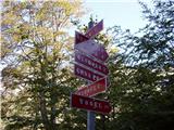 10
10 11
11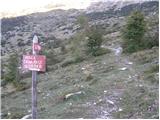 12
12 13
13 14
14 15
15 16
16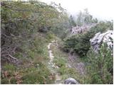 17
17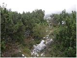 18
18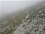 19
19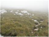 20
20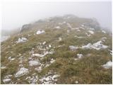 21
21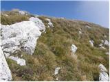 22
22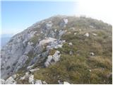 23
23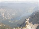 24
24 25
25
Discussion about the trip Planina Kuk - Vrh nad Škrbino (direct way)
|
| LISO2. 07. 2008 |
Nice trip! Congrats to the girls who on Saturday 28 June powered up the slope to the top. Real chamois.
|
|
|
|
| jax24. 06. 2012 |
The path has at the point where the crossing ends a somewhat awkward loose gully secured with a cable, and because of that it deserves in my opinion the rating of partially difficult. It's also marked with a triangle on the signpost.
|
|
|
|
| bosketi24. 08. 2012 |
Tomorrow I'm going on this path
|
|
|
|
| Enka13. 10. 2019 |
The trail is indeed marked as difficult on the mountain signpost, but I think partially difficult is more appropriate. When we emerge from the scrub and leave behind the section with steep grass, we enter a scree and higher partly rocky area not mentioned in the description. In this part the trail is mostly secured with some pegs, wooden steps holding back scree, and quite a few cables. The wire rope seems almost superfluous on ascent, but on descent one is quite glad it's there. Overall on descent you need to watch your step a bit, because scree is annoyingly slippery. But it's a nice, just right varied trail to the summit with magnificent views that invite ridge walking on both sides . .
|
|
|
|
| DVas20. 05. 2024 08:36:13 |
How is the road to the parking lot?
|
|
|
|
| miri20. 05. 2024 08:42:16 |
Asphalt, gravel. And requires a lot of caution.
|
|
|
|
| DVas20. 05. 2024 08:48:45 |
So it's not the best for a low car or does it go?
|
|
|
|
| miri20. 05. 2024 08:51:07 |
Peugeot 206, for example, drives fine.
|
|
|
|
| DVas20. 05. 2024 09:06:03 |
Super, then it should go, thanks
|
|
|
To post a comment you must log in:
If you do not yet have a username, you must first
register.