Planina Jezerca - Vrh Korena (via planina Koren)
Starting point: Planina Jezerca (1410 m)
| Latitude/Longitude: | 46,2855°N 14,5314°E |
| |
Route name: via planina Koren
Walking time: 2 h 30 min
Difficulty: easy marked way
Elevation gain: 589 m
Elevation difference along the route: 670 m
Map: Kamniške in Savinjske Alpe 1:50.000
Recommended equipment (summer):
Recommended equipment (winter): ice axe, crampons
Views: 32.864
 | 2 people like this post |
Access to starting point:
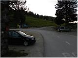
A) From the Ljubljana–Jesenice highway, take the Vodice exit, then continue driving to the first traffic-light intersection in Vodice, where turn left in the direction of Cerklje na Gorenjskem and Brnik. When we reach the main roundabout in Spodnji Brnik, continue driving in the direction of Cerklje and Krvavec ski area. At the end of the settlement Cerklje na Gorenjskem, leave the main road which continues towards Velesovo and Visoko, and continue driving slightly right onto the road in the direction of the Krvavec ski area. Further on, reach the village Grad, where signs for the settlement Ambrož pod Krvavcem direct us right onto a steep asphalt road (straight ahead: lower station of the circular cable car on Krvavec and Štefanja Gora). When the steepness on the steep road decreases a little, we arrive at an intersection, where we continue left in the direction of the settlement Ambrož pod Krvavcem (straight ahead: settlements Ravne, Apno and Šenturška Gora). A little further, the road temporarily descends a little, then ascends through occasionally quite panoramic slopes. Higher up, we reach Ambrož pod Krvavcem, where on the left side we bypass the church of St. Ambrož and tourist farm Pr Ambružarju. From the tourist farm onwards, the road passes into the forest and ascends through it all the way to the mountain pasture Jezerca, where there is a large arranged parking lot.
B) From the Jesenice–Ljubljana highway, take the Kranj-East exit, then continue driving towards Brnik, Komenda and Mengeš. When we reach the main roundabout in Spodnji Brnik, continue driving in the direction of Cerklje and Krvavec ski area. At the end of the settlement Cerklje na Gorenjskem, leave the main road which continues towards Velesovo and Visoko, and continue driving slightly right onto the road in the direction of the Krvavec ski area. Further on, reach the village Grad, where signs for the settlement Ambrož pod Krvavcem direct us right onto a steep asphalt road (straight ahead: lower station of the circular cable car on Krvavec and Štefanja Gora). When the steepness on the steep road decreases a little, we arrive at an intersection, where we continue left in the direction of the settlement Ambrož pod Krvavcem (straight ahead: settlements Ravne, Apno and Šenturška Gora). A little further, the road temporarily descends a little, then ascends through occasionally quite panoramic slopes. Higher up, we reach Ambrož pod Krvavcem, where on the left side we bypass the church of St. Ambrož and tourist farm Pr Ambružarju. From the tourist farm onwards, the road passes into the forest and ascends through it all the way to the mountain pasture Jezerca, where there is a large arranged parking lot.
Route description:
At the end of the parking lot, where the road turns to the left, and to the right branches off the road towards the nearby mountain pasture Jezerca, we will notice red hiking signposts which direct us straight onto a marked footpath in the direction of Kriška planina, Vrh Korena, Košutna, Kompotela and Mokrica, which ascends through pastures of the already mentioned mountain pasture. After a short ascent, we reach a cart track, which we follow to the left, crossing the slopes of Kržišče (1658 m). The cart track along which we walk soon splits into two parts, and we continue straight on the lower one. Temporarily, a nice view opens towards Kranj, Škofjeloško hribovje and Storžič, then the path begins to descend lightly. A few more minutes of walking follow, then we arrive at the parking lot by the lower part of Kriška planina.
From the parking lot, we continue in the direction of planina Koren and continue the path along a poorer macadam road, which goes through the underpass under the ski run. After the underpass, the marked path turns slightly left from the road, continuing parallel to the road alongside a sort of spruce avenue. When, after a few minutes of gentle ascent, we reach the eastern edge of Kriška planina, where there is a smaller watering place for animals, we continue slightly left across the pasture fence (right: planina Osredek and Kamniški vrh), but continue the gentle ascent in approximately the same direction. Ahead, the path from the planina leads onto somewhat steeper slopes of Krvavec, across which we ascend diagonally to a vantage point from which a nice view opens towards Kržišče (Pokovše), the ridge of Kamniški vrh, the Korošica valley, Velika planina, and the nearby Košutna and Veliki Zvoh.
From the vantage point, which is a few steps to the right off the path, we begin to descend more steeply towards the hunting cottage above the Korošica valley. When the descent stops and the path continues without major elevation changes, we arrive at a visible but poorly marked junction, where to the right branches the path to the aforementioned hunting cottage and further towards the Korošica valley and Kamniška Bistrica valley. At this junction, we continue slightly left and begin to ascend gently through the forest. The path quickly leaves the forest into bushes and dwarf pines, then across the pasture fence gradually leads us to the next unmarked junction, which is right in the middle of a sharp right-hand bend.
From this hairpin bend, an unmarked path continues straight towards the Razor saddle (saddle between Krvavec and Veliki Zvoh), but we continue right on the still-marked path. A short traverse ascent follows, and the path brings us to the southern part of planina Koren, from where a nice view opens over the central part of the planina and surrounding peaks. From the southern part of the planina, a short descent follows to the nearby shepherd hut, which is located in the central part of planina Koren.
Here our path continues slightly left (slightly right: planina Košutna) across meadows at the valley bottom (the path is initially poorly visible). The path then becomes steeper and after less than 30 minutes of walking brings us to a small pool, where there is a poorly marked junction. We continue straight (right: Košutna) and follow the gentle path to the next junction, where we turn left towards Vrh Korena (straight: Kompotela). Ahead, the path begins to ascend more steeply and quickly brings us across karst terrain to the point where we join the path from Veliki Zvoh to Vrh Korena (Jež ridge). We continue right, and the path brings us in a few steps to the point where the path to Vrh Korena branches right, which we reach after one more minute of walking.

Photos:
 1
1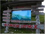 2
2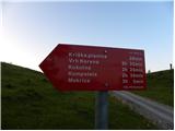 3
3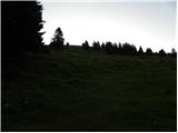 4
4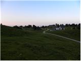 5
5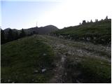 6
6 7
7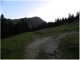 8
8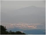 9
9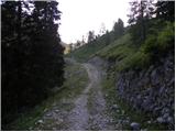 10
10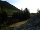 11
11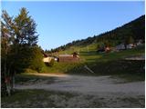 12
12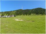 13
13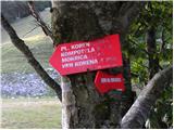 14
14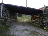 15
15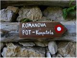 16
16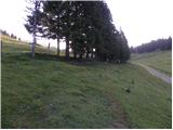 17
17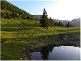 18
18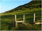 19
19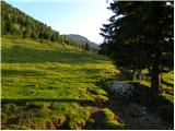 20
20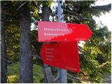 21
21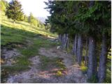 22
22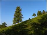 23
23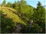 24
24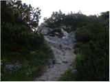 25
25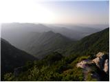 26
26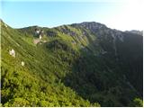 27
27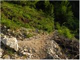 28
28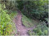 29
29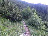 30
30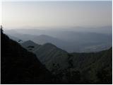 31
31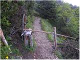 32
32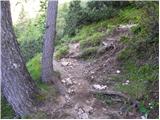 33
33 34
34 35
35 36
36 37
37 38
38 39
39 40
40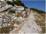 41
41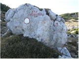 42
42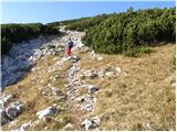 43
43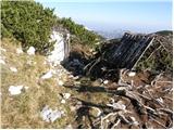 44
44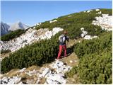 45
45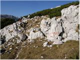 46
46 47
47 48
48 49
49 50
50
Discussion about the trip Planina Jezerca - Vrh Korena (via planina Koren)
|
| ljubitelj gora31. 12. 2019 |
The road is top-notch to the starting point among the best, parking 2 euros, but there are more cameras for safety. Excellent, that's how it should be done.
|
|
|
|
| Pekana17. 02. 2020 |
Hello, the moderator deleted my comment today about yesterday's ascent to Vrh Korena. Interestingly, I have no explanation for the comment deletion and believe it violated my copyrights. I ask the moderator to restore the comment, as it is significantly more interesting than most comments, which are anything but up-to-date. A bit of satire, non-offensive, original harms no one, but bothers mainly someone without a sense of humor. As the old saying goes, above 1000 meters there is no sin..and here we mostly go even higher. thanks
|
|
|
|
| Tadej17. 02. 2020 |
The deleted comment was completely inappropriate. It contained numerous profanities.
|
|
|
|
| turbo18. 02. 2020 |
Pekana,
your comment says everything about you and nothing about the conditions 
|
|
|
|
| Pekana18. 02. 2020 |
What's controversial here if I wrote that I had both heads above 2000 m given the height of the mountain? Among other things I also mentioned it was extremely icy and crampons are needed...I used swear words because swear words are part of our daily life and you're just closing your eyes and hiding the truth when denying the use of swear words. In the mountains from exceptional hikers I often hear the word kurba, tala is good up to the knees, tala ješprn is worth one dick, tela štrukle you can't even eat etc...
Well I didn't insult anyone, unlike turbo who compares the comment to me. What did he say about the conditions? Nothing, his comment says everything about him.
|
|
|
|
| Pekana1. 03. 2020 |
Ooooh Faloti, you're all pilots, what now? I'm lying miserably again! Yesterday with our Majdi-Marija around five past five from Košutna parking. We didn't pay 2 euros as it flows, she said those are two buckets! Tomorrow off to confession again. Of course it is, so we went. About 15 cm of snow on top. We flew up to Koča Koren, I told Majdi to wait, do you have Lucky Strikes, I asked, because you don't have two anyway. I said, I have two yes, but not Lucky Strikes  T-shirt, down jacket, gloves, hat, shorts, ready! Wind blowing at 100 meters, exactly that fast . Snowdrifts on the trail already over a meter deep, and with Puma sneakers, damn I told Majdi, if I drag it up it'll get wet. She said, that's how it is. We were the first to break trail up, terrible nowhere, black but like in the ass! Wind blew snow right into our faces so much that I had a beard like an apostle. The fool farts even moderately, because you can't hear, I still remember the words of a colleague who didn't understand where he went with his chick to the mountains, but then he boasts . T-shirt, down jacket, gloves, hat, shorts, ready! Wind blowing at 100 meters, exactly that fast . Snowdrifts on the trail already over a meter deep, and with Puma sneakers, damn I told Majdi, if I drag it up it'll get wet. She said, that's how it is. We were the first to break trail up, terrible nowhere, black but like in the ass! Wind blew snow right into our faces so much that I had a beard like an apostle. The fool farts even moderately, because you can't hear, I still remember the words of a colleague who didn't understand where he went with his chick to the mountains, but then he boasts .
Well, a bit more as we were walking, so that the admin doesn't DELETE the comment again and make a mistake with it! I want him to make mistakes because of me and I really don't forgive him for that.
From Koča Koren we decided to go to Košutna which we hadn't been to. There we messed up the trail and suddenly in the fog I told Majdi, now we're going to Kumputel. Now the trail wasn't visible at all, but I still recognized some rock. Of course we went straight through the bushes, where no one had been yet. Wow, enough snow everywhere. Only a polar bear was missing! Around minus 8! Majdi said, "where are we going?", right, I'm not going further! Then we argued... I said just 5 more minutes and we'll go down, stopped again, she said I've had enough, I said just be patient a bit, I see the summit... and really the footprints were deep and as we went up near the moon I saw the summit ahead. I said, "here Majdi that's it, here's Vrh Korena." She said, "I can't see it, you're fooling me again, you're really getting on my nerves." Wind blowing so hard that the hat would fly off upwards . Well and really a couple of meters before the summit I let her go, bowed to Majdi and like some English gentleman let her reach the top first. I said to myself, that's a real one! Then of course, no selfies no go. She said, gloves off so we take a picture next to that railway box where one looks like a midget in the distance, because it's empty! It was around 20. She got really horny there, because I'm holding this Samsung in my hands, big but like a fool with a pole in hands... Now down we flew as fast as the snow allowed to the hut for a drink. Down we went so fast we followed our footprints. But what, the wind messed everything up and on critical parts they weren't visible anymore. No, I switched on instinct, Majdi navigation. In about an hour we were at the hut, seems we drank moderately. In the hut schnapps 2 bottles, and we started teasing him, that's why it's there! On the way I counted them. Majdi had fruit gums in her pocket, reminiscent of a backpack. We ate 7 of them almost 6. Enough sugar, one sip of schnapps in the ass and gas down to the car. We chatted the whole way... you know, debates this that... she said a guy got horny at one party came up to her and said, tonight we're going to fuck, but mixed up the wrong one. She said to him we're mixing up the wrong one, he said everyone is. Today's 26-year-olds are something else.
This evening around ten we were back at the car, luckily didn't get reported to the police. The limit will be nice again, already 3x this month I was on Vrh Korena, I told Majdi I already have enough of it. Madonna even I don't think I'll ever reach the top again. She said let's not tattoo it on the arm. Yeah no it'll be like that, but I'll tell everyone this. The mountain isn't crazy, crazy is the one who goes up!
|
|
|
|
| jprim2. 03. 2020 |
Wow, what an interesting story. Maybe someone is bored again.
Best regards!
|
|
|
|
| Rokovnjacica4. 03. 2020 |
Pekana, you know I laughed heartily while reading and you really brightened my day!
Enjoy with "our" one and write more! Best regards
|
|
|
|
| margu504. 03. 2020 |
Well, when it dries up, I'll go see where this Koren is
|
|
|
|
| Reaktivc9. 05. 2020 |
Has the snow already melted? What's the situation like over the Jež-a ridge (snow/ice)? I'm planning a circular tour tomorrow (Jezerca, Vrh Korena, Zvoh and back).
|
|
|
|
| bistri1. 06. 2025 22:37:15 |
Has anyone been to Vrh Korena recently? I'm interested in the section with the rope, ditch.. Anyone know if there's still any snow by chance?
|
|
|
|
| anica.zu2. 07. 2025 19:24:44 |
What rope are you talking about? None anywhere, and very nice and easy walking, for everyone.
|
|
|
|
| anica.zu2. 07. 2025 19:26:19 |
And about the rope: YOU DON'T NEED TO GO THROUGH ZVOH AND JEŽA!
|
|
|
|
| tango6. 11. 2025 21:15:15 |
Beautiful day for a circular tour. Path without features, a bit frozen in some shady spots, but nowhere problematic. From Koren back to Zvoh via Ježa, along the "spring" path to Rozka and back to Jezerca. It added up to 12 km and just under 700 m elevation gain, all in the sun and with wonderful views
|
|
|
|
| plaNinaPirsMajcen7. 12. 2025 21:32:35 |
Hi, yesterday's mystical winter idyll on the trail from Planina Koren towards Vrh Korena,
https://youtu.be/O43wFFyh8gM?si=B-eAh4L-MVguMvaK
which unfortunately did not allow a safe ascent in the last 15 minutes to the summit. The snow was crusty, we sank in up to our knees and beyond, we couldn't see exactly where the trail goes. Very little trodden, nothing towards the summit. Not even tracks to Kompotelo further on or Košutno.
But it was nice at Planina Koren, the buffet full, the trail to there is safe 🙂
Best, Nina
|
|
|
To post a comment you must log in:
If you do not yet have a username, you must first
register.