Starting point: Planina Dol (1308 m)
| Latitude/Longitude: | 46,3178°N 14,6379°E |
| |
Walking time: 1 h 30 min
Difficulty: easy marked way
Elevation gain: 495 m
Elevation difference along the route: 495 m
Map: Kamniške in Savinjske Alpe 1:50.000
Recommended equipment (summer):
Recommended equipment (winter): ice axe, crampons
Views: 101.494
 | 7 people like this post |
Access to starting point:
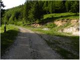
First, we drive to Kamnik, and then continue driving in the direction of the Črnivec pass. Just a few hundred meters before the mentioned pass, we notice signs for Kranjski Rak, which direct us sharply left onto a narrow and initially quite steep road. The road flattens higher up and then brings us to the Volovjek pass, where immediately behind the Kranjski Rak inn we turn left onto the road toward Velika planina. Further on, we drive along a macadam road, which higher up brings us to the next somewhat larger crossroads. We continue right (straight to Planina Kisovec) and follow the moderately ascending road past the Ušivec parking lot. From the mentioned parking lot, we continue on a somewhat poorer macadam road, which we follow at the crossroads in the direction of Planina Dol. After some time, the road starts to descend steeply, and we follow it to the marked parking lot near Planina Dol.
From the Savinjska Valley, we first drive to Luče, and then continue driving toward Kamnik. When we arrive at the Volovjek pass (Kranjski Rak), we continue right in the direction of Velika planina. Further, we follow the above description.
Route description:
From the parking lot, we continue on the macadam road, which barely noticeably descends toward the western part of the mountain pasture. After a few minutes of easy walking, we will notice a shepherd hut on the left side, but we continue on the macadam road for another 10 meters or so, to the spot where on a tree we notice signs for Konj, which direct us right across the meadow (left Velika planina, straight valley Kamniška Bistrica - bottom cableway station to Velika planina). The path ahead moderately ascends across the meadow, then transitions into the forest, where it turns right and gradually starts to ascend more and more steeply. Approximately 20 minutes of steep ascent through the forest follow, then the path brings us to a smaller viewpoint. Here the path turns left and also flattens somewhat. We continue on a moderately steep path, where from increasingly sparse forest we soon pass into the belt of dwarf pines. A short ascent follows on a well-trodden path through the dwarf pines, and the path brings us to Planina Rzenik, on the edge of which we notice a shepherd hut.
From the hut, we continue on the marked path toward Konj (slightly left Rzenik via the western path, the path to Rzenik is not marked), which quickly brings us among the dwarf pines. We continue the ascent on a moderately steep path, which continues to lead us through the dwarf pines. Higher up, the path brings us right beside the main ridge, where the path turns right and continues ascending through the dwarf pines. Only a few more steps remain, and the increasingly scenic path quickly brings us to the summit of Konj.
The logbook box is located somewhat lower, specifically in the direction toward Presedljaj. A short steep descent on a secured climbing path separates us from it.
Planina Dol - Planina Rzenik 1:00, Planina Rzenik - Konj 30 minutes.

Photos:
 1
1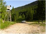 2
2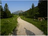 3
3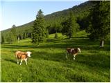 4
4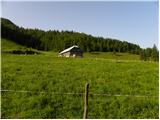 5
5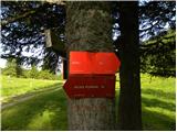 6
6 7
7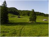 8
8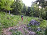 9
9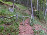 10
10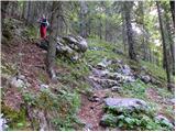 11
11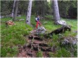 12
12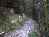 13
13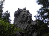 14
14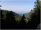 15
15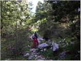 16
16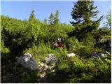 17
17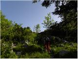 18
18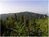 19
19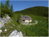 20
20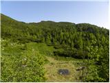 21
21 22
22 23
23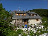 24
24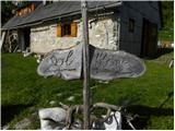 25
25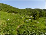 26
26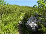 27
27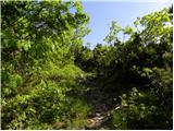 28
28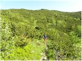 29
29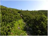 30
30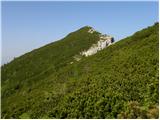 31
31 32
32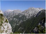 33
33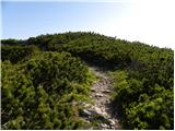 34
34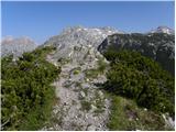 35
35 36
36
Discussion about the trip Planina Dol - Konj
|
| podgana12. 09. 2008 |
Nice half-day easy excursion. From the summit there is a nice view of Ojstrica, Planjava and Brana.
|
|
|
|
| tom66623. 07. 2011 |
Nice recreational tour.
p.s. The summit register box and stamp are right at the top (and not a bit lower in the direction towards Presedljaj!).
|
|
|
|
| iztok30. 07. 2011 |
Well, at least we are on the horse, if everything else is in ...
|
|
|
|
| bostjan8512. 10. 2011 |
I'm interested in what condition the road to Planina Dol is in?
|
|
|
|
| iztok13. 10. 2011 |
What can I say, fine and not disturbing forest road
|
|
|
|
| pohodnik383. 05. 2012 |
Nice easy path, dry and without peculiarities.
Short video impressions from the path.
|
|
|
|
| Lisica1. 12. 2012 |
The views from this peak are in good weather 'to die for'. 
|
|
|
|
| Fulcrum5. 10. 2013 |
Ahead of a bad weather forecast, I quickly "popped up" to Konj today. The summit is not badly visited at all, as one might first think. In the last week, there were 10 people up there, including from Spain, Portugal, and Lithuania.
|
|
|
|
| borutpovse10. 12. 2013 |
On Saturday my son (6 years) and I completed this tour. Since you can't drive far enough by car at the moment, it took us 1 hour and 20 minutes to Planina Dol. For the ascent from the pasture to the summit, 1 hour and 45 minutes. We were the only ones in the last few days, the weather was phenomenal. Clear, no wind, which is almost a rarity. View ... The path to the summit is not that demanding, there is a bit more snow in some places and you sink in up to your butt quickly. The snow is slightly frozen, the crust doesn't hold an adult person. The path is quite well trodden, although there aren't many visitors. Towards the summit there are even dry sections. Regards The path to the summit is not that demanding, there is a bit more snow in some places and you sink in up to your butt quickly. The snow is slightly frozen, the crust doesn't hold an adult person. The path is quite well trodden, although there aren't many visitors. Towards the summit there are even dry sections. Regards

|
|
|
|
| balon24. 05. 2014 |
Is it possible to reach the starting point with an MPV (Ford S-Max)?
Best regards,
Balončki
|
|
|
|
| otiv24. 05. 2014 |
In the past there were no problems, as there is a normal gravel road to Planina Dol.
Best regards!
|
|
|
|
| borutpovse24. 05. 2014 |
The road is still in good condition, in winter they also drove through the snow with off-road vehicles.
|
|
|
|
| balon24. 05. 2014 |
Thanks and best regards.
|
|
|
|
| seinfeld17. 08. 2014 |
The road is in good condition, takes 20min on gravel. The path is very nice, views from the viewpoint onwards phenomenal. I don't know if I've ever been to a summit with such views in all directions. We were from 8 to 66 years old, no problems. For up and down with many stops we needed three hours and a quarter. Highly recommend!! We met quite a few hikers, but only a handful of us, compared to hundreds of cars parked along the road below Velika Planina, which must have been an anthill of people today.
|
|
|
|
| blazhk26. 10. 2014 |
Yesterday my girlfriend and I went up. The path is easy, but after about 15 minutes it becomes increasingly snowy. At the top we were greeted with up to 20cm of snow, which doesn't affect safety. Suitable destination for a half-day trip even in lightly snowy conditions without the need for crampons and ice axe. On the macadam path we encountered some sawn trees, which can prevent passage for larger vehicles.
|
|
|
|
| fonko9. 06. 2015 |
Quite a steep path at the beginning. From Planina Rzenik onwards, the path runs only over scree. Since the day was hot, I almost cooked myself. All the effort was rewarded by the views from the top. The descent was quite unpleasant due to the heat and steepness.
|
|
|
|
| AndrejRibic13. 09. 2015 |
The path is steep at the beginning, but nicely laid out. Along the path at the Mlakarjeva bajta mountain hut, very friendly gentleman and lady. Tried their "rzeniški smrekovec". Very good. Rewarded with views of Cojzovo kočo and Kamniško sedlo, all KSA beautiful in one word. New is that on descent you can save up to 15 minutes if you pay attention to the kožica in the middle of the path, which directs left. On this path you will meet Berkmandlca, who is drying laundry. Voditelj careful, it is by the root. Nice mountain greeting.
|
|
|
|
| AndrejRibic13. 09. 2015 |
Voditelj means be careful
Kožica means cairn
This translator translates as it pleases.
|
|
|
|
| claire2. 08. 2018 |
Nicely marked path. Most of the path is in shade. Gaiters and poles are mandatory - it is quite slippery on the rocks. At the top, wonderful views.
|
|
|
|
| mornar6. 05. 2020 |
Please for information on road access to Planina Dol, and how traceable is the path further to Konj. Thanks and best regards.
|
|
|
|
| smatjaz7. 05. 2020 |
I don't know what the road to Pl. Dol is like because I've never been up there by car in my life. The path from Pl. Dol to Konj is nicely traceable and without peculiarities. When going to Konj, a bit before the summit there's also a left branch to Rzenik which you definitely shouldn't miss, this path isn't marked but nicely traceable (cca 20 min) to the top and newly renovated last year. When at Rzenik, find the chapel sign south of the summit and descend to it, it's worth seeing.....to it is 5 minutes. best Matjaž
|
|
|
|
| mornar7. 05. 2020 |
Matjaž, biggest thanks for the info. Would ask you from where you start if you go to this mountain. Lp.
|
|
|
|
| Climber917. 05. 2020 |
To me personally very nice through Dolski graben. You park at the gondola for Velko and it's marked to Planina Dol.
|
|
|
|
| smatjaz8. 05. 2020 |
Mornar there are more paths, one is through Dolški graben as Climber mentions, then you also have from Pred Bele past Orglic to Preselaj and Konj, that one is very demanding climbing, partly secured too, by far the nicest is from Kopišč along the hunting path Martinj stezi to Pl. Dol and Konj, or along the Vrvanja ridge directly to Pl. Rzenik, which is completely pathless, for which you need quite a lot of knowledge. If you're not very skilled I suggest via Dolski graben..... http://www.hribi.net/izlet/kraljev_hrib_konj_/3/289/2584
|
|
|
|
| malihodec8. 01. 2021 |
What are the current snow conditions on the Planina Dol - Konj tour? Thanks for the reply and help...
|
|
|
|
| G3425. 12. 2022 15:15:40 |
Is there any snow on Konj? During the holidays we want to go on this tour with mom, who when she was young hiked a lot in the mountains but now it's the first time with us.
|
|
|
|
| G3425. 12. 2022 15:17:14 |
And is the hut on Planina Rzenik open?
|
|
|
|
| ejti25. 12. 2022 20:19:14 |
The hut on Pl. Rzenik is private. It has never functioned as an alpine hut.
Snow at altitudes of over 1800 m is certainly there, even if the thaw is taking it.
|
|
|
|
| lijaneja28. 12. 2022 12:29:33 |
Mom just take the pelte up, to awaken nice memories!
|
|
|
|
| G3426. 01. 2023 19:03:36 |
Then we drove up without mom. She'll go with us another time. Even we didn't reach the starting point because there was too much snow.  But then we went to some lake and skated on it because it was frozen. But then we went to some lake and skated on it because it was frozen.
|
|
|
To post a comment you must log in:
If you do not yet have a username, you must first
register.