Planina Dol - Gradišče (Velika planina)
Starting point: Planina Dol (1308 m)
| Latitude/Longitude: | 46,3178°N 14,6379°E |
| |
Walking time: 1 h
Difficulty: easy marked way
Elevation gain: 358 m
Elevation difference along the route: 358 m
Map: Kamniške in Savinjske Alpe 1:50.000
Recommended equipment (summer):
Recommended equipment (winter): ice axe, crampons
Views: 121.398
 | 1 person like this post |
Access to starting point:
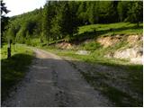
First, we drive to Kamnik, then continue driving in the direction of the Črnivec pass. Just a few hundred meters before the mentioned pass, we notice signs for Kranjski Rak, which direct us sharply left onto a narrow and initially also quite steep road. The road levels out higher up and then brings us to the Volovjek pass, where immediately behind the Kranjski Rak inn we turn left onto the road in the direction of Velika planina. Further on, we drive along a macadam road, which higher up brings us to the next somewhat larger crossroads. We continue right (straight Planina Kisovec) and follow the moderately ascending road past the Ušivec parking lot. From the mentioned parking lot we continue on a somewhat poorer macadam road, which we follow at the crossroads in the direction of Planina Dol. After some time, the road starts to descend steeply, and we follow it to the marked parking lot near Planina Dol.
From the Savinjska valley we first drive to Luče, then continue driving towards Kamnik. When we arrive at the Volovjek pass (Kranjski Rak) we continue right in the direction of Velika planina. Further, we follow the above description.
Route description:
From the parking lot, we continue on the macadam road, which barely noticeably descends towards the western part of the mountain pasture. After a few minutes of easy walking, we will notice a shepherd's hut on the left side, but we continue on the macadam road for another 10 meters or so, to the spot where on a tree we notice signs for Konj and Velika planina. Here we continue left (right Konj) and after a short gentle ascent we arrive at the shepherd huts on Planina Dol.
From the shepherd huts on the mountain pasture, we ascend past a cross to the edge of the forest, then continue the ascent on the path ascending through the forest. Higher up, the forest becomes thinner and the path, after approximately 30 minutes of ascent from Planina Dol, brings us to Planina Konjščica, from which a view opens towards the nearby Rzenik.
We continue the ascent on a gentle, partly grassy path which barely noticeably ascends towards the south. The increasingly panoramic path, from which views open up on the central Grintovce, soon brings us to a forest road, where we arrive at a well-marked junction. We continue right in the direction of the inn Zeleni Rob (left chapel of Marije snežne, Domžalski dom, Črnuški dom...) along the road, which after 50 m of further walking brings us to the next junction. This time we continue on the cart track in the direction of "Rože vrhov", which steeply ascends past numerous shepherd-holiday cottages. The path soon levels out and brings us to a grassy clearing, from which we already nicely see the highest peak of Velika planina, which we reach after one minute of further walking.
In fog, orientation from Planina Konjščica to the summit is very difficult.

Photos:
 1
1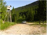 2
2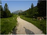 3
3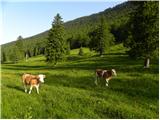 4
4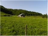 5
5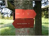 6
6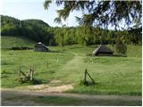 7
7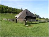 8
8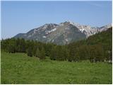 9
9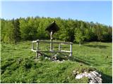 10
10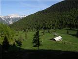 11
11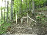 12
12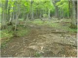 13
13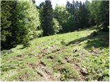 14
14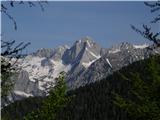 15
15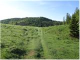 16
16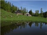 17
17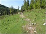 18
18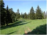 19
19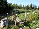 20
20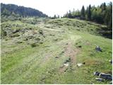 21
21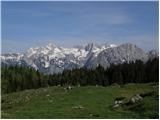 22
22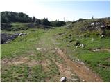 23
23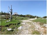 24
24 25
25 26
26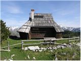 27
27 28
28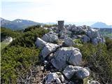 29
29
Discussion about the trip Planina Dol - Gradišče (Velika planina)
|
| balon23. 05. 2014 |
Is there a stamp at the top?
|
|
|
|
| pohodnik3823. 05. 2014 |
At Gradišče the stamp is near the direction sign (picture 29) and also a box with the logbook.
|
|
|
|
| balon23. 05. 2014 |
Thank you for the response.
Balončki 
|
|
|
|
| borutpovse28. 05. 2014 |
They haven't changed the stamp yet, so it won't help you at all. Last autumn it was in such bad condition that nothing could be read at all.
LP
|
|
|
|
| AndrejaL917. 07. 2016 |
Hi!
I'm interested if anyone has recently gone by car to the starting point and how accessible the path is with a personal vehicle. Thanks!
|
|
|
|
| margu507. 07. 2016 |
14 days ago I went on foot to Planina Dol. Since the road was closed due to repairs and I didn't know how far Planina Dol is (2h), I would certainly have decided for Velika planina already there. I don't know how much of the road they repaired, but it wasn't that bad at all, except the last part that descends towards Planina Dol was quite washed out by water, but it wouldn't represent a big obstacle for driving, just go slowly. So go boldly 
|
|
|
|
| tejam28. 04. 2018 |
The road to Planina Dol is not yet passable or there is still a huge amount of snow on it.
|
|
|
To post a comment you must log in:
If you do not yet have a username, you must first
register.