Planina Blato - Planina Blato (circular path on Fužinske planine)
Starting point: Planina Blato (1147 m)
| Latitude/Longitude: | 46,3112°N 13,8501°E |
| |
Route name: circular path on Fužinske planine
Walking time: 6 h 35 min
Difficulty: easy marked way, easy unmarked way
Elevation gain: 0 m
Elevation difference along the route: 875 m
Map: Triglav 1:25.000
Recommended equipment (summer):
Recommended equipment (winter): ice axe, crampons
Views: 34.521
 | 2 people like this post |
Access to starting point:
From the Ljubljana-Jesenice motorway, take the Lesce exit and follow the road towards Bled and further towards Bohinjska Bistrica. Continue driving towards Lake Bohinj (Ribčev laz), where you reach a junction and continue right towards Stara Fužina. In Stara Fužina, at the junction by the chapel, turn sharply left onto the ascending road towards Planina Blato, Planina Vogar and Voje valley. The road then takes you to the toll and parking fee point, but follow it further to the next junction, where you continue left (right to Voje). Follow the road to the next junction (after quite some driving), where you turn sharply right towards Planina Blato (straight to Planina Vogar). Follow this road to the parking lot above Planina Blato.
Route description:
From the marked parking lot at Planina Blato, return a few dozen steps back, then head onto the wide and initially quite steep cart track towards Planina pri Jezeru. After ten minutes of fairly steep ascent, reach a marked junction, continuing on the left steep cart track (straight Planina v Lazu), to which a marked path from Planina Vogar joins a little higher up. Continue on the wide, partly stony cart track which temporarily levels higher up, then steeply ascends through a small cut. Further the path levels again and then crosses steep slopes (danger of slipping in snow and ice). A little further the path turns sharply left leading into the cold valley named Pungrat, where you cross the renovated pasture fence. The path ahead ascends more steeply again, then turns right and levels completely. Just a few meters further, a path from Planina Vodični vrh joins from the left, we continue straight and after five minutes of further walking arrive at Planina pri Jezeru, in the middle of which stands the mountain hut.
From the mountain hut descend to the marked junction, where signs for Planina Viševnik direct left onto an initially less visible trail. The path ascends transversely ahead, then enters the forest through which it climbs all the way to Planina Viševnik.
At Planina Viševnik continue right towards Planina Ovčarije and Koča pri Triglavskih jezerih on the path which begins to ascend more steeply on the relatively steep slopes of Griva (1757 m). The path soon levels, then continues with some shorter ascents and descents all the way to Planina Ovčarije. From the shepherd huts continue a little further, then the path leads to a marked junction, continuing right towards Planina Dedno polje.
The path ahead first ascends steeply for a short time, then begins to descend gradually towards Planina Dedno polje, which you reach after more than 30 minutes of further walking.
From Planina Dedno polje continue towards Planina v Lazu on an initially harder-to-follow and barely visible trail. Approximately five minutes away from the pasture the trail becomes more distinct and easier to follow. Follows a short ascent to an indistinct pass between Kredo and Mizčna glava, then the path begins to descend towards the path leading from Planina pri Jezeru to Planina v Lazu. When you see the mentioned path already a few dozen meters below, our path turns left and temporarily ascends slightly. Follows crossing of steep and slightly exposed slopes, then the path finally descends to the aforementioned trail. Follow the trail left and climb up to Planina v Lazu in ten minutes of gentle ascent.
When stepping onto the pasture, bypass several shepherd huts, we continue on the moderately ascending path towards Planina Krstenica. After a short ascent reach the next junction, where signs for Krstenica direct slightly left onto the path which levels completely and then continues with some shorter ascents and descents along the foot of Ogradov. Later the path begins to descend more noticeably and leads into an indistinct valley east of Ogradov. Follows a few minutes of walking through dense forest, then gradually begin ascending towards Planina Krstenica. The forest ahead becomes sparser, the path leads to Planina Krstenica after 15 minutes of further walking, from which a nice view opens.
At the pasture leave the sparse markings already from Dedno polje onwards and begin descending on an unmarked cart track towards Planina Blato. When the cart track levels on a larger meadow, you will notice a well-trodden hunter's path on the right side, which first ascends gently, then enters dense forest, where it first descends gently, lower more steeply. When the path has been descending for some time, it leads to a wide cart track, down which you descend to Planina Blato in a few minutes.
From the pasture only a short five-minute moderate ascent on the macadam road separates us from our goal (starting point).
Starting point - Planina pri jezeru 1:00, Planina pri Jezeru - Planina Viševnik 0:30, Planina Viševnik - Planina Ovčarija 0:50, Planina Ovčarija - Planina Dedno Polje 0:40, Planina Dedno polje - Planina v Lazu 1:00, Planina v Lazu - odcep za Ograde 0:20, odcep za Ograde - Planina Krstenica 1:20, Planina Krstenica - Lovska koča 0:10, Lovska koča - Planina Blato 0:40, Planina Blato - Starting point 0:05.

Photos:
 1
1 2
2 3
3 4
4 5
5 6
6 7
7 8
8 9
9 10
10 11
11 12
12 13
13 14
14 15
15 16
16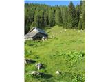 17
17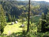 18
18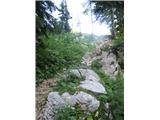 19
19 20
20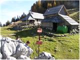 21
21 22
22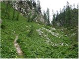 23
23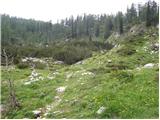 24
24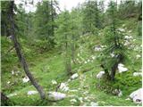 25
25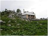 26
26 27
27 28
28 29
29 30
30 31
31 32
32 33
33 34
34 35
35 36
36 37
37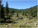 38
38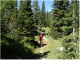 39
39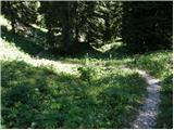 40
40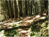 41
41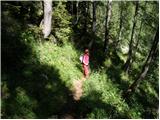 42
42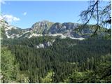 43
43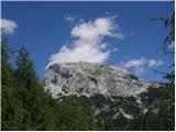 44
44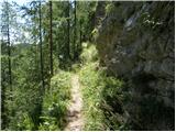 45
45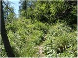 46
46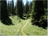 47
47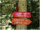 48
48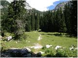 49
49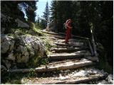 50
50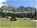 51
51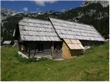 52
52 53
53 54
54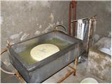 55
55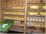 56
56 57
57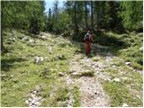 58
58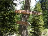 59
59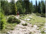 60
60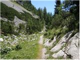 61
61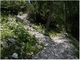 62
62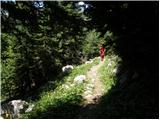 63
63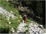 64
64 65
65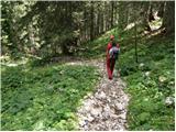 66
66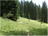 67
67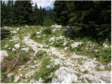 68
68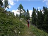 69
69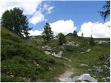 70
70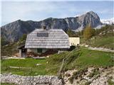 71
71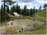 72
72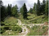 73
73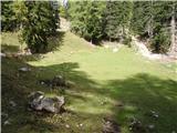 74
74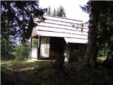 75
75 76
76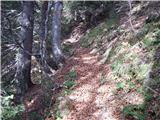 77
77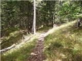 78
78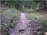 79
79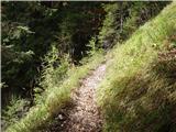 80
80 81
81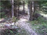 82
82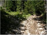 83
83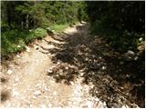 84
84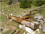 85
85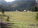 86
86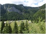 87
87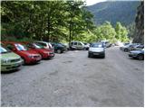 88
88
Discussion about the trip Planina Blato - Planina Blato (circular path on Fužinske planine)
|
| felix4. 08. 2010 |
For those for whom 7 hours is too much, they can skip planina Viševnik and Ovčarija, thus shortening the trip to about 5 hours. Personally I prefer the reverse direction, from Blato to Krstenica.
cheers
|
|
|
|
| Urshka15. 08. 2010 |
Hi, I'm interested if it's possible to overnight somewhere on the trail (except hotel "nature")? Best regards, Urška
|
|
|
|
| viharnik16. 08. 2010 |
At Pl. pri Jezeru, Pl. Viševnik.
|
|
|
|
| heinz28. 01. 2011 |
Is the road to Planina Blato passable? Do they charge toll down there?
|
|
|
|
| Tadej28. 01. 2011 |
With chains you can get to Suha waterfall, they don't charge toll.
|
|
|
|
| stasa_t27. 07. 2011 |
Hi, wondering if you can drive to Planina Blato with your own car - I've heard that supposedly a van drives hikers to the mountain pasture?
|
|
|
|
| MatejaT6. 07. 2018 |
I'm wondering if this is the trail that was chosen as the Best Hiking Trail this year? Probably some other alpine pasture is also included there?
Thanks for the reply!
|
|
|
|
| pojoča travica6. 07. 2018 |
No, this is not the Best Hiking Trail, but this one is also very nice.
|
|
|
|
| alexandra2. 08. 2019 |
Hello, I'm interested in drinking water (springs, fountains) on the Fužinske planine - I know that a few years ago I drank excellent water at Planina v Lazu, is it still the case? What about the other planinas, Krstenica, Dedno polje..?
Since we'll be wandering around the Seven Lakes in the coming days, I'd also like to ask here about the cleanliness / drinkability of them?
Thank you very much for the answers.
|
|
|
|
| georgia2. 08. 2019 |
I can only tell you that at the koča at Triglav Lakes outside there is still a tap with good drinking water. Free! 
Similarly near Koča na Planini pri Jezeru, although there is a warning about drinkability - at both places we recently filled our bottles with good water.
A few years ago there was also a good spring of drinking water somewhere in the middle of the path from Koča pod Bogatinom to Koča pri Triglavskih jezerih. How is it now?
I'm not sure about planina Dedno polje, it seems to me there is a trough with drinking water along the path?
I hope others will write you more...
|
|
|
|
| marjetap2. 08. 2019 |
At planina v Lazu there is very good and very cold water flowing, at Krstenica it's also possible to get water, but at planina pri Jezeru last week there was no water because they were repairing something (and otherwise that water wasn't good for me). At Dedno polje there is a trough with water for livestock, but I didn't see anyone filling water.
|
|
|
|
| franca2. 08. 2019 |
at Dedno polje you can get water in the cheese dairy
|
|
|
|
| alexandra2. 08. 2019 |
Thanks to everyone for the answers.
|
|
|
|
| winni20. 06. 2021 20:10:17 |
The path (mule track) between planina v Lazu and planina na Dednem polju is still quite substantially under snow, and I also don't understand who marked it, because all markings are on stones under the snow, none on trees. Very easy to get lost!
|
|
|
To post a comment you must log in:
If you do not yet have a username, you must first
register.