Planina Blato - Koča na Doliču (Za Kopico)
Starting point: Planina Blato (1147 m)
| Latitude/Longitude: | 46,3112°N 13,8501°E |
| |
Route name: Za Kopico
Walking time: 5 h 30 min
Difficulty: easy marked way
Elevation gain: 1004 m
Elevation difference along the route: 1350 m
Map: Triglav 1:25.000
Recommended equipment (summer): helmet
Recommended equipment (winter): helmet, ice axe, crampons
Views: 22.764
 | 3 people like this post |
Access to starting point:
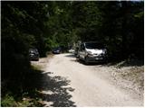
From the Ljubljana-Jesenice motorway, take the Lesce exit and follow the road towards Bled and further towards Bohinjska Bistrica. Continue driving towards Lake Bohinj (Ribčev laz), where you reach a junction and continue right towards Stara Fužina. In Stara Fužina, at the junction by the chapel, turn sharply left onto the ascending road towards Planina Blato, Planina Vogar and Voje valley. The road then takes you to a place where toll and parking fees are collected; follow it further to the next junction, turning left (right to Voje). Then follow the road to the next junction (after quite some driving), where you turn sharply right towards Planina Blato (straight to Planina Vogar). Follow this road to the parking lot above Planina Blato.
Route description:
From the marked parking lot in front of Planina Blato, return a little back and head to the wide and initially steep cart track, alongside which are signs for Planina pri Jezeru. After about ten minutes of ascent, arrive at a marked junction, from which continue left towards Planina pri Jezeru (slightly right Planina v Lazu and also the steep path towards Planina pri Jezeru).
Continuing on the less steep cart track that still leads through the forest, a marked path joins from the left shortly ahead, leading past Kosijev dom on Vogar, but we continue right and keep walking on the cart track. Higher up, the path leads through a narrow passage, then crosses quite steep slopes where there is a great risk of slipping in ice and snow, otherwise the path is not demanding. At the end of the steep slope, the aforementioned steep path joins inconspicuously from the right, the cart track turns left here and passes into the fairly cool Pungrat valley, where we ascend through mostly spruce forest. When the path levels out higher up, a path joins from the left leading past Planina Vodični vrh, but we keep slightly right and continue walking on the cart track, alongside which the forest begins to thin. A few minutes of easy walking follow and we step onto the pastures of Planina pri Jezeru, where on a small hill stands Koča na Planini pri Jezeru.
At the hut, a path branches right towards Planina v Lazu, but we continue left from the hut and descend to a marked junction where there are also a few shepherds' huts.
Choose the wider right path alongside which are signs for Planina Dedno polje and Koča pri Triglavskih jezerih (slightly left Pršivec, Planina Viševnik and Črno jezero).
Continuing ascent on the cart track, which is quite rocky on steep sections, after about ten minutes of ascent arrive at a place where a path branches left over Krištofojca towards Planina Viševnik, but we continue straight on the gradually less steep cart track that leads through gradually sparser forest. A few minutes of easy walking follow on the path that later turns slightly right, when the path turns back west we reach the edge of Planina Dedno polje, from which a walk to the central part of the pasture follows, where next to the shepherds' huts there is also a marked junction.
Here we leave the wide path leading straight towards Koča pri Triglavskih jezerih and nearby Planina Ovčarija and continue right on the path towards Zasavska koča na Prehodavcih, pass Vratca and saddle Hribarice. The path ahead leads past a few huts on the pasture, after which a path branches right towards Planina v Lazu, Planina Krstenica and Vodnikov dom na Velem polju, but we continue straight to the northwest part of the pasture, where the path begins to ascend. Here the path first leads past a dry watering place for animals, then the path becomes steeper and ascends through mostly coniferous forest of spruces and larches. After about thirty minutes of steep ascent, the path levels out and takes us to a kind of saddle between Kovačičeva glava on the left and Kredo on the right.
A little ahead of the saddle, for which we can trace the name Stog, an unmarked path branches right towards Slatna, and we get the first beautiful views of the mountains rising above the Za Kopico valley. A traverse ascent follows above the abandoned Planina Ščavje, the path gradually passes from the slopes of Slatna to the slopes of Prvi Vogal, and higher up the view increasingly catches the interesting rocky peak of Kopica rising on the left, western side of the Za Kopico valley.
Higher up we gradually arrive in the central part of the valley, where from the slopes we enter a series of several smaller valleys, through which we mostly ascend moderately, only occasionally a shorter steeper section follows. With beautiful views we continue upwards through the wonderful landscape, the valley narrows higher up and at an altitude of 2192 meters we reach the pass Vratca, which separates the Za Kopico valley from the Dolina Triglavskih jezer.
From the pass, located between Velika Zelnarica on the left and Zadnji Vogal on the right, from the marked junction continue straight towards Prehodavci, Hribarice and Dolič (sharply left Mala Zelnarica, Mala Tičarica, Štapce, Planina Ovčarija and Koča pri Triglavskih jezerih) and begin to descend transversely across the screes of Zadnji Vogal. The path ahead levels out briefly and leads for a short time through flatter terrain, then arrive at the slopes of Vršaki, where the slope gradually becomes steeper, on a shorter section also somewhat slippery, when the slopes become less steep we reach a marked junction below Hribarice.
Continue right towards Triglav, Dolič, Kanjavec and Hribarice (left down Dolina Triglavskih jezer, Zasavska koča na Prehodavcih, Trenta, Zadnjica and Špičja ridge) and begin ascending towards the Hribarice plateau. At the beginning of the Hribarice plateau, the first path branches left towards Kanjavec, a bit higher at the saddle Hribarice the second one.
From both junctions continue straight and follow the signs for Koča na Doliču, after the saddle Hribarice begin descending across screes between Kanjavec on the left and Mišeljski konec on the right. Lower down leave the area of vast screes and in a few minutes of further walking arrive at the saddle Dolič, where there is a marked junction.
Here go left towards Koča na Doliču (sharply right Vodnikov dom na Velem polju, right Dom Planika pod Triglavom) to which we arrive in a few minutes of gentle descent.
Starting point - Planina pri Jezeru 1:00, Planina pri Jezeru - Planina Dedno polje 0:30, Planina Dedno polje - Stog 0:30, Stog - Vratca 1:40, Vratca - junction below Vršaki 0:45, junction below Vršaki - saddle Hribarice 0:30, saddle Hribarice - saddle Dolič 0:30, saddle Dolič - Koča na Doliču 0:05.

Along the route: Razpotje Pungrat (1255m), Razpotje pod Vodičnim vrhom (1449m),
Koča na Planini pri Jezeru (1453m), Razpotje Krištofojca (1512m),
Planina Dedno Polje (1560m), Stog (1740m), Vrata (2192m), Razpotje pod Vršaki (2192m), Hribarice (2332m), Sedlo Hribarice (2364m), Sedlo Dolič (2165m)
Photos:
 1
1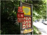 2
2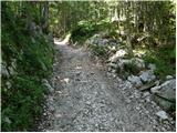 3
3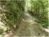 4
4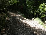 5
5 6
6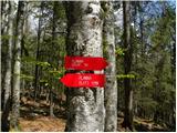 7
7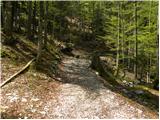 8
8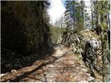 9
9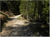 10
10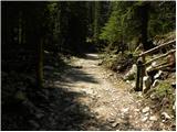 11
11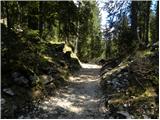 12
12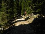 13
13 14
14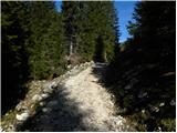 15
15 16
16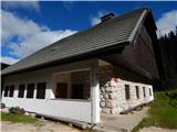 17
17 18
18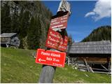 19
19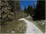 20
20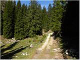 21
21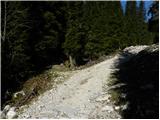 22
22 23
23 24
24 25
25 26
26 27
27 28
28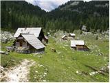 29
29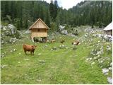 30
30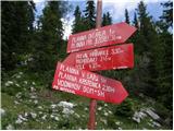 31
31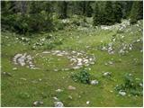 32
32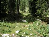 33
33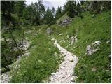 34
34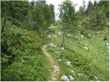 35
35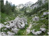 36
36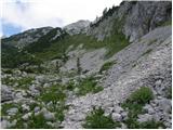 37
37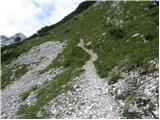 38
38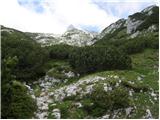 39
39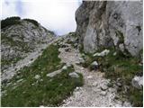 40
40 41
41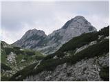 42
42 43
43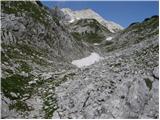 44
44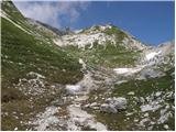 45
45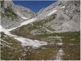 46
46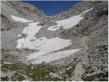 47
47 48
48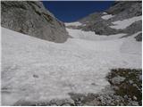 49
49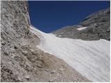 50
50 51
51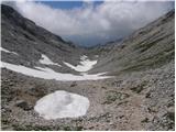 52
52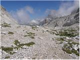 53
53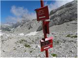 54
54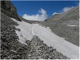 55
55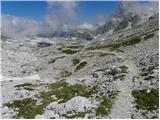 56
56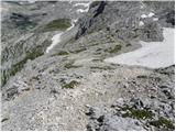 57
57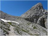 58
58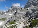 59
59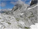 60
60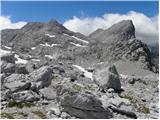 61
61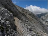 62
62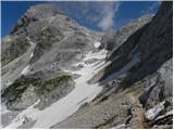 63
63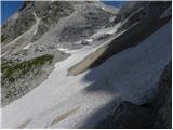 64
64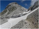 65
65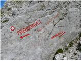 66
66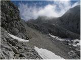 67
67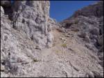 68
68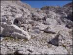 69
69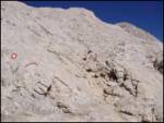 70
70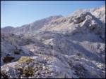 71
71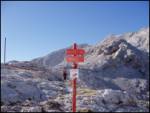 72
72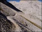 73
73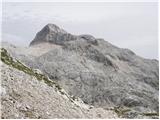 74
74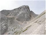 75
75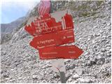 76
76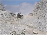 77
77 78
78
Discussion about the trip Planina Blato - Koča na Doliču (Za Kopico)
|
| mojcej'7218. 07. 2011 |
On 16.7. three enthusiastic hikers set off along the described path from Planina Blato at 8:50 towards Koča na planini Jezero, Dedno polje and then turned right towards Tržaška koča na Doliču (sign says 4h30). Except on the slope of Vršakov, where one snow patch was riskier to cross (due to the slope), the path was not demanding (just long). On the way we didn't meet anyone until the Prehodavci-Hribarice junction (except a Velika podlasica and one chamois). Weather was pleasant. In the Hribarice area there are still some snow patches, but all are easier to cross (flat). But be careful at the saddle, where you need to watch the markers (in fog they are not visible well! - we found out the next day on the way back), the path towards Koča na Doliču turns left down towards the scree, then descends about 200 vertical meters and turns left again to Tržaška koča na Doliču. Considering photography, crossing snow patches, snack etc. we could have saved maybe an hour (we arrived there at 17h - so those 4h30 are more for the "fast" ones). There's still no water in the hut. You can buy it in bottles (1.5 liters costs 4.40 EUR). According to the price list http://www.pzs.si/index.php?stran=Cene and discounts in huts they charge an extra 1 EUR ecological fee. Meatless stew (for 5 EUR) is not on the menu. Terrifying prices: sausage and cabbage for 10 EUR and 0.3 liter Laško for 3.9 EUR. At 2151 m you can also get "tomato salad"-? Half of "all overnight guests in the hut" were walking up and down all night for unknown reasons (altitude, full moon, beer-WC, etc.) and due to the "racket" none of us slept well. We decided to leave for Zasavska koča na Prehodavcih at 5:20 am, caught a bit of sunrise and fell into total fog again at the top of Hribaric, where "mountain hens" (?) surprised us with interesting calls. At 3 m lower a chamois approached us. Return through the Valley of the Seven Lakes was pure idyll in sunny, slightly cloudy weather, we also saw 3 small black and funny močerarde, some green little birds and of course plenty of geological curiosities. We returned via Prode towards Planina Ovčarija and arrived at Planina Blato at 16h.
|
|
|
|
| velkavrh18. 07. 2011 |
Last year I went from the saddle to Kanjevec and on the way back at the saddle I went too far left and you really need to watch the markers, because Bribarice are quite wide and you easily miss the markers especially if you're going there for the first time as I did. Then after fifteen minutes I realized I really don't see any marker and simply returned to the saddle, where I immediately spotted the correct marker for the right direction. Last year at that time there were still extensive snow fields on Hribarice and below Kopica. I also saw those hens last year, they are ptarmigans, which are pure white in winter, but in spring they change color and blend completely with the rocky landscape.
|
|
|
|
| Jeremish21. 07. 2021 07:11:28 |
Hi, has anyone hiked this trail in July this year? I'm a bit worried about the snowfields, especially under Vršaki.
Thanks for all info, LP
|
|
|
To post a comment you must log in:
If you do not yet have a username, you must first
register.