Pišnica - Škrlatica (via Kriška stena)
Starting point: Pišnica (850 m)
| Latitude/Longitude: | 46,4688°N 13,7833°E |
| |
Route name: via Kriška stena
Walking time: 8 h 25 min
Difficulty: very difficult marked way
Elevation gain: 1890 m
Elevation difference along the route: 2210 m
Map: Kranjska Gora 1:30.000
Recommended equipment (summer): helmet, self belay set
Recommended equipment (winter): helmet, self belay set, ice axe, crampons
Views: 7.650
 | 2 people like this post |
Access to starting point:
a) First we drive to Kranjska Gora, then we continue driving towards the Vršič pass. When Kranjska Gora ends, the road leads us past Lake Jasna, after the lake we come to the bridge over Velika Pišnica, where the described path begins. We park at the smaller parking lot at the intersection, or a little earlier, at the larger parking lot before the start of TNP, or after the bridge near the former Hotel Erika.
b) We drive to Trenta, then over the Vršič pass we start descending towards Kranjska Gora. After we cross the bridge over Velika Pišnica, the described path begins. We park at the smaller parking lot at the intersection, or a little earlier near the former Hotel Erika, or a little after the bridge, at a somewhat larger parking lot opposite the TNP sign.
Route description:
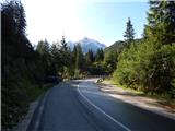
From the bridge over Velika Pišnica we continue in the direction of Koča v Krnici, where the path leads us along a macadam road, which then runs along the Velika Pišnica valley. The fairly gentle road, which runs along the mountain stream, first crosses several torrents, then after the dam, which is quite photogenic due to the high mountains in the background, a little further it brings us to a marked crossroads, where the path through Kačji graben to Špik branches off to the left.
We continue straight along the still gentle road, which then via a gravel bed brings us to a marked crossroads, where at the edge of Planina v Klinu the path from Ruski križ joins from the right.
We continue left in the direction of Krnica, then immediately after crossing the torrent right onto the forest footpath. Follows a moderate ascent through the forest, and after about 20 minutes of further walking we arrive at Koča v Krnici.
From Koča v Krnici we continue straight (left Špik and Velika Dnina) in the direction of Križ, Pogačnikov dom na Kriških podih and Škrlatica. The path ahead first still leads us through the forest, then brings us into a belt of shrubbery, where we walk for some time along mighty torrent deposits. Higher up the path turns a little to the left and begins to ascend steeply. Follows a steep ascent through the area called Travno brdo, where the path still leads through the last belt of forest. Higher up the larch forest first thins out, then quite quickly also ends. Follows ascent over a short grassy part, and from the path, which transitions to scree, nice views open up to the surrounding mountains and walls. Higher up, at an altitude of approximately 1900 meters the path levels out and brings us into the cirque V kotu, at the end of the cirque the path turns left and brings us to the entrance to Kriška stena (in early summer there is often still snow at the entrance to the wall).
Before entering the wall, or even earlier, we put on the helmet, then carefully step into the wall. The path at the beginning of the wall turns left and ascends steeply, in the continuation the path is mostly led along natural passages, at harder places we are helped also by protections. The ascent on the wall, which besides exposure is also exposed to falling rocks, lasts approximately one hour. Above the wall the path levels out and brings us to a crossroads at Vrh Kriške stene, where we continue left downhill in the direction of Škrlatica (right Križ,). Already after a few minutes descent the path brings us to the next crossroads, where we again continue left (straight bivak na Rušju and dolina Vrata). Further we walk under the walls of Gubno and Dovški Gamsovec, without major changes in height. After half an hour of further walking the path begins to ascend again, leading us through scree terrain towards the steep Rdeča škrbina, which is located between Dolkova Špica and the lesser known Rogljica.
From the škrbina we continue straight downhill in the direction of Škrlatica (right Dolkova špica 15 minutes). The path ahead crosses a short secured gully, then descends down a steep gully that is quite dangerous for slipping (in early summer possible snowfields). The descent ends 200 vertical meters lower, in a smaller cirque Zadnji Dolek, where we also arrive at a crossroads.
From the crossroads we continue left uphill in the direction of Škrlatica (straight dolina Vrata) and climb up the steep scree. We climb the scree all the way to the entrance to the climbing part of the path on Škrlatica. Here the markings direct us right and the path transitions from the scree to the rocky part of the path. The path ahead runs along the western wall and is well secured with pitons and steel cables. Soon we come to a difficult, but well secured passage. Our view escapes to the wall, which is almost vertical, across it leads the path, which is secured with stirrups and steel cable. We go across carefully, as sometimes one of the stirrups spins. Follows some easier climbing on the secured path. In the last part of the difficult part of the path we can notice a window in Škrlatica, which however many hikers overlook. Soon after that we step onto the ridge, from which we have to the summit only another 20 minutes of scenic, not particularly difficult walking. When we see the cross we are already almost at the summit.
Izhodišče - odcep za Kačji graben 0:40, odcep za Kačji graben - Planina v Klinu 0:25, Planina v Klinu - Koča v Krnici 0:20, Koča v Krnici - V kotu 2:30, V kotu - Vrh Kriške stene 1:00, Vrh Kriške stene - Na rušju 0:10, Na rušju - Rdeča škrbina 1:15, Rdeča škrbina - Zadnji Dolek 0:35, Zadnji Dolek - Škrlatica 1:30.

Along the route: Eriški most (852m), Rušev graben (899m), Odcep za Kačji graben (916m), Planina v Klinu (980m),
Koča v Krnici (1113m), Pod Kriško steno (1945m), Rob Kriške stene (2300m), Na rušju (2218m), Rdeča škrbina (2521m), Zadnji Dolek (2332m), Pod steno Škrlatice (2403m), Na grebenu Škrlatice (2624m)
The trip can be extended to the following destinations: Škrlatica
Photos:
 1
1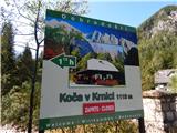 2
2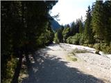 3
3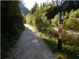 4
4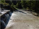 5
5 6
6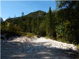 7
7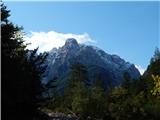 8
8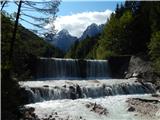 9
9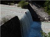 10
10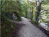 11
11 12
12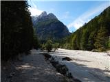 13
13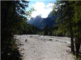 14
14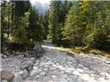 15
15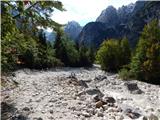 16
16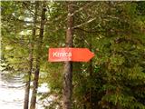 17
17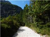 18
18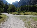 19
19 20
20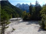 21
21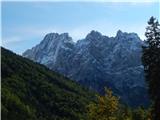 22
22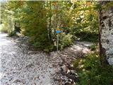 23
23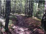 24
24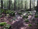 25
25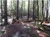 26
26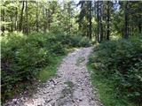 27
27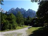 28
28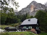 29
29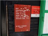 30
30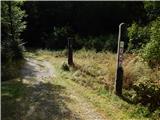 31
31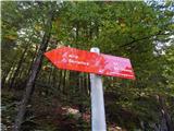 32
32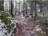 33
33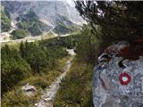 34
34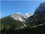 35
35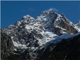 36
36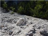 37
37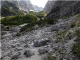 38
38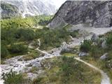 39
39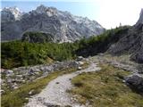 40
40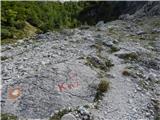 41
41 42
42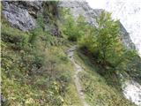 43
43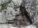 44
44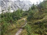 45
45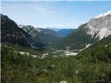 46
46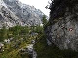 47
47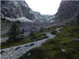 48
48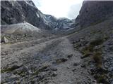 49
49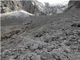 50
50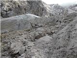 51
51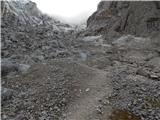 52
52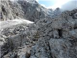 53
53 54
54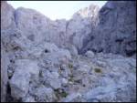 55
55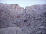 56
56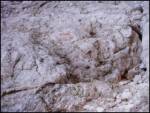 57
57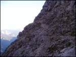 58
58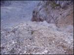 59
59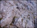 60
60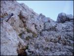 61
61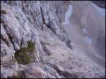 62
62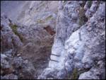 63
63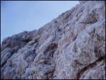 64
64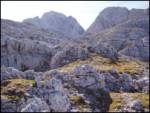 65
65 66
66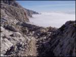 67
67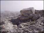 68
68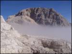 69
69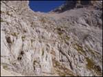 70
70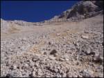 71
71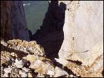 72
72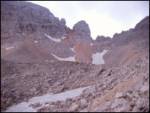 73
73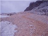 74
74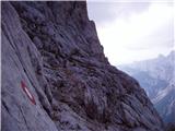 75
75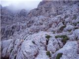 76
76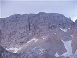 77
77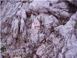 78
78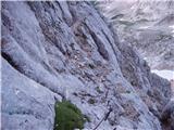 79
79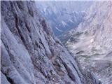 80
80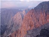 81
81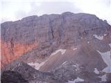 82
82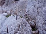 83
83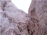 84
84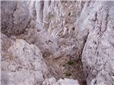 85
85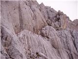 86
86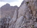 87
87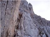 88
88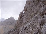 89
89 90
90 91
91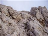 92
92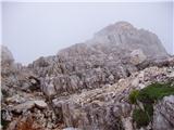 93
93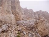 94
94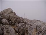 95
95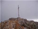 96
96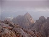 97
97
Discussion about the trip Pišnica - Škrlatica (via Kriška stena)
|
| Kawasaki22. 06. 2023 09:28:44 |
Is the path difficult for descent? Meaning ascent from Vratca to Škrlatica, descent via Dovški Gamsovec to the hut in Krnica? Or is it better the other way around?
|
|
|
To post a comment you must log in:
If you do not yet have a username, you must first
register.