Pirman - Turjak Castle (shorther path)
Starting point: Pirman (360 m)
| Latitude/Longitude: | 45,8738°N 14,6054°E |
| |
Route name: shorther path
Walking time: 20 min
Difficulty: easy marked way
Elevation gain: 162 m
Elevation difference along the route: 162 m
Map:
Recommended equipment (summer):
Recommended equipment (winter): crampons
Views: 3.006
 | 1 person like this post |
Access to starting point:
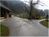
A) First, we drive to Škofljica (from Ljubljana or Grosuplje to here), and then we continue driving in the direction of Velike Lašče, Ribnica and Kočevje. When we get to Pijava Gorica, we leave the main road and continue right in the direction of the settlement Želimlje. When we get to the hamlet Podreber, we continue straight (right Želimlje) and further we drive through the valley of Želimeljščica. A few kilometres ahead, a road branches off to the left, which ascends to Turjak, and we still continue through the valley and follow the road to Pirman, beside which there is a crossroad, where a road branches off to the right towards Četež, Javorje and Kurešček, and straight ahead the road continues towards Prazniki. We park in a suitable place near the crossroad, by Pirman, where there are hiking signposts but there are no suitable parking spots.
B) We can also arrive at the starting point from the direction of Turjak, namely along a narrower road that leads past the castle. Near the castle, the road starts to descend steeply and brings us lower to a crossroad, where we continue left. From the point where we reach the valley, we drive along the road for only about 200 to 300 m and the road brings us to Pirman, where we park near the crossroad.
Route description:
From the signposts at Pirman we continue left in the direction of the castle Turjak (straight Turjak, right Kurešček, Zapotok and Četež) and through a meadow we ascend to the edge of the forest. Here an arrow on a power line pole directs us into the forest onto a gradually steeper footpath. Further on, we ascend relatively steeply through the forest, and the marked path past some archery targets (caution because of archers is advisable) brings us to the castle Turjak in approximately 20 minutes of walking, from which a nice view opens up onto the nearby surroundings.
Photos:
 1
1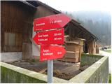 2
2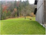 3
3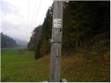 4
4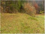 5
5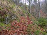 6
6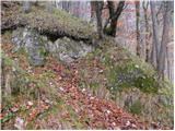 7
7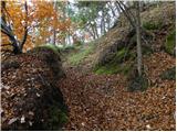 8
8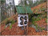 9
9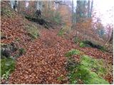 10
10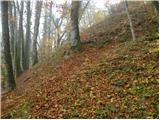 11
11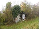 12
12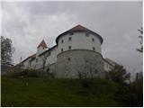 13
13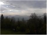 14
14
Discussion about the trip Pirman - Turjak Castle (shorther path)
To post a comment you must log in:
If you do not yet have a username, you must first
register.